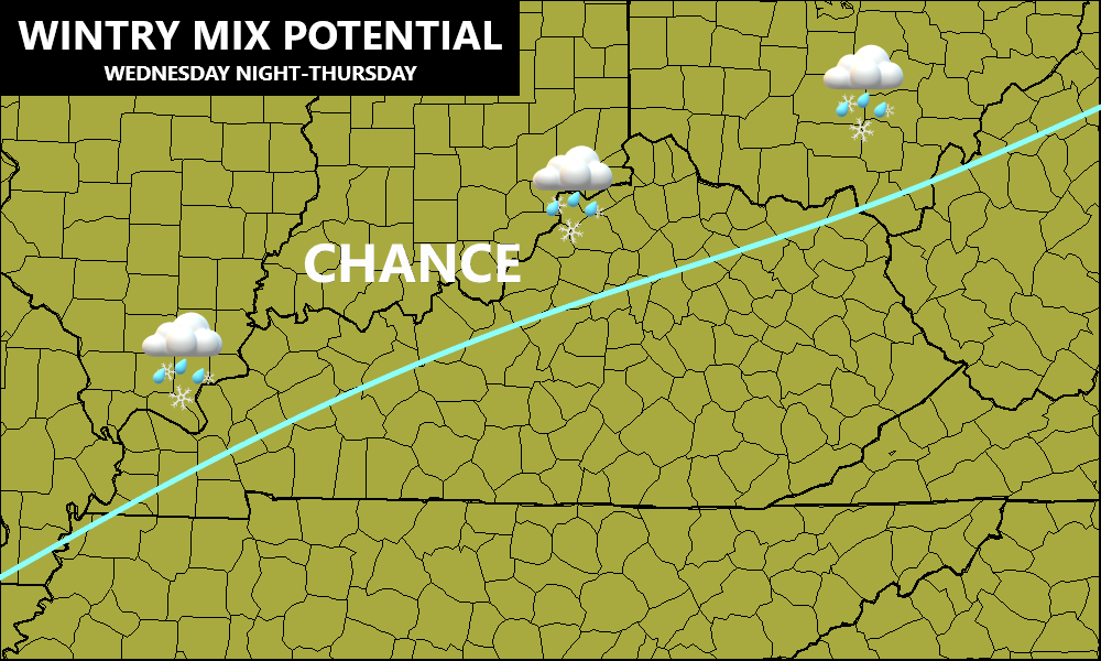
Good Wednesday, everyone. The first part of our three-pronged storm system is rolling into the region today, bringing an increase in temps and rain. This is ahead of a strong cold front dropping into the state tonight and this may bring a bit of winter weather across areas of the north and west. This is followed up by our main system for New Year’s Eve and Day. We will go in depth on this and have a deep look into where the pattern is going. Buckle up cause this is one long post.
Let’s get this party started with the first system moving in tonight. This is a cold front that has rounds of rain increasing ahead of this. Winds will also be gusty as temps spike. Your radars will follow the rain in from the northwest…

As this front slides through tonight, much colder air crashes in from the northwest. This likely gets cold enough for some winter weather in the areas I’ve been highlighting for the past few days…
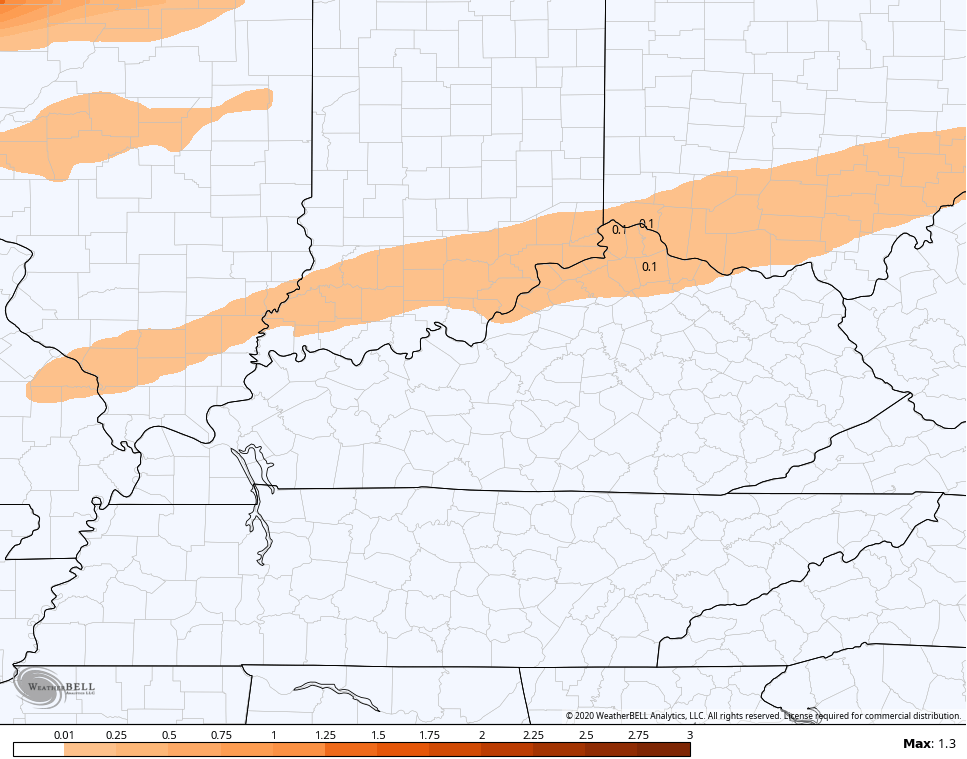
A few of the short range models (as of this writing) are showing this getting a little farther south and more pronounced…
HRRR

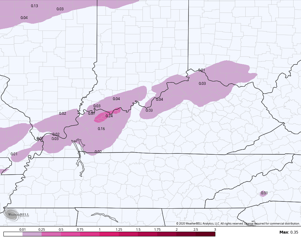
The RAP snow map has a similar look…
The NAM isn’t as enthusiastic, but has some winter weather…
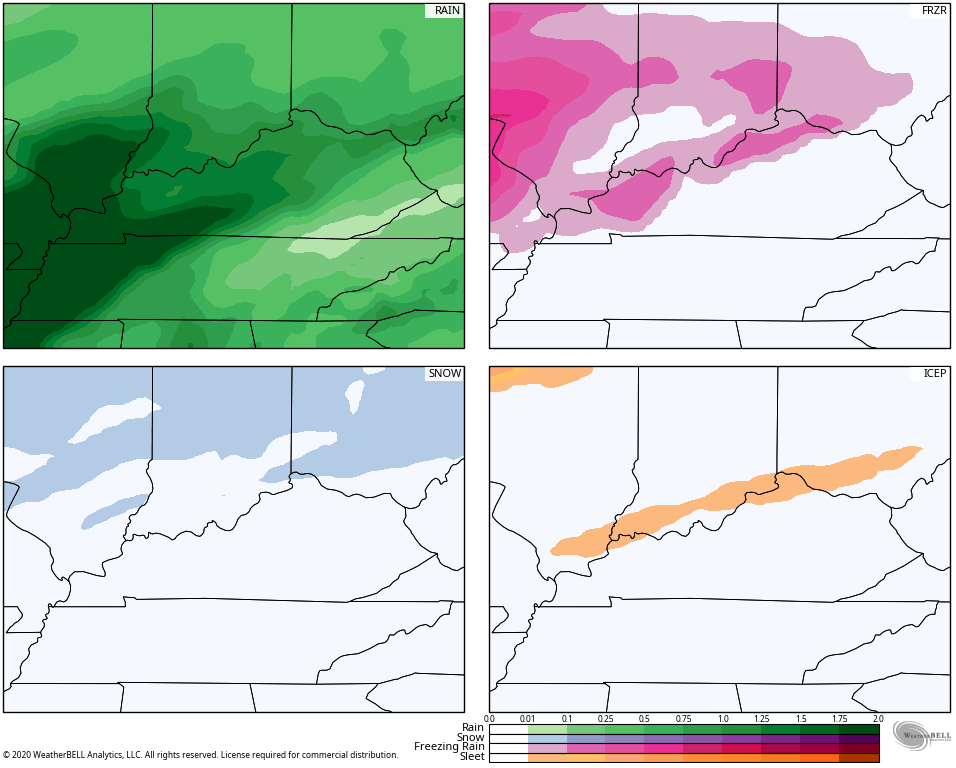
SNOW

FREEZING RAIN

The Short Range Canadian Model shows sleet and freezing rain…
SLEET
FREEZING RAIN
The GFS shows a little of everything…

The Canadian is similar…
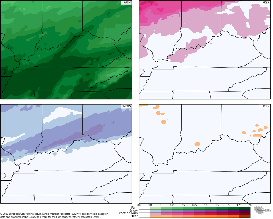
The EURO continues to have just a little more of a snow look…
How far south this front can get will be the determining factor on how far south that winter weather can get. The models are growing progressively colder as we get closer to Thursday. Look at the afternoon temps showing up…

For areas seeing the 30s, it’s going to feel much colder because of that gusty wind blowing.
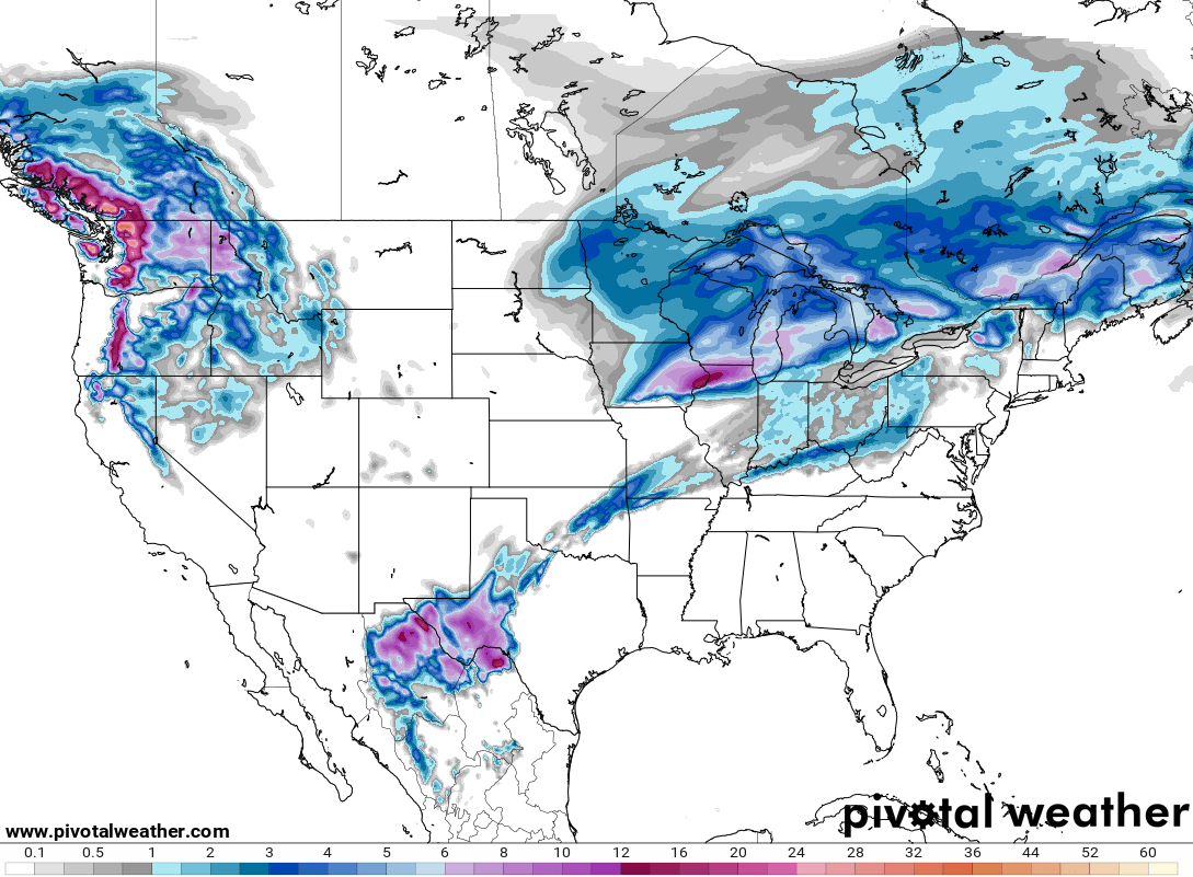
A potent low pressure develops Thursday across the lower Mississippi Valley then lifts northward through New Year’s Day. Temps surge toward the 60s across central and eastern Kentucky early New Year’s Day as winds absolutely crank ahead of the low. Gusts of 40mph or greater likely show up. We may also see a few thunderstorms joining in the the waves of showers.
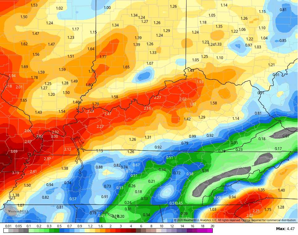
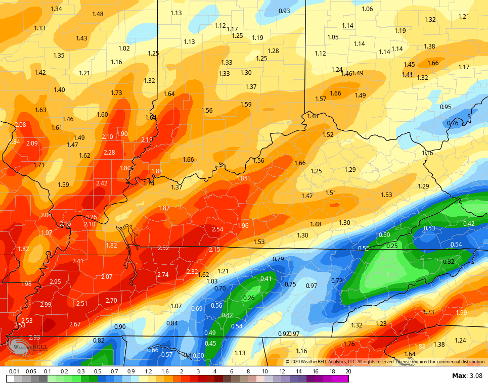
Heavy rainfall is likely through Friday night with many areas in the 1″-2″ range with locally higher amounts in the west…
NAM
GFS
Another system follows this Saturday night into Sunday with marginal temps for winter weather, but a little rain and snow will be possible. Another system likely dives in here behind that by the middle of next week with another rain or snow threat.
The evolution of the pattern continues toward major blocking showing up to our north and a deepening trough settling in here by week two of January…

One of the things I posted about a few weeks ago was the Madden Julian Oscillation or MJO as it’s known. What the heck is the MJO? Here’s the clinical definition from the CPC:
Tropical rainfall exhibits strong variability on time scales shorter than the seasonal El Niño-Southern Oscillation (ENSO). These fluctuations in tropical rainfall often go through an entire cycle in 30-60 days, and are referred to as the Madden-Julian Oscillation or intraseasonal oscillations. The intraseasonal oscillations are a naturally occurring component of our coupled ocean-atmosphere system. They significantly affect the atmospheric circulation throughout the global Tropics and subtropics, and also strongly affect the wintertime jet stream and atmospheric circulation features over the North Pacific and western North America. As a result, they have an important impact on storminess and temperatures over the United States. During the summer these oscillations have a modulating effect on hurricane activity in both the Pacific and Atlantic basins.
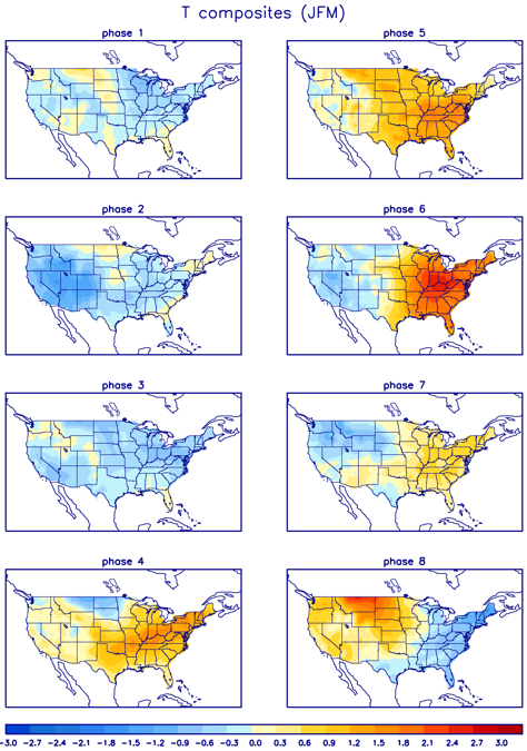
In my last discussion on this, I mentioned how the MJO would largely be in the null phase, meaning it would not likely be the driving factor in the overall pattern. We didn’t want this to get into phases 4, 5 or 6 because those were warm phases for the United States. Conversely, winter lovers wanted this to get into phases 8- 3. Here’s what each phase typically means this time of year…
Some of the latest forecasts take this into phases 2 and 3…
CFS
 EURO Extended shows the MJO weakly into phase two before circling back toward 7 and 8…

Without an overpowering MJO signal, were does this put us? That’s all up to the fight currently showing up among the various other signals I look at. The cold signatures come from the -NAO and -AO…

Both of those have been negative for a while and are forecast to go severely negative in the weeks ahead. Both are trying to lock into place for January and likely into February.
The warmer signal has been from the EPO which has been positive and is forecast to continue to be positive…

The PNA is meandering around the “I don’t really mean anything” line…

The above signals are why we’ve been seeing a lot of back and forth with the pattern over the past month. When the -NAO and -AO flex, we winter it up. When the +EPO flexes, we don’t winter it up.
Going forward, odds favor the -NAO and -AO flexing more and more.
Did ya get all that? Good. 😏😎
I will have updates later today, so check back. Have a good one and take care.

normal for KY
Thanks Chris for the teleconnections info. Ever since the change over to GEFS V12 in Sept I have had a difficult time in accessing the models.
Thanks Chris for all your hard work. Your weather blog is the best !
Rain changing to a few flakes.
That is all I see happening in the near future.
Go go -NAO and -AO!! Let’s winter it up!
Starting to hear about a major SSW event in the Twitter world.Zonal winds reversing at 1mb,10mb and 30mb which should lead to tons of blocking around mid January.Of course there’s always a hitch.Which side of the continent does the blocking sets up shop.Heard this type of talk before when winter is about to go bye bye.Who knows.