Good afternoon, everyone. Rounds of snow have become lighter this afternoon, but the next bigger and stronger round kicks in this evening and takes us through Tuesday morning. From there, we follow snow showers and flurries through Wednesday while turning our attention toward the weekend. That’s when snow and an arctic outbreak continue to look more and more likely.
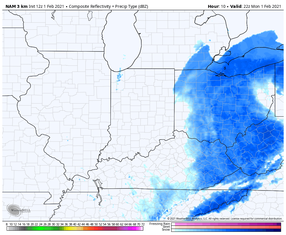
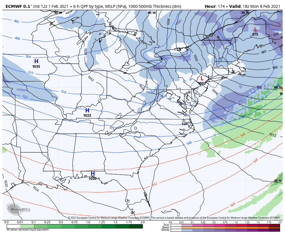
Let’s begin with the current setup. The future radar from the Hi Res NAM shows this big increase in snow wrapping in from the north and northeast. This impacts central and eastern Kentucky in a big way…
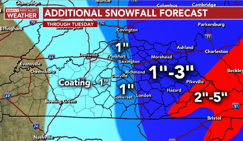
That’s another 1″-3″ along and east of the Interstate 75 corridor, with higher amounts in the higher mountains along the Virginia border counties…
Here are your radars to follow along…

A plume of snow showers and flurries will show up from Lake Michigan into Kentucky later Tuesday and continue into Wednesday. This will put down hit and run light accumulations.
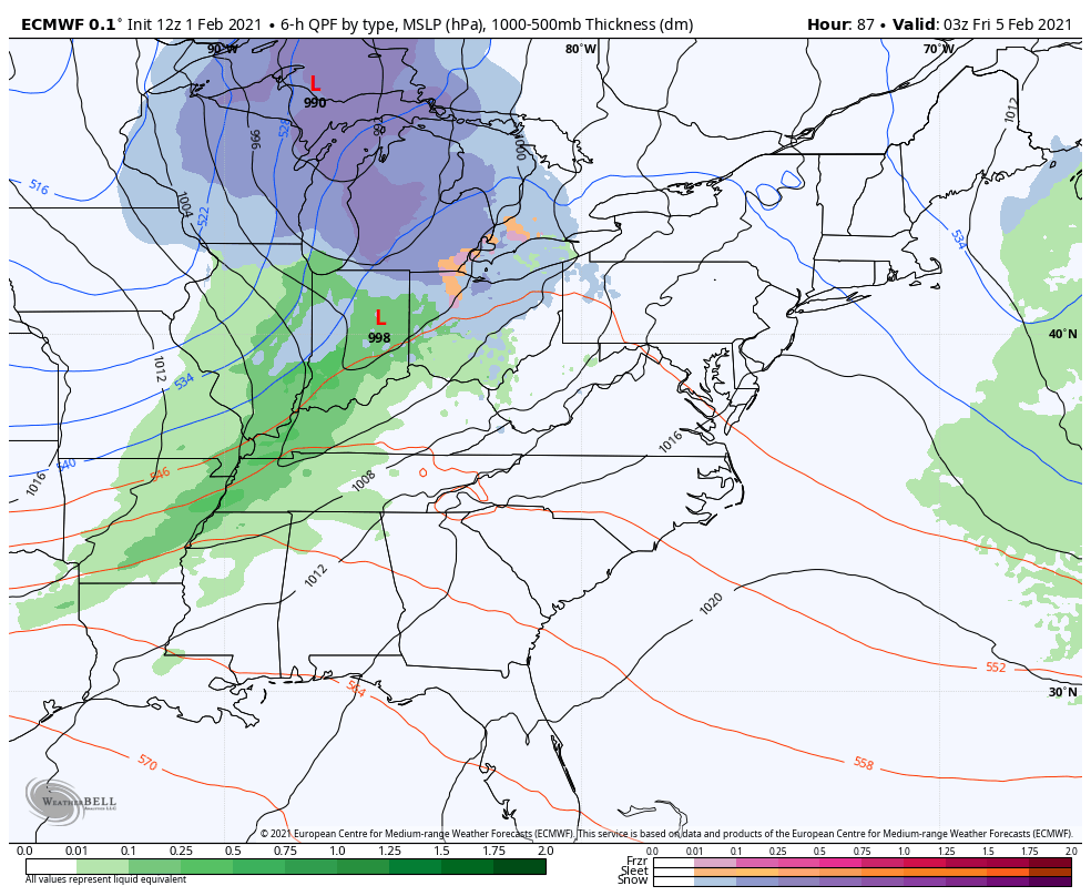
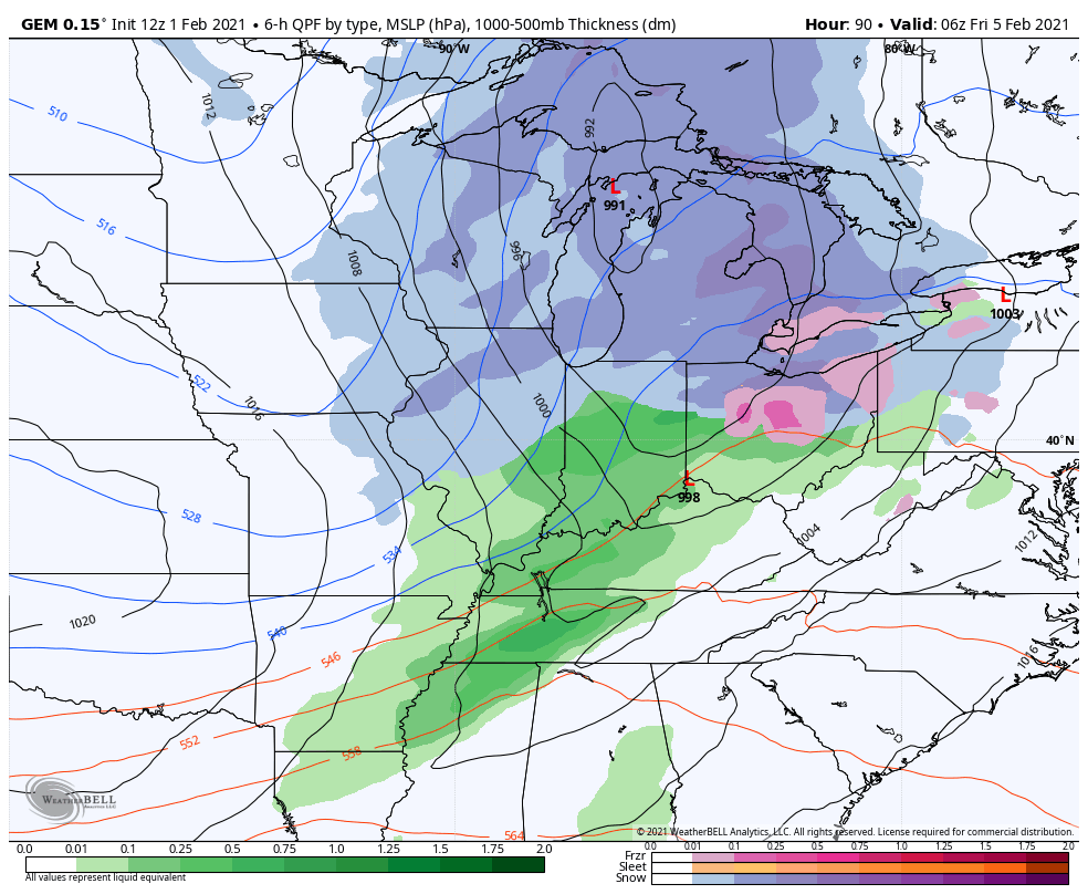
A strong cold front moves in Thursday night and early Friday with a period of rain that quickly changes to snow as colder air surges back in. The setup behind this features the Polar Vortex invading the country, settling into the Great Lakes late this weekend and early next week. This will likely bring brutally cold temps and wind chills to much of the USA during this time. The arctic front moves in here later Saturday or into Super Bowl Sunday and may have an arctic wave along it producing snows.
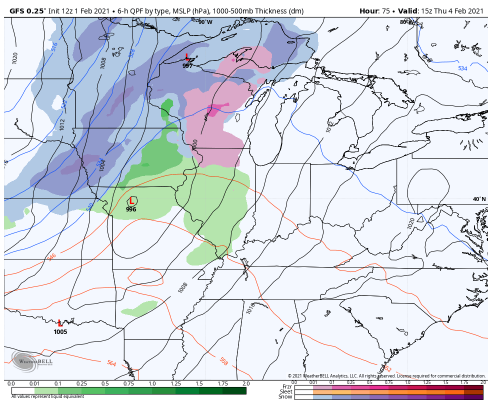
That’s what the GFS is showing well…
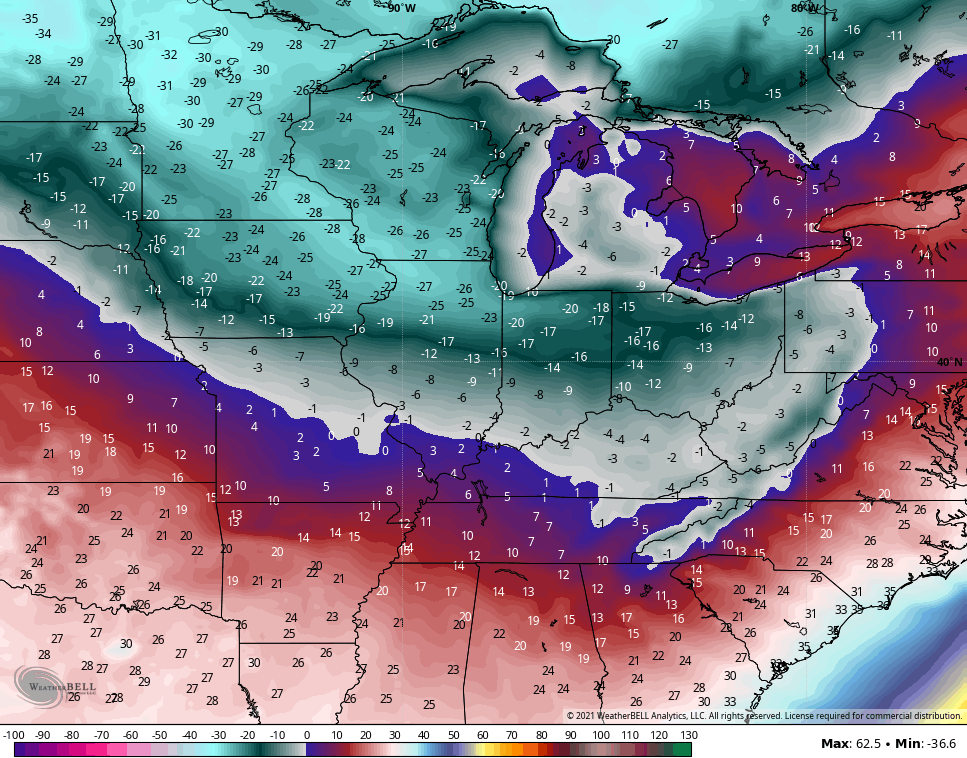
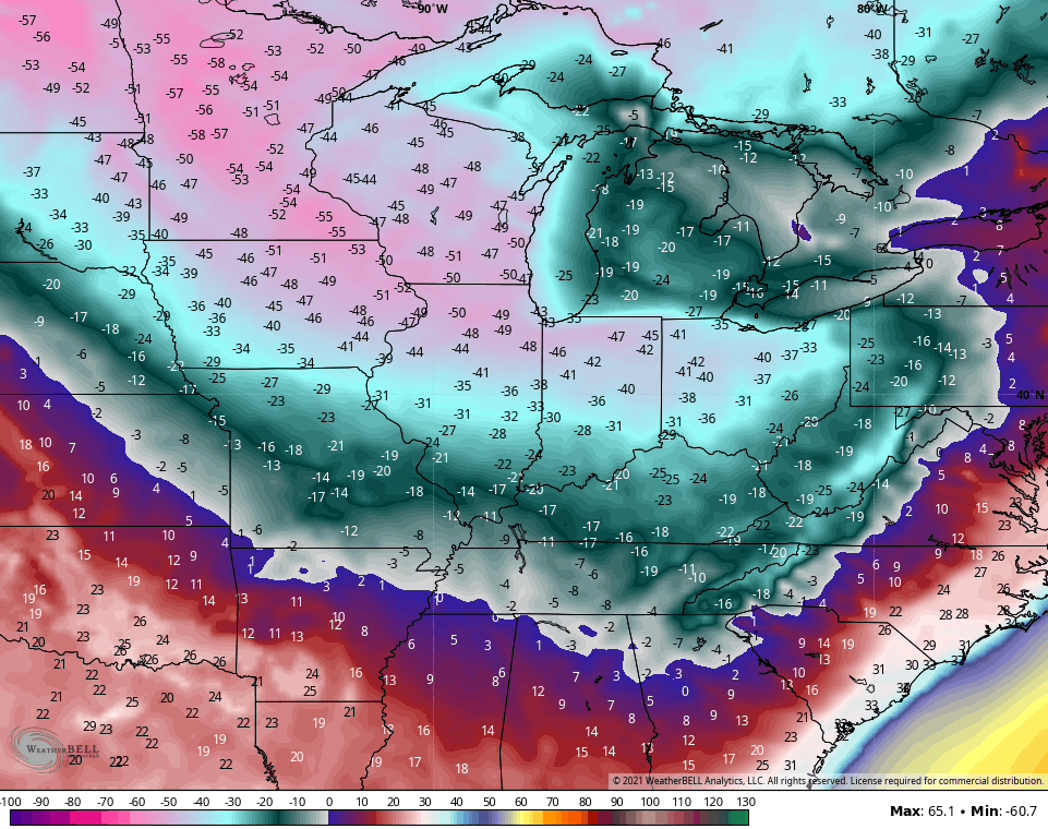
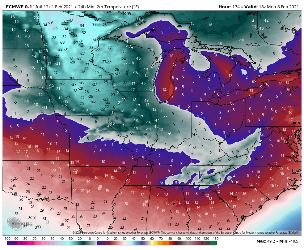
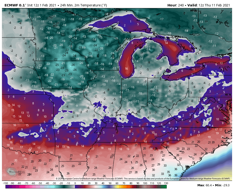
Lows from the GFS are brutal…
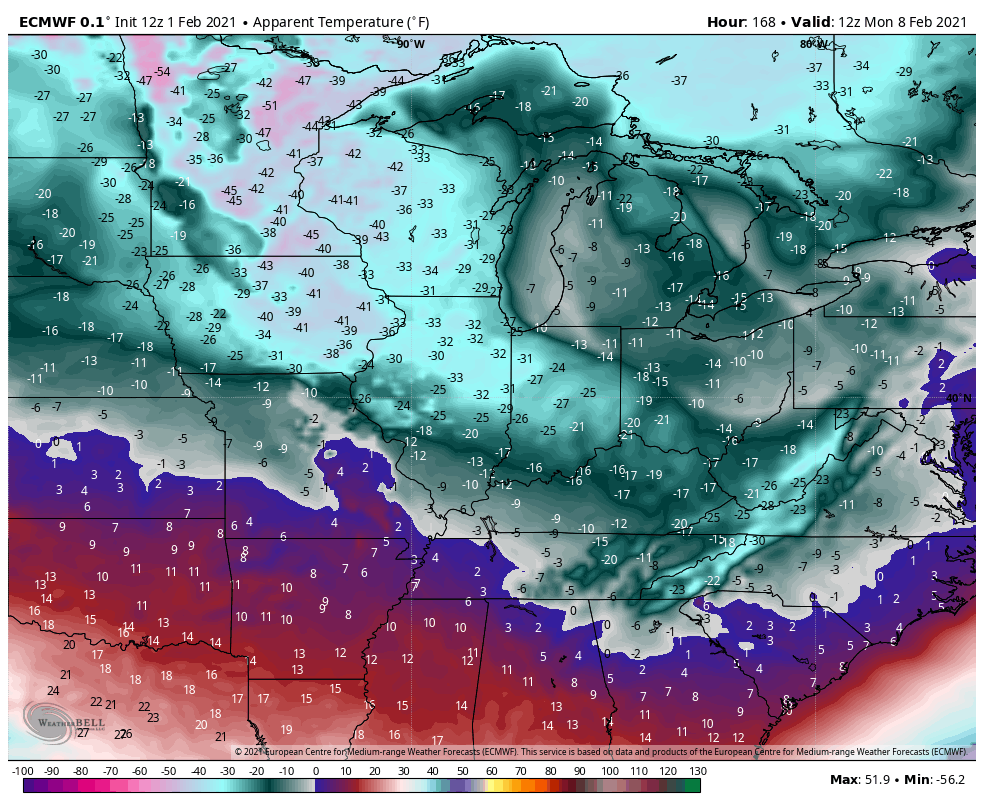
Wind chills are crazy…
The European Model takes this to another level with, taken verbatim, is a blizzard…
Temps behind that…
Wind Chills
The Euro follows that up with another big snow event…
And another dose of bitter cold…
The Canadian Model is also seeing the multiple snow threats…
 Yes, it also has bitter cold…
 I will have the latest on WKYT all evening and will drop by for another update. Have a good one and take care.

Man the price we have to pay for a decent snowfall.
Looks like the cold air is going to be for real.
Nothing worst than seeing frozen brown grass rooted in frozen mud. ( frozen tundra) If the extreme cold air is coming, I hope we do see an accumulating snowfall that is 4”or more.
Bring on the SNOW!!!
Yes bring on the blizzard!! If it happens I called it back in the fall this is the year for a blizzard. If it doesn’t happen, well I was wrong lol
Based on the apparent set-up, that seems about right that it either would be a little snow , or a lot (blizzard-ish) with not much in between. Will be interesting to see which side things might fall for snow.
True!
Lol.Kuchera map on the Euro has the whole state basically with 2 feet with Western and Eastern over 30 inches.
If the models come to fruition(doubtful) W.Ky can no longer complain about their snow deficit.LOL
I check out the Arctic Region on the Ventusky Weather site and it is still showing the Arctic Air is “locked up” on the Western side, but it has three to four days to change to make the model’s forecast right.
In the Northeast, a piece of Arctic Air phased yesterday with a Surface Low off the Atlantic coast and as a result a potent Nor’Easter. This is what I call a perfect Snowstorm/Blizzard.
We ended up with one inch of Snow today as light Snow Showers fell through mid morning.
At this time the NWS is not predicting any significant Snowstorm for my area of Central Kentucky, but next Sunday night they are predicting a low of nine degrees so they are picking up on the Arctic Air invasion.
I’m more concerned if we do get the Arctic Air/Polar Vortex and it reacts with an over running event of moisture from a very warm Gulf of Mexico. The worse kind and most dangerous weather type one can get so bad I refuse to mention it.