Good evening, everyone. Snow continues to increase across the eastern half of the state as the Buckeye state throws snow into the Bluegrass state. This action will cause slick roads to develop once again and could put down another 1″-3″ in the east. After this, it’s all eyes on the potential for the coldest air in years to arrive in the state this weekend and early next week. Can we get some big snows from this?
Let’s concentrate on the precious present. A Winter Weather Advisory is out for much of central and eastern Kentucky through tonight…
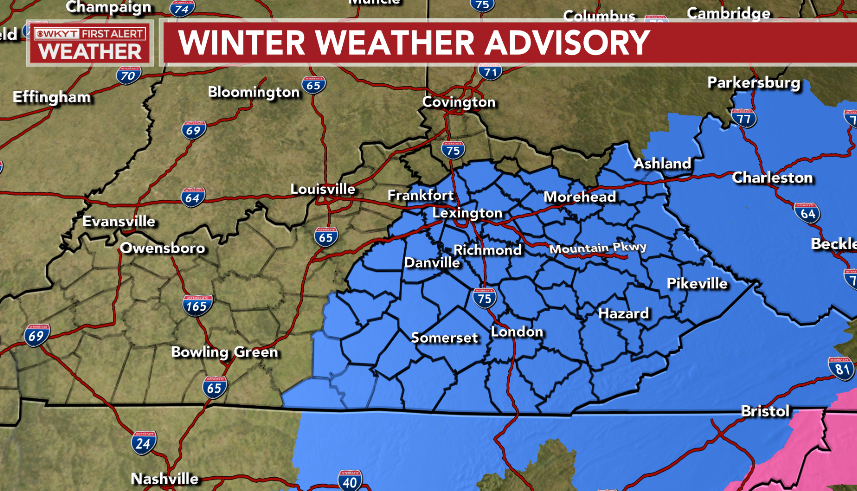
Here are your radars to follow the snow in from the north and northeast…

Lake Michigan will then throw some snow showers and flurries at us later tomorrow into Wednesday.
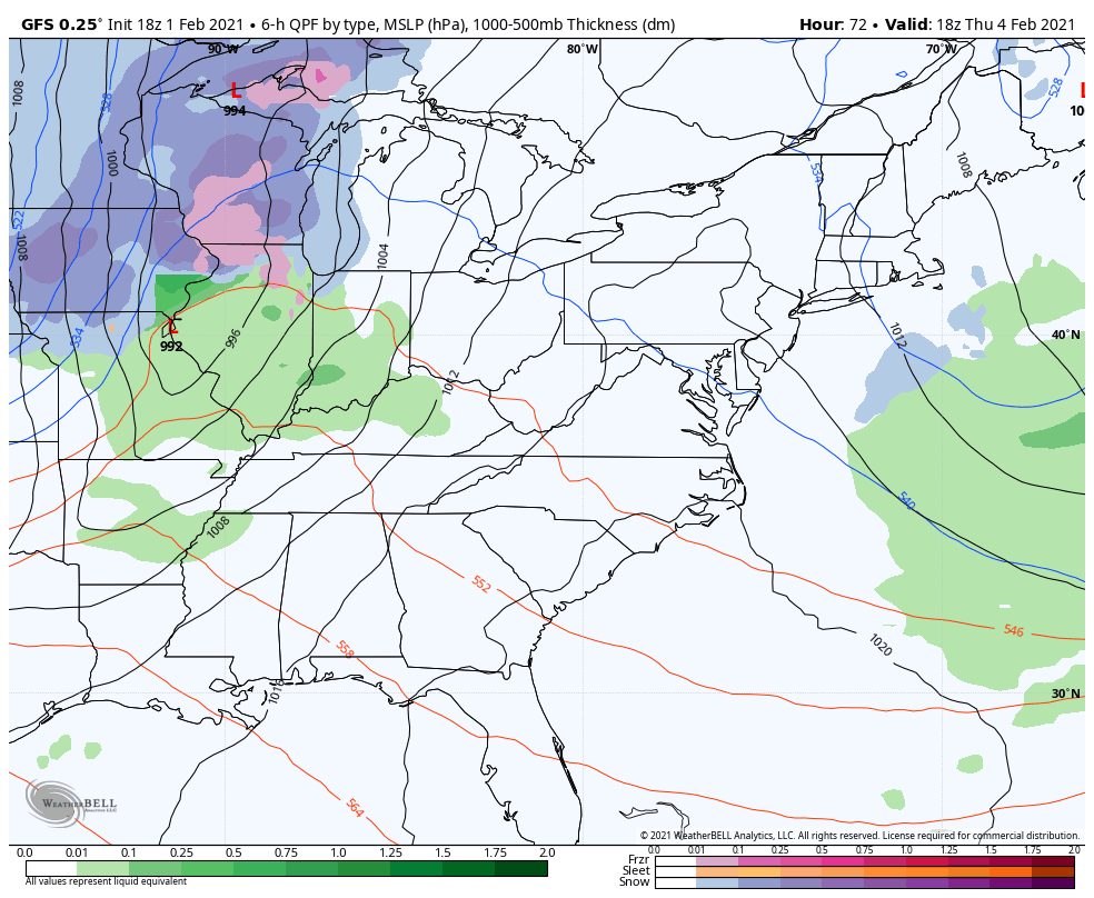
The setup for the weekend into next week continues to look extreme as the Polar Vortex moves into the northern part of the country. One front is well ahead of this and arrives Thursday night with some rain in front and snow behind.
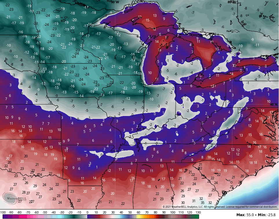
The arctic front slams in here Saturday night and early Sunday. Does this have a wave of low pressure along it or does it just come through with a healthy band of snow? That’s the question to be answered in the coming days. That unleashes brutally cold temps and wind chills and may be followed up by another snow maker coming from the southwest. You can see all this on the late day GFS…
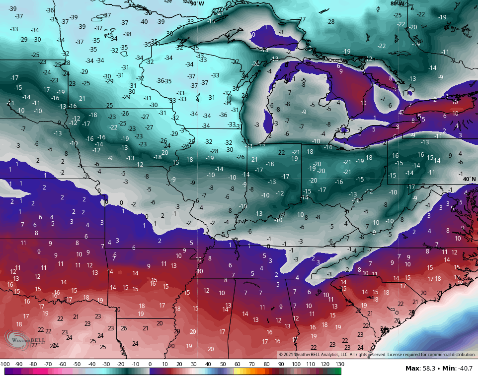
Here are the Sunday night lows from that run…
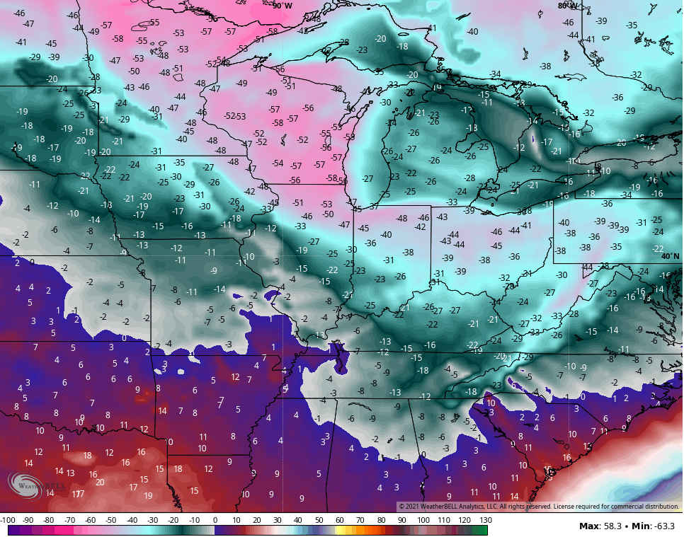
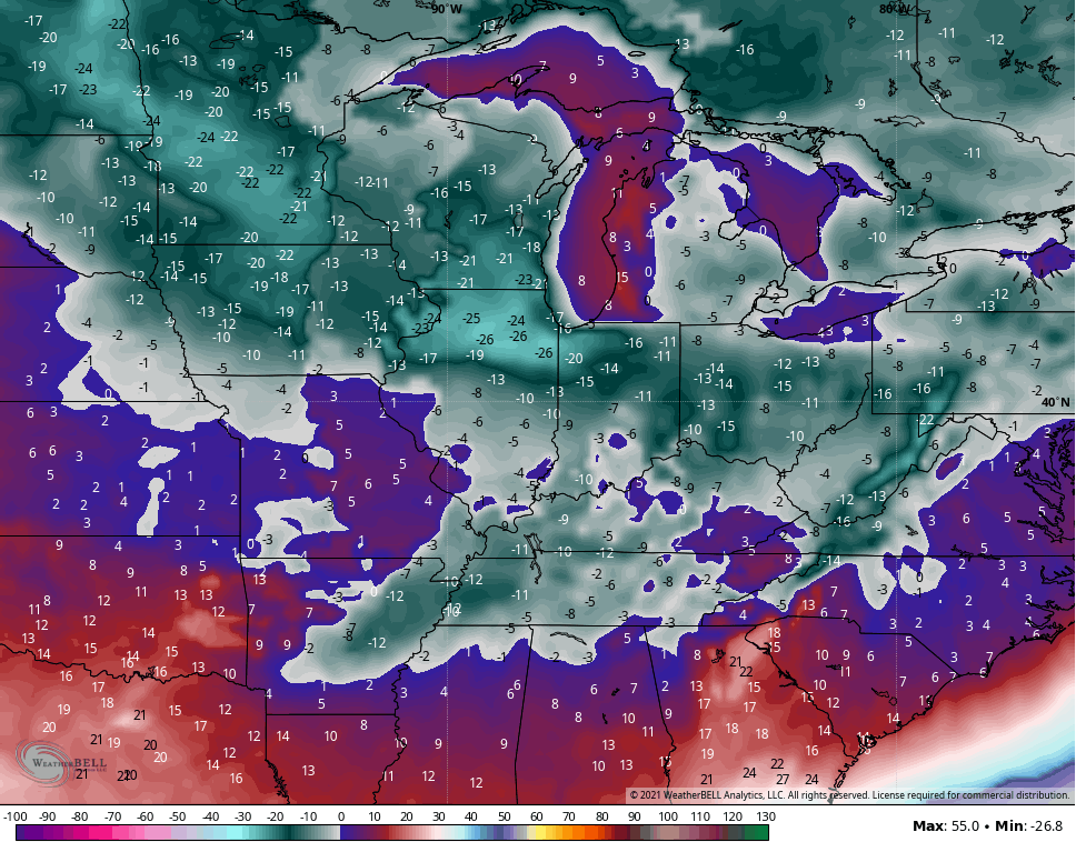
Wind chills are absolutely crazy…
Like the EURO and Canadian, the GFS also sees a second shot of brutal cold behind the second possible system later next week…
Wind chills…
Folks, this is the type of cold that can cause tremendous hardship across the country and likely take lives. We want NO part of this setup, so let’s hope it changes in the coming days.
Your full update comes later tonight. Make it a good one and take care.

No snow update maps, so perhaps it is leaning more towards a little snow with real cold air.
Models- not maps.
The article cold will end up pushing the low front to far south. LOL
Arctic
As long as no ice, I’m fine with flurries.
Here is the Ventusky Site, which is what is going on with Temperatures at the present in the Arctic. Not a model actual map of the Earth. Much more accurate.
If I’m reading it right, it looks like Siberia’s frigid temperatures are beginning to moderate and the Canadian Arctic temperatures are beginning to decrease and move slowly Southward towards the US. You can find this out by advancing the time.
The AO and NAO and EPO are all negative last time I checked. Also the PNA is going positive, but not sure as this just has to do with the Temperature.
https://www.ventusky.com/?p=61;-160;1&l=temperature-2m
The cold air ahead of the Polar Vortex intrusion may be what finally ends western Kentucky’s snow drought, by being the irresistible force countering the immovable La Nìna object.
based on some science…mostly gut feeling.