Good Tuesday to one and all. The steady snows that have blanketed much of the state for the past few days are winding down as a few snow showers and flurries hang around. The pattern that follows all this features arctic air and the potential for additional snow systems. The extreme winter option is also on the table later this weekend and early next week.
Let’s start things out with the current setup then roll forward. Roads are a mess across central and eastern Kentucky to start this Groundhog Day. Many roads are snow covered and slick as the flakes continue to fly across the east and southeast. As the main snow shield winds down, we will see some breaks in the clouds before a little flurry and snow shower action builds back in from the northwest.
Here are your radars…

A few flurries may even stick around into Wednesday as the flow is off Lake Michigan.
A strong cold front will then target the region Thursday night and early Friday. Rain will be alone and ahead of the front with a quick shot of some light snow behind it…
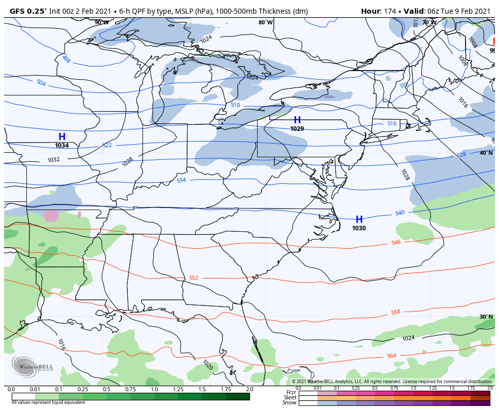
The setup after this will feature a mega arctic front dropping in here later Saturday into early Sunday. This is likely to have a wave of low pressure along it as another low pops near the east coast. If you want the ultimate storm, you would want those two to fully hookup. That would make for the extreme solution, but isn’t the most likely scenario at the moment.
This arctic front will likely produce a decent snowfall across our region as it moves through. This is snow in arctic air, so you get insane ratios and also some big time winds.
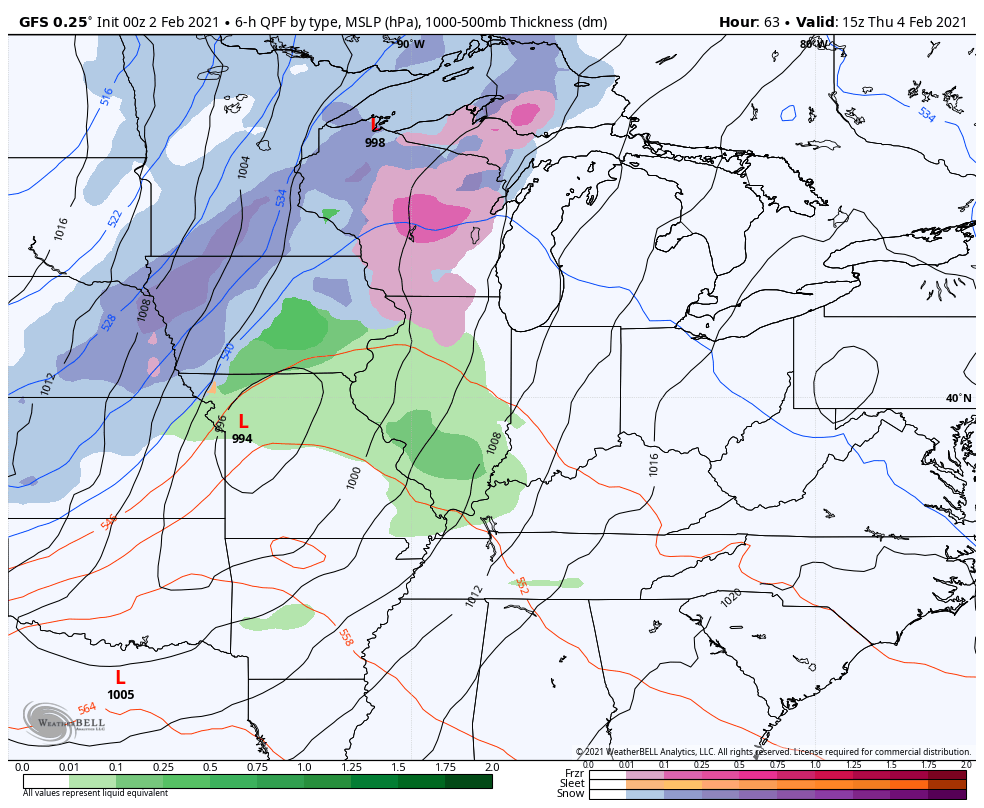
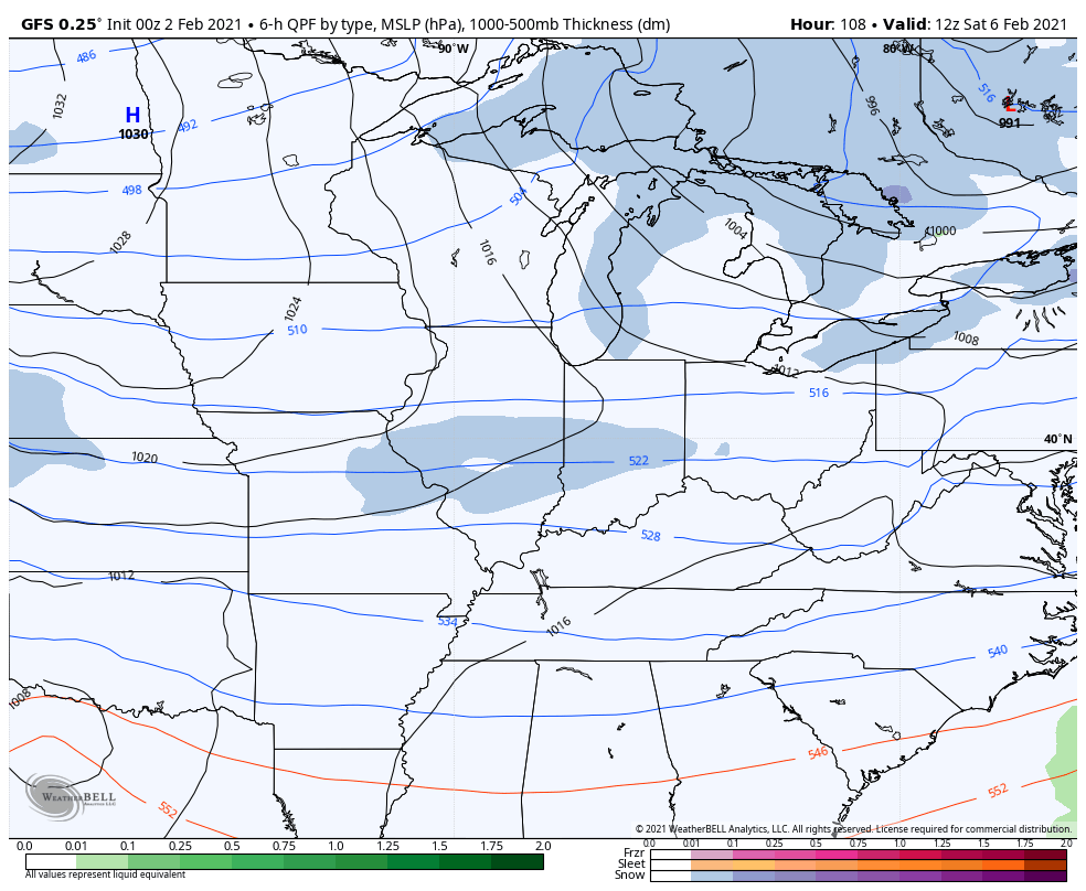
Here’s the GFS…
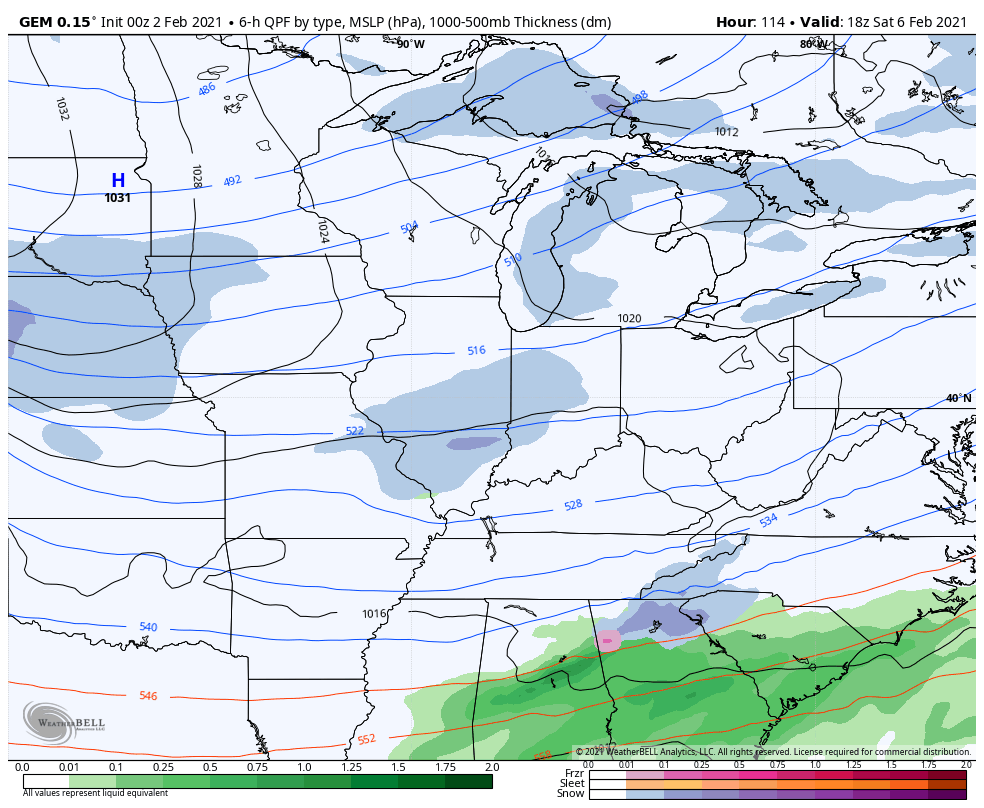
The Canadian…
The EURO now has a similar setup, but has MUCH more interaction with a storm along the east coast and is close to being the extreme solution…
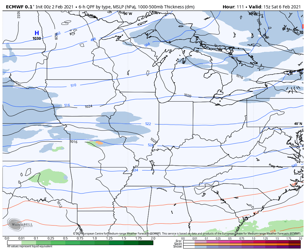
All three models are faster moving that through because they have a system quickly coming in behind it and another behind that…
GFS
The models are going to struggle with timing and magnitude issues with each of these systems, so I wouldn’t be banking on any one solution coming to pass.
If we do in fact get quicker moving systems, it would keep the core of the cold front fulling dropping in here. Here’s the GFS for Monday morning lows…
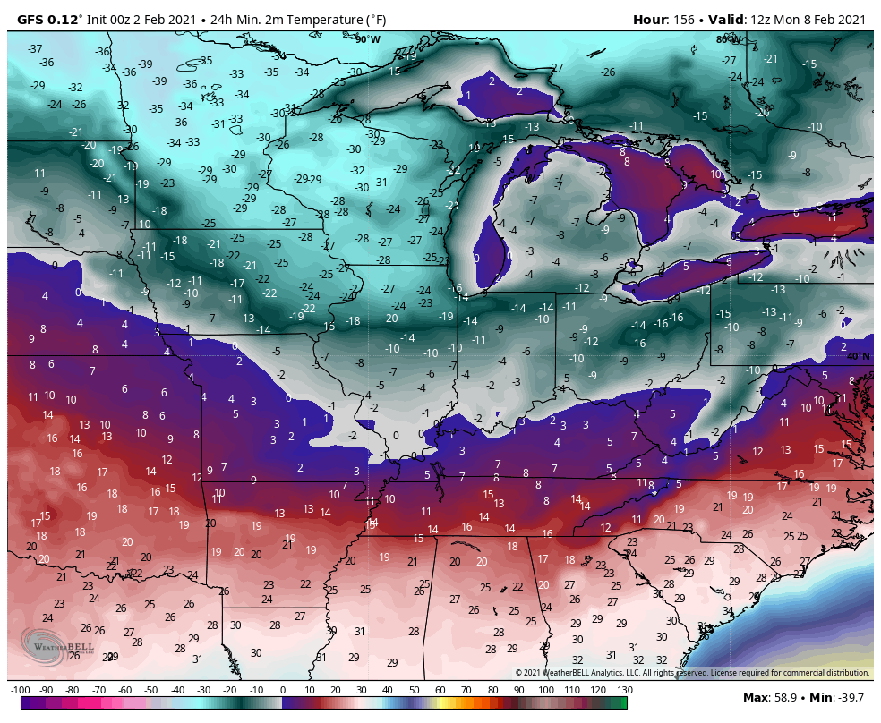
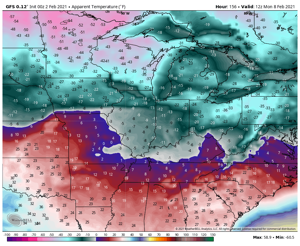
Wind chills…
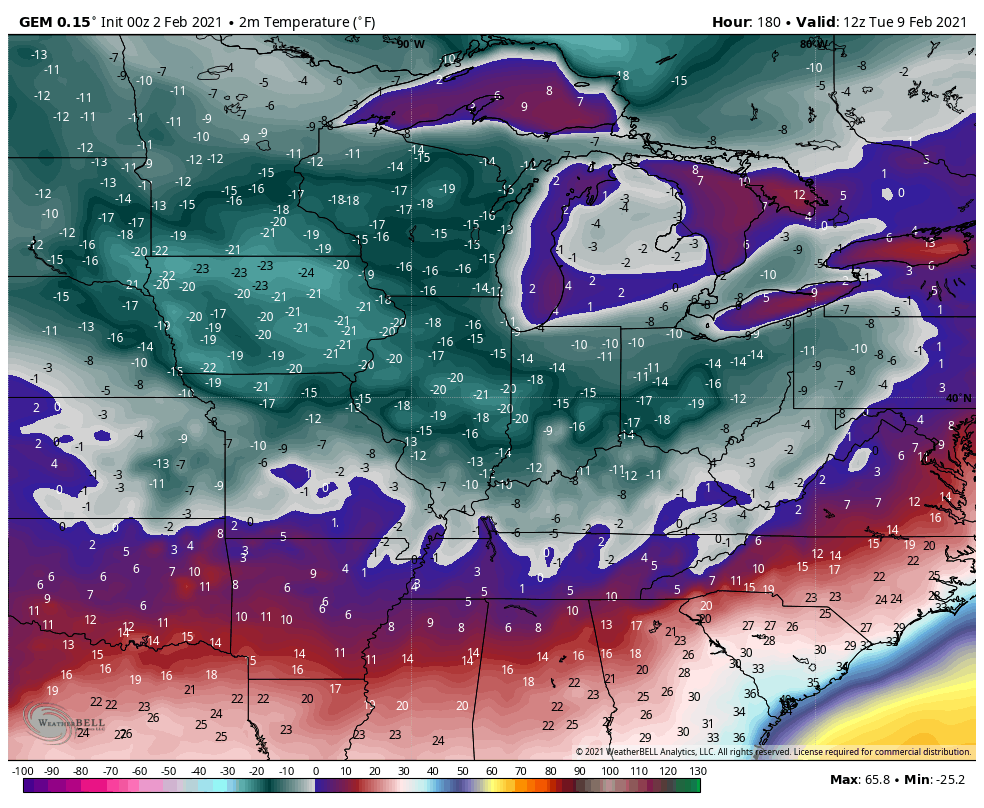
Canadian temps are a day later, but still brutal…
Once again, I will cheer on any scenario that results in not as much cold anywhere in the country. Of course, the weather will have the final say about what happens… As it always does.
I’ll see you for updates later today, so check back. Have a good one and take care.

Good morning everyone, it is snowing here at my house in Letcher Co , with temperatures at 25. Looks like we got around 2 1/2 to 3” of snow since yesterday and I’m only guesstimating…. to early to measure. Our roads are really bad this morning. Every thing that was wet yesterday is a solid sheet of ice and snow covered this morning. Be careful!
Good morning to you as well. Just for fun and while we are waiting to see exactly where the Arctic Air will enter the US, I decided to post this fun fact:
https://www.weather.gov/lmk/groundhog_day_lmk
I don’t like to seeing pink & orange on the GFS.
Especially with temps way below normal.
Yep, being we are in a La Nina Winter that GFS model with the pink and orange makes me nervous for sure.
Well, this is the longest we’ve gone since the 1940’s (did not look back further) to not have a big ice storm. We’ve gotten at least one in every decade until the 2010’s. If part of the outlook chance, I would bank on that more than a big snow for the area due to the gap…..
Hopefully the word “ice” does not enter into CB’s posts much. Unless we are just going to get more small snows, I think we know what would win out for the area if between big ice, or big snow. It ain’t snow.
My comments don’t post. I’m logged in 🙁
Unfortunately, In our area of Central Kentucky Ice Storms are common. Most of the Ice Storms that occur are not as destructive as the one that occurred in 2009. Just a couple of years ago we had a minor Ice Storms that just broke off a few limbs.