Good afternoon, everyone. Our latest snow maker has wrapped up, but a few flurries and snow showers will continue into early Wednesday for some parts of the state. Now we turn our attention to a cold front early Friday with an arctic front to follow for Super Bowl Sunday. That one may bring snow and bitterly cold air into our part of the world.
Here’s our regional radar to see if it can pick up on any leftover flake or two…

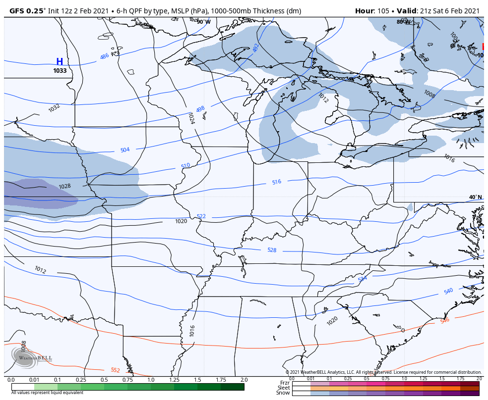
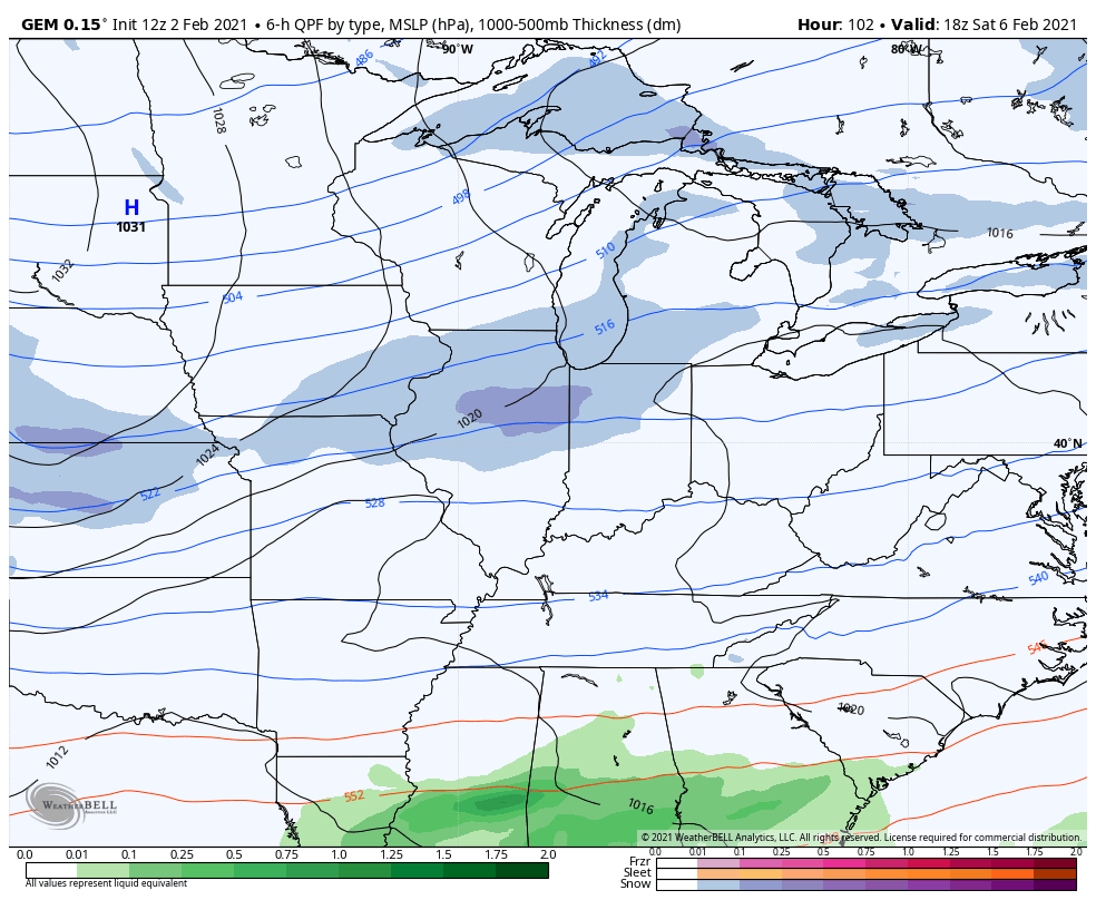
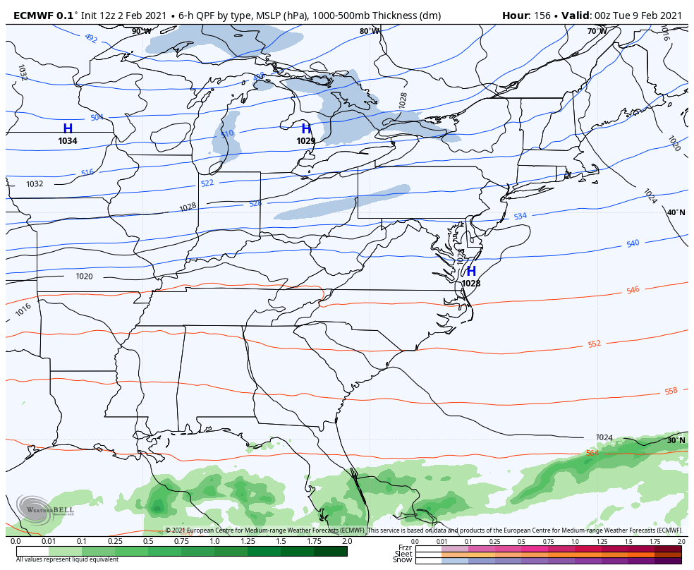
The Thursday night/Friday morning cold front has showers ahead of it and a few flakes behind it as temps crash.
The arctic front moves in Saturday night and early Sunday with a band of snow, gusty winds and bitterly cold air sweeping in. Does this front have a wave of low pressure along it and can it hook up with a system to our east and southeast? I can’t answer that and may not be able to for a few more days.
The GFS is the fastest of the bunch with this, but that’s the progressive bias of the model likely coming into play…
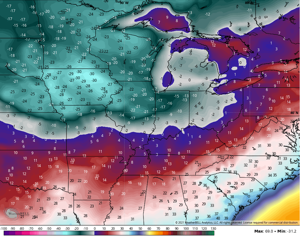
Monday Morning lows on this run…
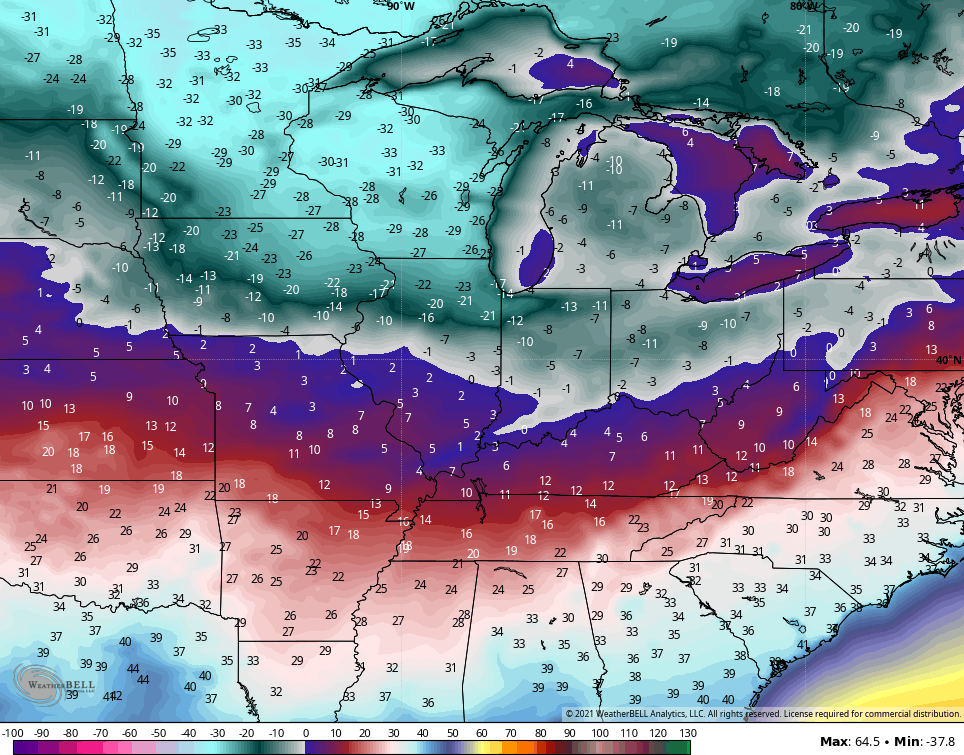
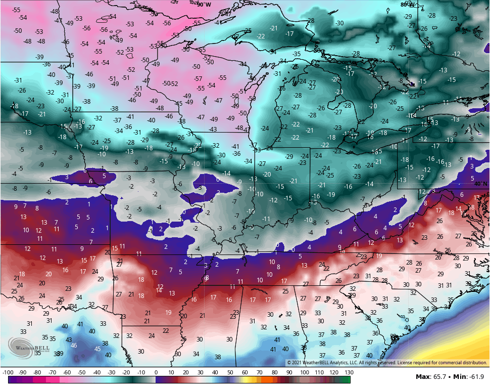
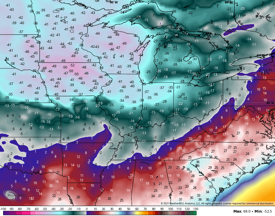
Wind chills…
The GFS does follow this up with a much bigger snow system a few days later…
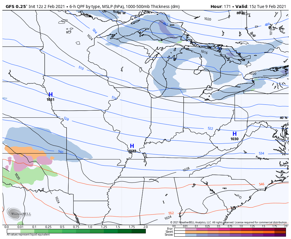
The Canadian Model is a little closer to playing the hookup game with the Sunday system…
Monday morning lows…
Monday Morning wind chills…
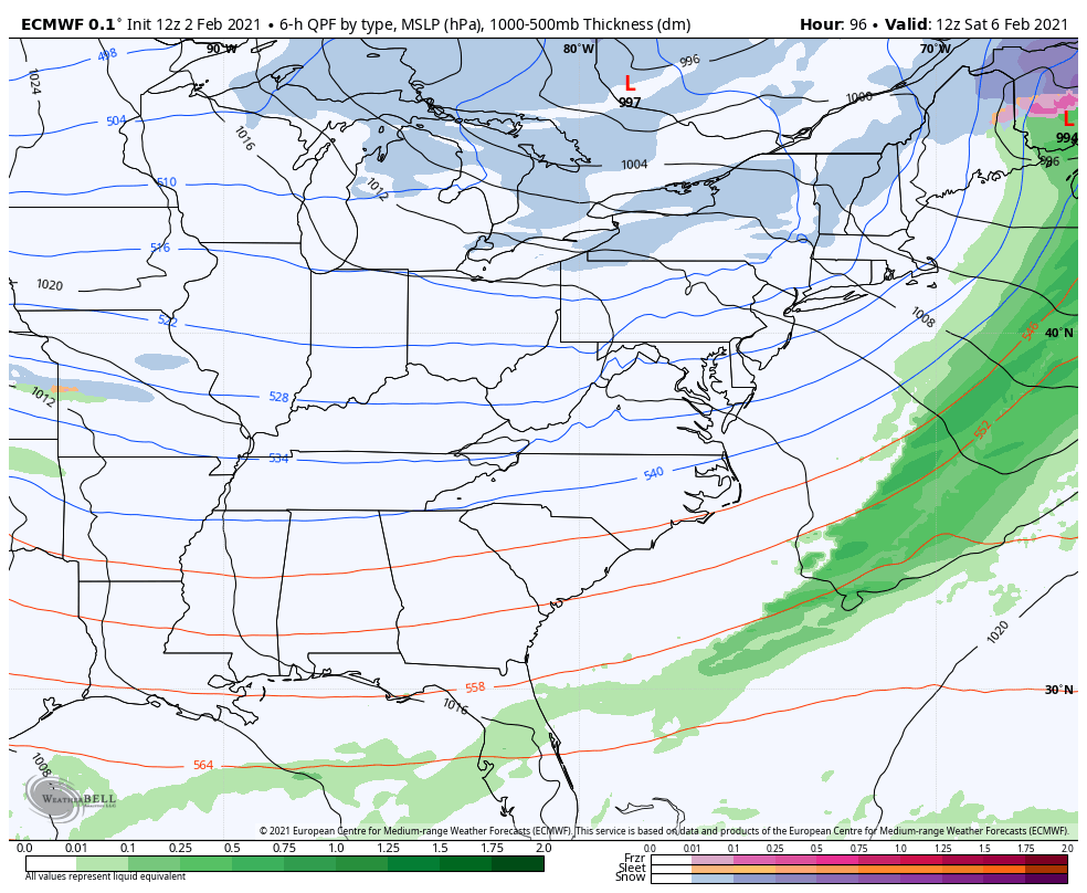
The European Model has a parade of systems starting with the Sunday one. The EURO looks to be holding too much energy back in the southwest, which is a bias of the model…
One thing we almost always see is the models showing one thing from a week out. The individual model biases then take over in the 3-6 day window, then we usually see the models go back to what they had from a week away. We’ve talked about that many times through the years on here.
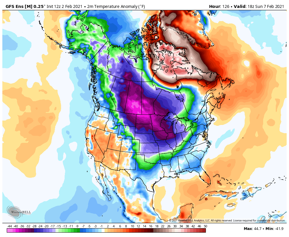
One thing is for certain, this is one cold period setting up through the middle of the month. The GFS Ensembles…
I will have another update this evening. Until then, have a good one and take care.

I guess I will go back to last Sunday and see what the models were thinking.LOL
With a Polar outbreak in the cards for us this coming weekend, newscasts nationwide are full of Polar Vortex stories, planting images of frigid tornadoes in viewer’s heads. When one such event looms, I like to check the blog of the PV’s acknowledged guru, Dr. Judah Cohen. but even Dr. Cohen is having prediction issues in our “new normal” climate. Check out how he opens the Impacts segment of his blog:
“I want to warn everyone first that in this blog, I will be winging it and spit balling it. As I have been saying in many previous blogs, I do consider this event unique in the observational record and in my own experience. …”
I’ve included a link to the blog, below.
https://www.aer.com/science-research/climate-weather/arctic-oscillation/
https://www.aer.com/science-research/climate-weather/arctic-oscillation/
Joe, thanks for sharing. Looks like another Nor’Easter, which would keep us cold and dry here in Kentucky.
I just worry about the return Flow from the Gulf of Mexico causing an over running Ice Event.
The trough in the Northeast responsible for this week’s Nor’Easter is hanging tough and not moving out to Sea because it is wedged between two ridges of high pressure. One high pressure ridge in the Central US and the other in the Atlantic.
Looks like now the piece of Arctic Air may move farther West as it approaches the US boarder or it may split into two pieces, one West and one East. Don’t really know. This has really been a weird Winter.
I would predict another one to two inch Snowstorm ( two to four inches ) would be better. LOL
Seriously, the Arctic Air is moving South, Southeast out of Northwest Canada towards the Central US.
If it stays on this track and not move into the Northeast and move to the West of our area, Western and Central Kentucky would have a better chance of Snow, only if the Subtropical Jet is active enough to phase and make a real Snowstorm.
If the frigid air slides East across the Great Lakes into New England it will form another Nor’Easter for those Folks that just got around three feet of Snow inland.
One thing for sure the “Lake Effect Snows” will kick in Big Time.
Seems a little snow and a lot of cold might be the summary.
The NWS has upped the low temperatures here in my area for Monday morning with Monday’s high temperature near 30 degrees. Low chances for any Snow or Ice at this time.
Well Schroeder has all the answers!!! Thanks Chris for all you do! I hope we get tons of cold and snowy weather throughout the commonwealth. We are overdue for extreme winter weather, despite what the southeast ridge has to offer. I for one am enjoying our nickel and dime snows. I also appreciate your dedication, for the past 12 or so years, to keeping us informed on what may or may not come to fruition as only Mother Nature can deal with that.
Still holding out hope for a “old skool” thumping for all the Kentucky snow lovers.
I could go further with the current discussion, but it seems like weather forecasting three days out is in the tank.