Good evening, everyone. As we put the wraps on our Groundhog Day, we turn our attention toward the active setup for the end of the week through Super Bowl Weekend and into next week. A harsh winter pattern continues to unfold across the country, but the evolution of it all is a work in progress.
Before we look too far ahead, watch the northwest flow kicking in off Lake Michigan tonight. This can spawn some flurries and snow showers that can even put down minor accumulations in the southeast. Here’s regional radar…

The first cold front arrives Thursday evening with rain ahead of it and a temp crash and some snow behind it. The temp drop is pretty dramatic and we may see a 20 degree or greater difference from one side of this front to the other. This is also going to become a major wind maker with gusts well over 40mph possible…
Wind chills may reach the high single digits Thursday night.
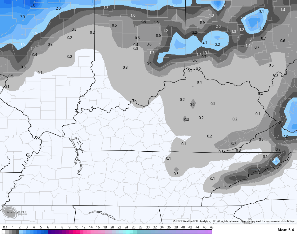
The models are showing the period of light snow a little better. Here’s the GFS snow map Thursday night and early Friday…
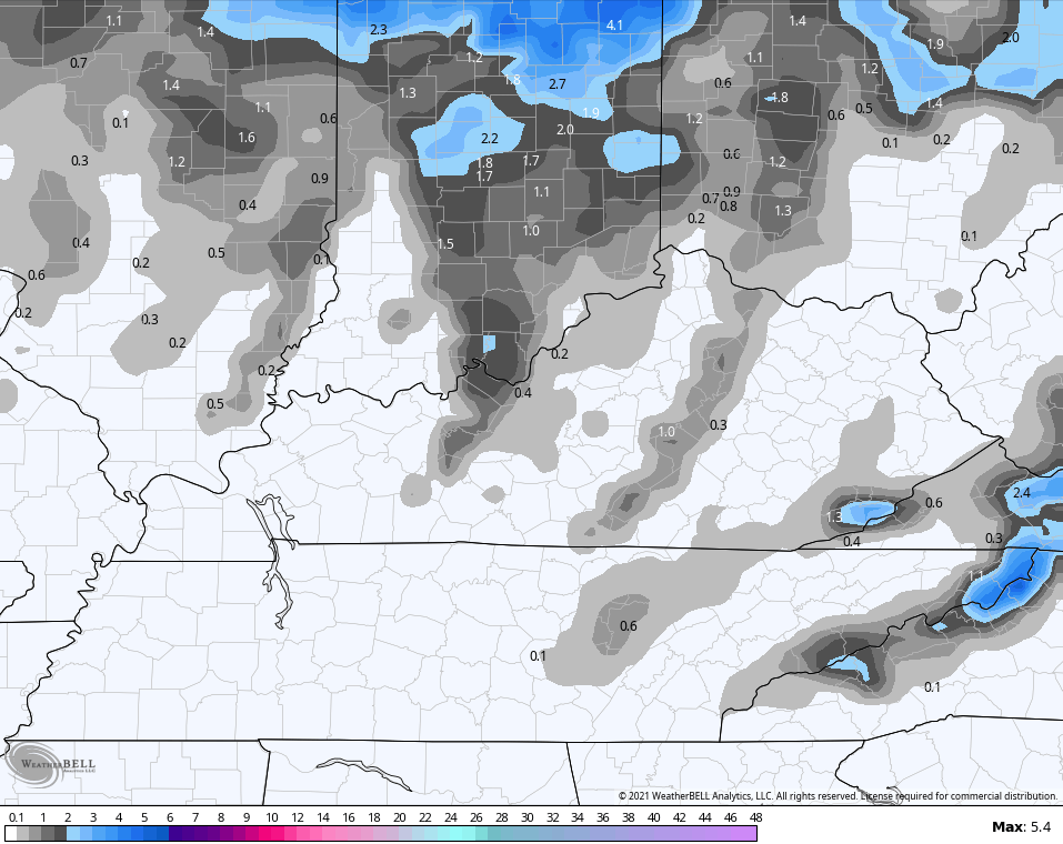
The NAM is a little more blotchy with the snow, but you can see how the model wants to have the cold catch the back edge of the rain and flip it over…
With a temp crash, we will have to watch for a quick ice up in some areas.
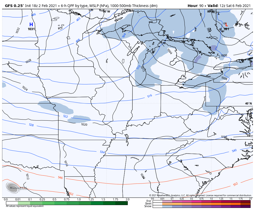
There are no new model runs for the weekend and next week setup, except for the GFS. We are now getting totally different solutions with each model and with each model run. The late day GFS doesn’t bring the brutal cold in here and doesn’t develop a huge storm. Instead, it brings arctic air in with multiple snow makers…
Snow lovers should go ahead and lock that one in because it’s a snow maker every day or two.
I’ll see you guys back here with a full update later tonight. Enjoy the rest of your evening and take care.

Hope it holds Snow better than Ice. Hopefully Snow for Western Kentucky ?
LOL, who knows? The models certainly do not seem to.
Those little snow makers might be overachievers.
We could see some high snow ratios events.
Need the colder air for the ratios. The models are already off from the expected real cold air and seems to have been the case all winter so far- Colder air a week or two out and we get there and no really cold air happens. That is the main trend I’ve noticed so far. CB must go nuts trying to make sense of the models.
Chris….keep doing what you are doing. You have weather and people skills. You connect with your audience. Push on.
It may be too early to ,predict specifics, but even I, the Western Kentucky snow pessimist, sees the potential in February!