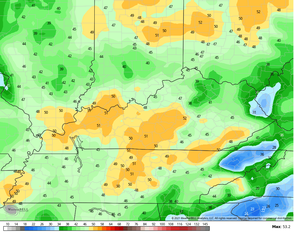
Good afternoon, everyone. A super-active pattern is ahead of us (not that it’s been quiet this winter) with the first in a series of systems arriving late Thursday. Gusty winds will usher in a colder setup with arctic air and snow threats lining up from the weekend through next week. How many of those snow threats can we cash in on? As always, time will tell. The system moving in tomorrow will have some big time winds along and ahead of it. Here are the latest gusts from the NAM Fam… 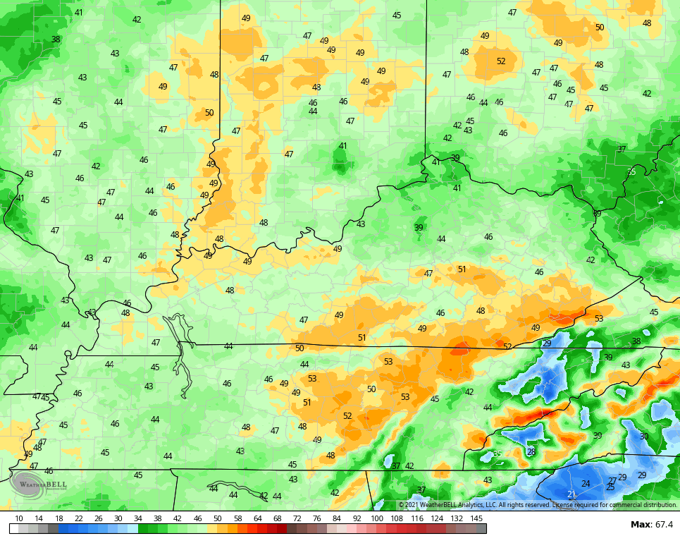
 Rain will be ahead of this front, but with a big temp drop behind it, a switch to light snow will occur. The leading edge of the rain could even start out as a touch of frozen stuff. The models are trying to put down some very light accumulations Thursday night… NAM
 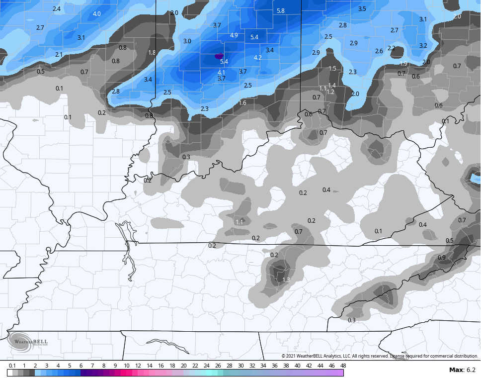 GFS
GFS 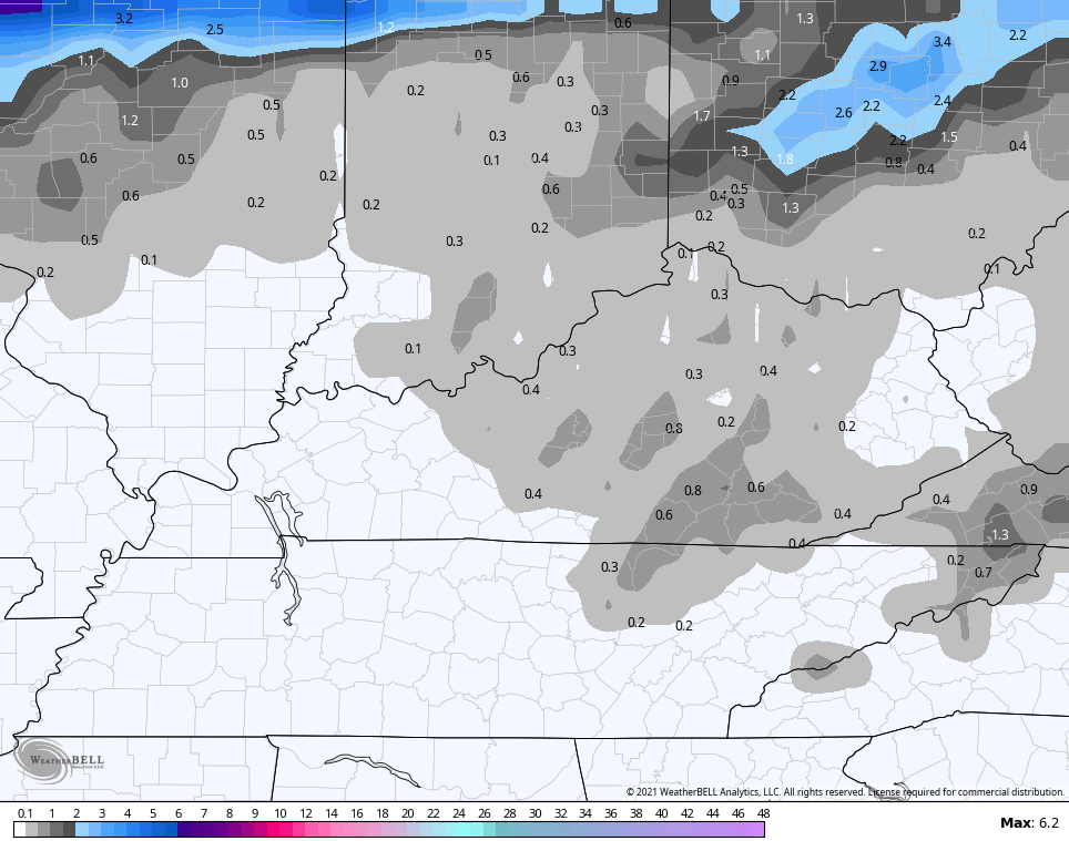 For the upcoming pattern starting this weekend and going through next week, the models are doing exactly what I’ve been talking about. Each run looks different than the last run of each individual model, but the overall theme of the models continues to be one for a harsh winter pattern to invade much of the country. Too many folks get caught up in specifics from each individual run. Instead, look for what the pattern is saying then we will figure out specifics as we get closer. Bitterly cold air will take control of the overall setup across the USA from the weekend through next week. The models can’t handle that very well to begin with, but we also have several systems working along the southern edge of this air. That means even more chaos from the models. The core of the arctic cold for our region continues to show up more toward later next week than this weekend or early in the new week. We will likely get in on several snow threats starting Friday night and going through next week. How many can we cash in on? That remains to be seen, obviously. Let’s take a look at the recent model forecasts… The Canadian is probably the closest to reality as of right now…
 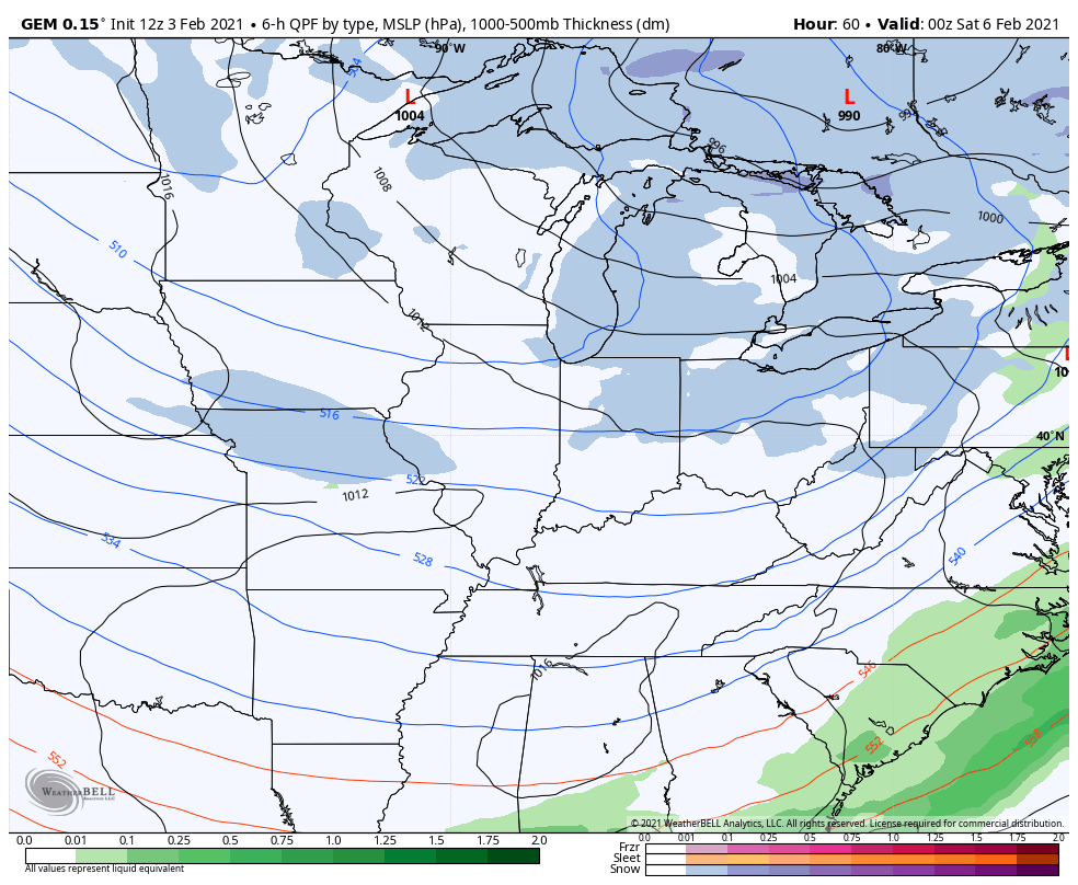 The GFS isn’t too far off from that…
 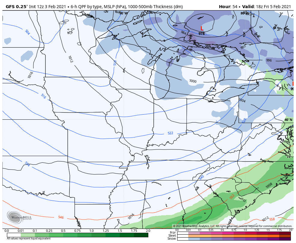 The EURO is the model exhibiting the wildest swings of late and is likely to continue to do so. The bias of the model in holding back too much energy in the southwest is coming into play. Still, here’s what it shows…
 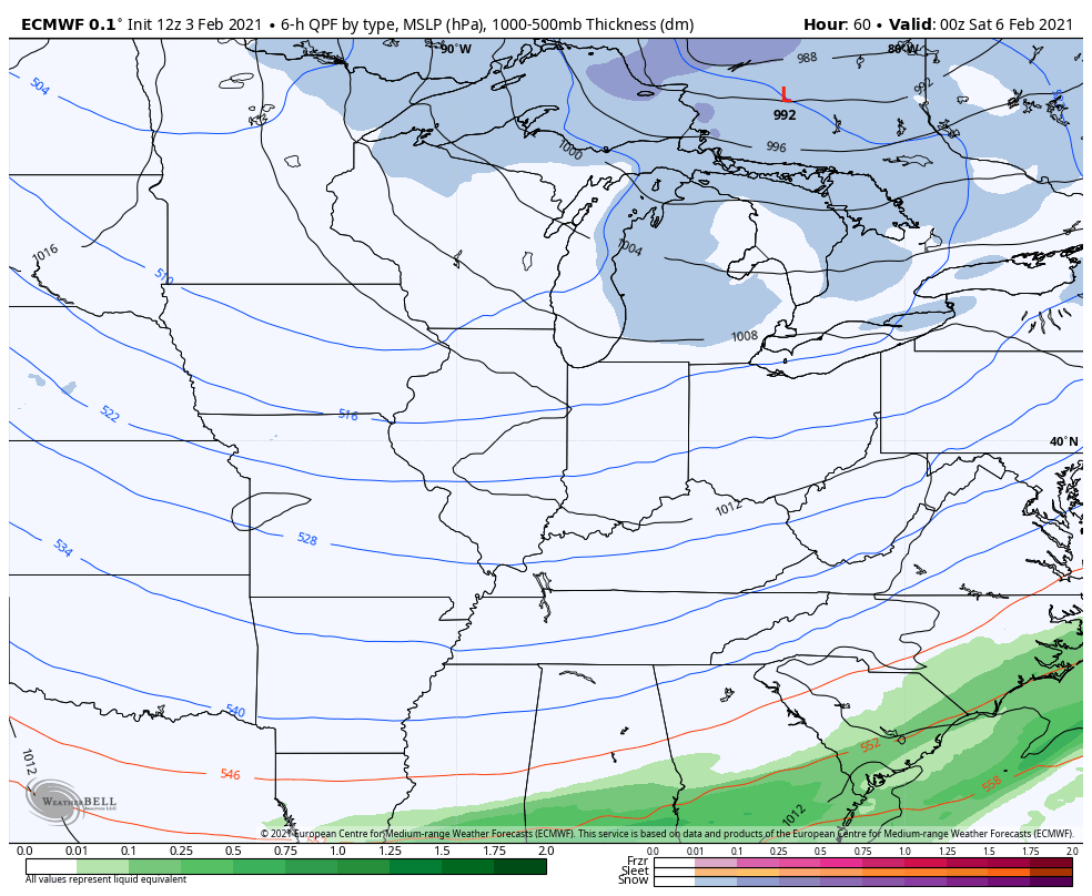 Instead of focusing on the specifics of operational models, check out the average of the GFS Ensembles 21 members for temp departures starting Sunday and going through February 19th…
 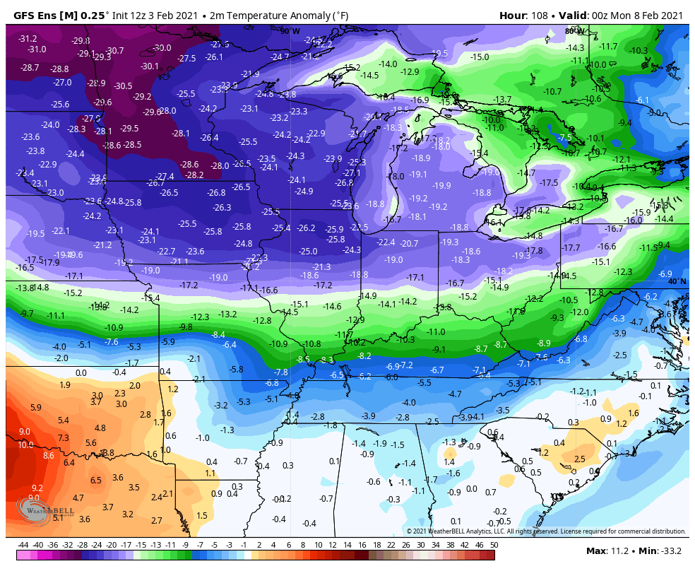 Again, those are smoothed out averages, especially as you get deeper in time. Of course, this is when your friendly weatherdude starts thinking spring thoughts, so I’m not sure how I feel about this pattern. 🤷♂️ I will try to throw you an evening update, but no promises today. Have a good one and take care.
Select Page

Glad the Arctic Air is on hold for our area, but it’s just like “kicking the can down the road” with these various weather models.
It’s too early to talk about Spring, but when Spring arrives will it stay Spring (weather?)
Hoping for a BIG snow. Western KY been left out this season.
It’s literally NEVER too early to talk about spring. 😉
It is if you are growing Azaleas to sell. If the blossoms come out too early and freeze around Easter Sunday your literally out of business for that Spring.
I had this happen to me many times, and it happened in years like we are having now. It happened last year.
Not glad I’m retired from the business as I miss the years when the Azalea Blossoms were glorious and the sells were very productive.
I’m still an Azalea Consultant for various growers throughout North America. At least that something.
I am scared that all we are going to get out of this cold period is frozen mud &’higher energy rates.
c’mon my friends, say it with me…. #TeamSpring 🙂
Us winter lovers should like the overall setup leading into next weekend. Snow chances should be good. Although as BubbaG noted, if has been awhile since a ice event. Still holding out for a old skool thumping of a snow. I don’t think spring until mid March. Thanks Chris for all you do.
B
Jenks good to hear from you. As far Bubba theory the 2009 ice storm is enough for this century
That Ice Storm in 2009 cost me $12,000 to clean up the downed trees around my property.
To make matters worse we didn’t have any electrical power for 15 days and it would have been longer if I didn’t call my Lawyer to get the power back on.
I’m turning 70 years old this year and I don’t think I would be able to stay in my home if that weather type happened again.
I’m saving for a whole house Generator that runs on propane gas, but right now with the cost of living going up it will be a while longer.
So please Lord no Ice Storms.
It’s looking now that all the “Big Time Snowstorms” will continue to be where they have been occurring ever since Winter started on December first.
February is our Snowiest month, so there is still a chance we will see more of the two to three inch Snows.
That’s enough Snow not to cause too many problems unless it’s on the roadways.
So far this Winter in my backyard I recorded five inches of Snow. More than last year and it hasn’t been that cold. I would rate this an average Winter for Central Kentucky.
I like to think about Spring three weeks after Easter Sunday.
I’m hoping that we don’t have those dreaded late freezes. Last year there was a freeze in May !
I like the first model best! Lol. Chris I am with YOU! #TEAMSPRING! BUT ONLAfter we get a REAL snowstorm ” desl? Lol
last time i checked BAILEYspring time is a month maybe 2 away, so this spring crap from you in early feb is a crock. i dont want zero weather and a big snow either. so as a forcaster with a blog you cant feed the dogs and starve them in same breathe. you bailey need quit im ready for spring on feb 4th. love all you all, great see mrs kristen k back at work!!!