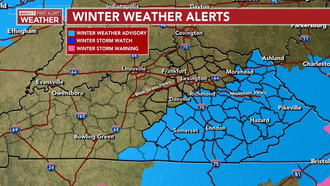
Good evening, winter weather weenies. A Winter Weather Advisory is out for much of eastern and southeastern Kentucky through Sunday morning. Rain and snow moves into this region in the coming hours with accumulating snow taking over tonight. Beyond all this is a pattern locked and loaded to become memorable for much of the country.
Here’s a look at the Winter Weather Advisory…
The northern counties in that are iffy with this type of setup as we will likely see a sharp cutoff. My forecast from last night still looks to be in good shape, so I’m going to let it ride…
Some areas in that coating-1″ zone may get totally shut out by the dreaded snow split. You’ve been warned. 🤪
The NAM isn’t as amped up as before and matches my forecast pretty well…
So does the GFS…
You can see there why I have concerns on the northern counties of the Advisory. The HRRR has a little better coverage, though…
All of the models continue to point toward some areas exceeding 4″ in the far southeast.
The late day run of the GFS continues to indicate a crazy winter setup behind this for next week and even beyond. This run has one ice event, then goes all snow as brutal cold moves in later in the week…
Here’s the brutal cold following it…
Even the average lowest temp forecast from the 21 member GFS ensembles is below zero…
Beyond this, the models continue a frigid and active pattern. For fun, the late day GFS builds a glacier across the country over the next two weeks…
I will have the full update later tonight, so check back. Here are your radars to follow the wintry mix and snow into the region…
Enjoy the evening and take care.

