Good Evening and Happy Super Bowl Sunday. Your friendly weatherdude is at the office and working on this semi-national holiday because the weather never stops. That, or maybe our boss wanted the M-F folks to work. 😣 Regardless, there’s a lot of weather to focus on for the upcoming week.
We continue to see a very ugly pattern showing up for the week ahead. With an arctic front draped right on top of the region, waves of low pressure will be riding through and bringing a lot of different precipitation types. Snow and ice are an increasing threat as the week wears on.
Folks, this is not a good setup on the way. My concern for freezing rain continue to increase and you are seeing the models going straight to this scenario. The EURO has had some serious issues of late, but the late day run seems to be gathering itself and is taking on the look the GFS has been spitting out for days.
This run only goes through 7am Thursday, but you can clearly see the ice concern…
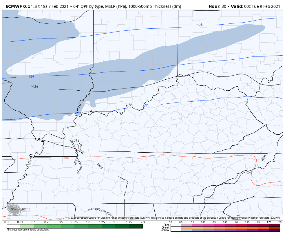
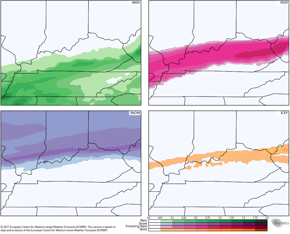
Here’s the model output for liquid equivalent for each precipitation type through 7am Thursday…
The GFS has had this signal for a long time, but the EURO has been showing the bias of the model in how it handles energy coming out of the west and southwest. You’re also seeing the power of arctic air which all models struggle to deal with. In most cases, the cold is much stronger than the models think.
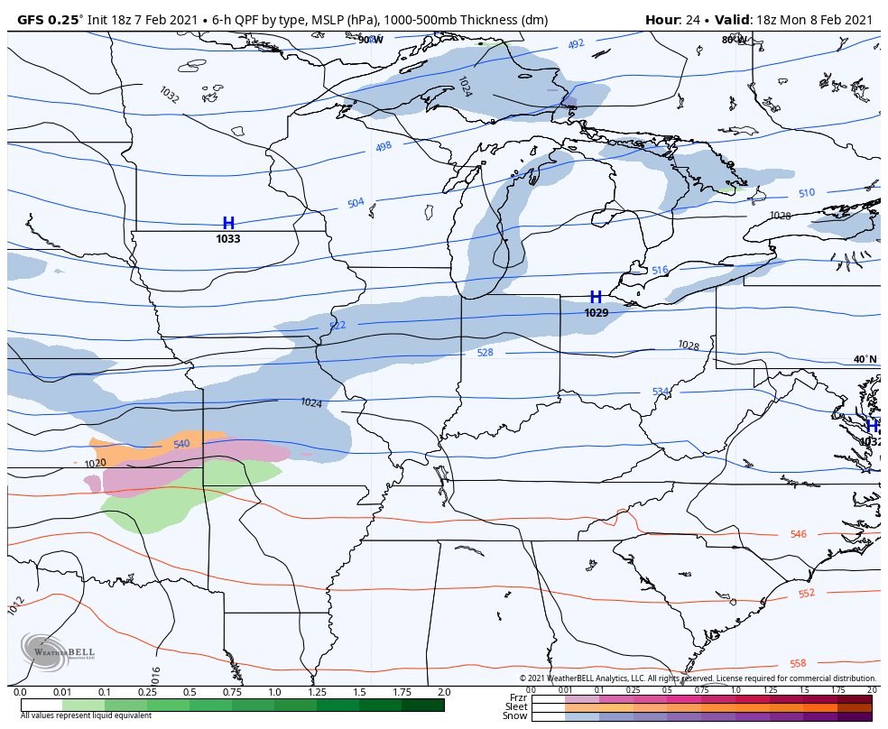
The late day GFS continues to spit out winter weather systems through the week and into early the following week…
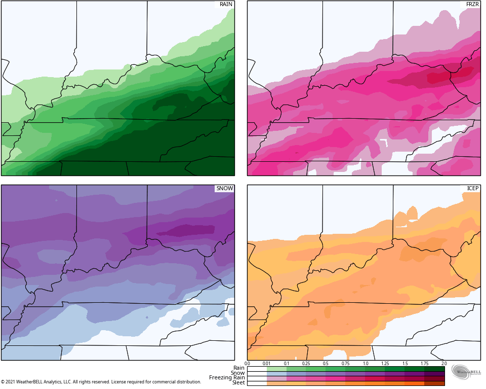
The corresponding liquid equivalent totals for each precipitation type…
Again, we want ZERO part of freezing rain. Plain old rain or plain old snow would be just fine, but the odds favor some nasty.
I’ll see you guys on WKYT later tonight and then with another KWC update. Have a good one and take care.

Ice = Boo!
Bubba G your latest comments were an act you wanted ice storm and you may wish more than you want.lol
Not seeing in any stretch how I wanted one. Had no power for four days. All I did was point out over the past weeks this is the longest we’ve gone in many decades without an ice storm and that the models do much better jobs predicting big ice, rather than big snow.
Not seeing how I was wishing for one.
Let’s get it on!
Not looking good no improvement with the 12z runs.