Good Monday, everyone. A harsh winter pattern continues to unfold across the Commonwealth of Kentucky and surrounding areas. We have multiple winter weather makers working in that will have a significant impact. The most concerning issue is the increasing threat for widespread freezing rain by the middle of the week.
We have a lot to talk about, so let’s start with the immediate threat for snow late today into early Tuesday in the north.
This comes from a wave of low pressure along the stalled arctic front. Rain and snow develops this afternoon in a narrow swath across southern Illinois and Indiana. This will then work northeastward into Kentucky, bringing accumulating snows. Watch how the Future Radar of the Hi Res NAM handles this…
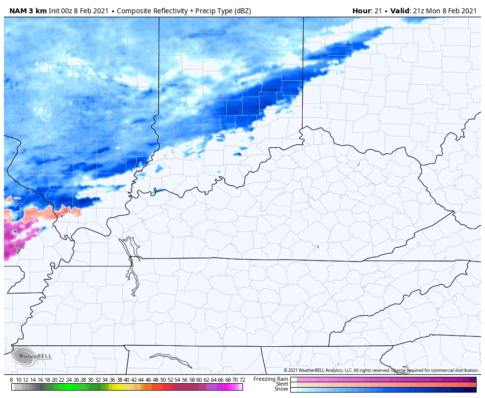
That run of the Hi Res NAM is throwing down a corridor of hefty snows in the north…
So is the NAM, but it’s just a bit farther north…
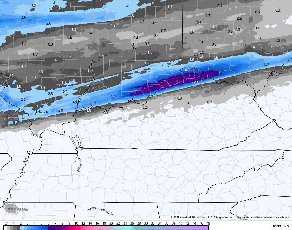
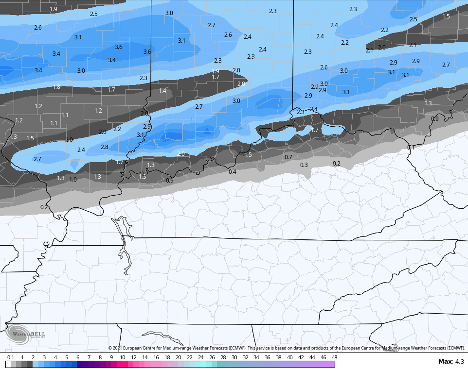
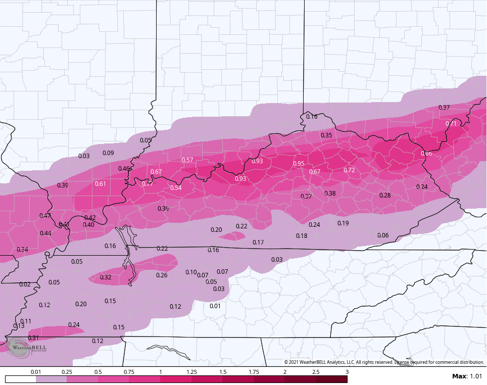
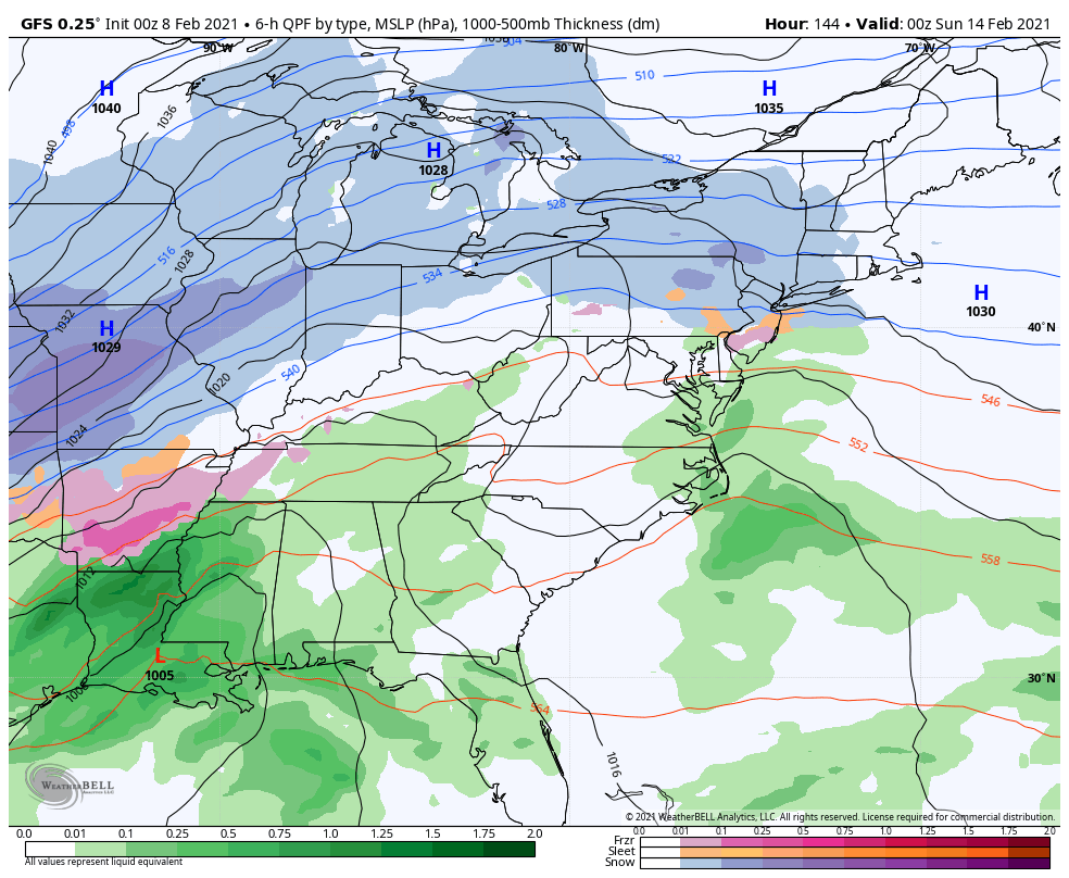
The GFS offers this up for snowfall…
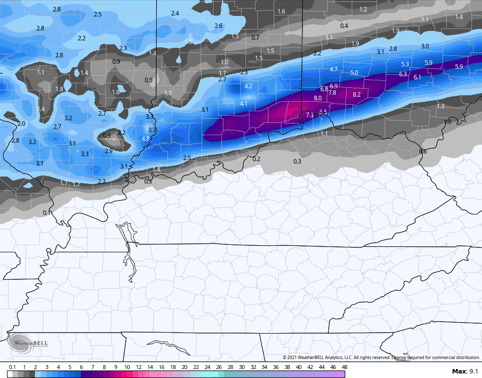
The EURO is similar…
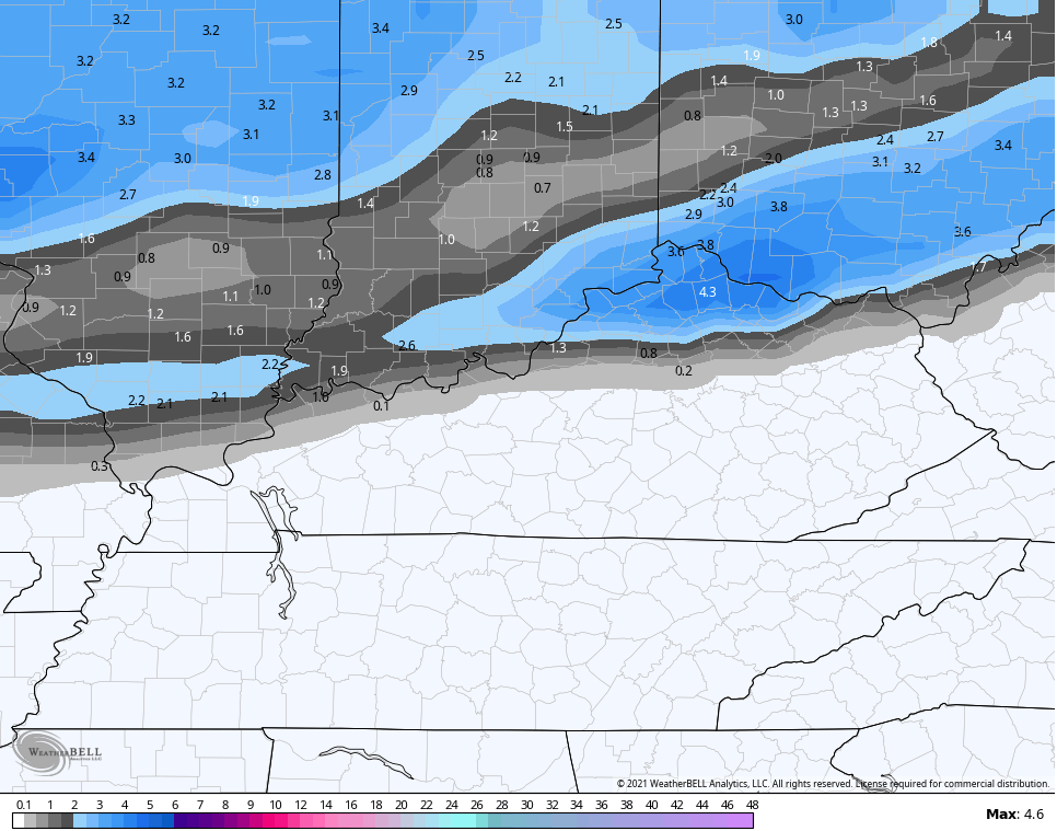
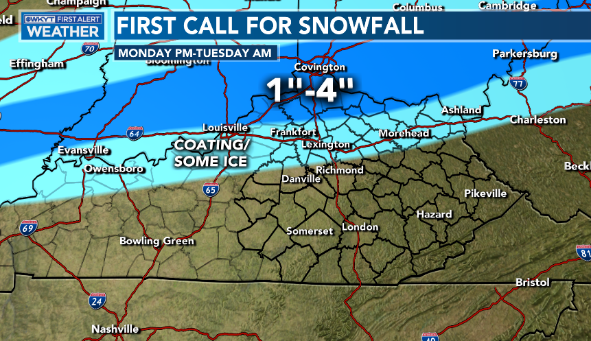
There is also the opportunity for some freezing rain just to the south of the accumulating snow. Here’s my First Call For Snowfall for this event…
The next wave of low pressure zips by to our south Wednesday and Thursday and brings the potential for significant amounts of freezing rain for much of the state.
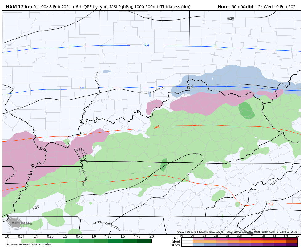
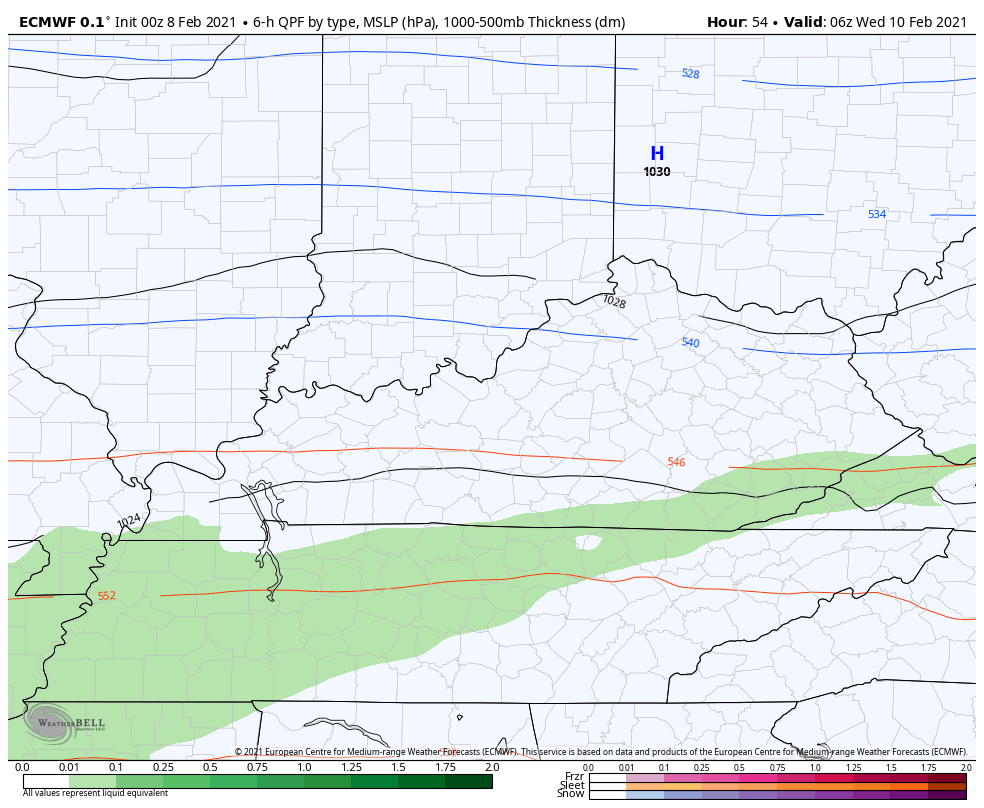
The NAM only goes through 7am Thursday, but shows the magnitude well…
The GFS has been all over this for days now and continues to show it, but it’s likely lacking in the snow department in the north and may be ending this too quickly…
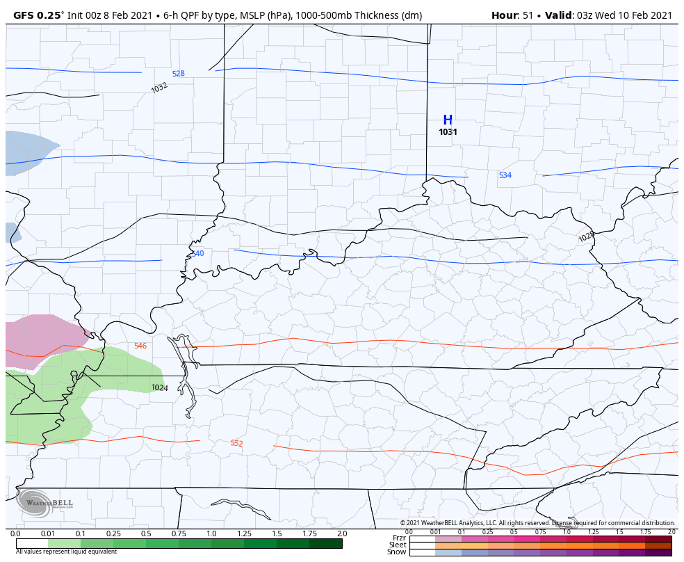
Nothing good can come from the amount of freezing rain it’s spitting out…
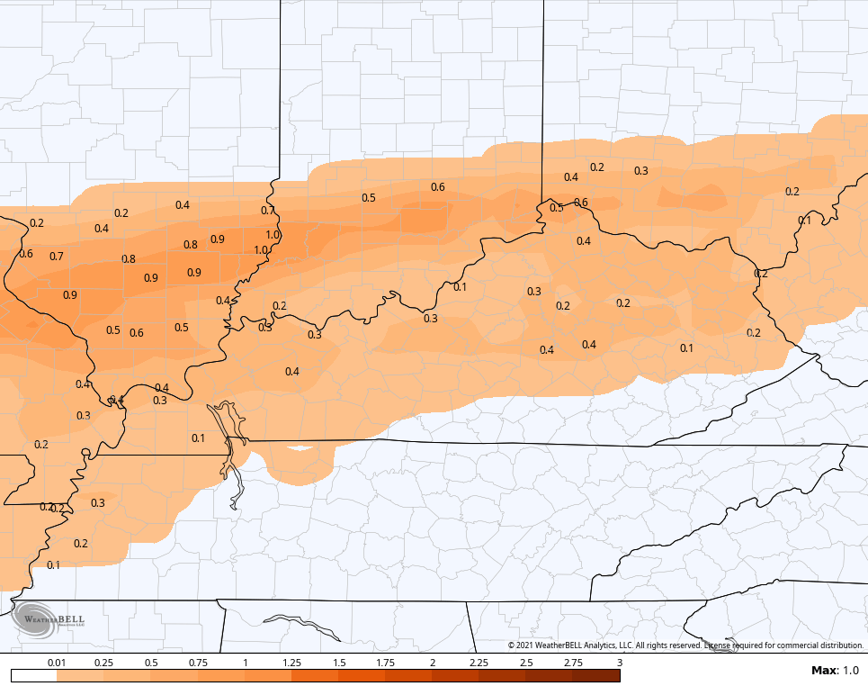
Here’s the sleet forecast…
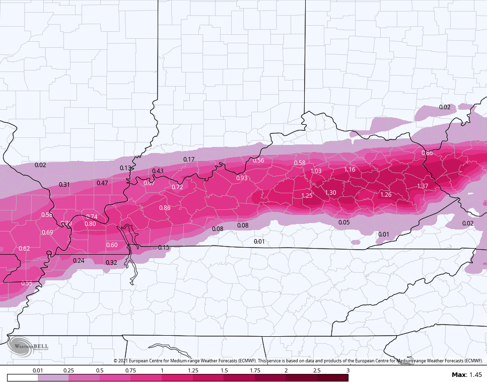
The EURO has taken a major jump to what the GFS has been showing, but is a little colder and has even more ice…
This is some serious ice…
After this, the pattern is likely to throw additional winter weather systems at us this weekend through next week…
Updates will come your way later today. I leave you with the radars and a cool addition for you techies…


Have a good one and take care.

Where is that polar express?? Was showing below zero temps? Not complaining I’m glad the models have been completely wrong for my area of northeast Tenn!! Hurry Spring!
The Polar Express is closed for maintenance. Please come back next season.
The Southeast Ridge is causing a damming effect and keeping the core of the coldest Arctic Air to our North.
On the Ventusky it is showing that the Arctic Air is moving South towards Texas.
All weather models are showing worse case scenario.
Be prepared, but if you loose electrical power it could be life threatening.
Im in the sweet spot for freezing rain. Why me! Lol
Just be prepared and hope for the best. I can’t say that enough.
Given that the models kept pushing the colder air out each run to “two weeks out”, seems obvious that was likely not happening. What you see in the models now with all that now snow stuff is Kentucky being a meteorological fence. The ice trend was showing last week and that is about the only thing for KY the models get right as far as bigger events. They are comic fodder for big snow.
non snow, now snow- what’s the difference- it ain’t snow.
Calm Down Bubba. I Know It’s Scary Because We Went Through The States Worse Ice Storm Back In 2009.
Just Be Prepared As The Confidence Is High That This Ice Scenario May Play Out.
I’m Ready To Go No Matter What Happens.
Not seeing any emphasis to facilitate a near condescending “calm down”. Trust me, there are other things much worse than ice and no power. My perspective is very jaded in that regard. LOL
I’m Sorry BubbaG I Was Out Of Line. Stay Safe And Warm !
Shout out to Schroeder for the weather links thanks much! Stay safe!
Your Welcome Russell.
Stay Safe And Warm !