Good evening, everyone. One area of snow and a light mix is working into Kentucky and will cause issues across the north. This is the opening act to a bigger winter storm rolling our way from late Tuesday night through Thursday night. This will bring a nasty mix to much of the state.
Let’s start with the Winter Weather Advisory for tonight across areas of northern Kentucky and southwest along the Ohio River…
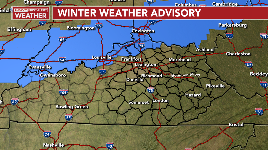
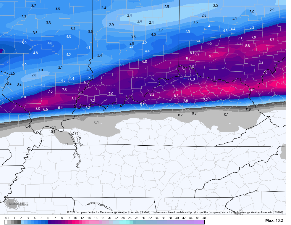
That may get expanded a little farther south because some light snow and light freezing rain may show up all the way down to the Interstate 64 corridor. Here’s my latest Call For Snowfall…
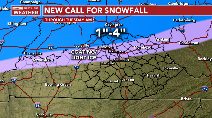
Some areas around Covington/Cincy may pick up 4″+ inches if everything works out perfectly.
The Winter Storm Watch is out for much of the state starting late tomorrow night…
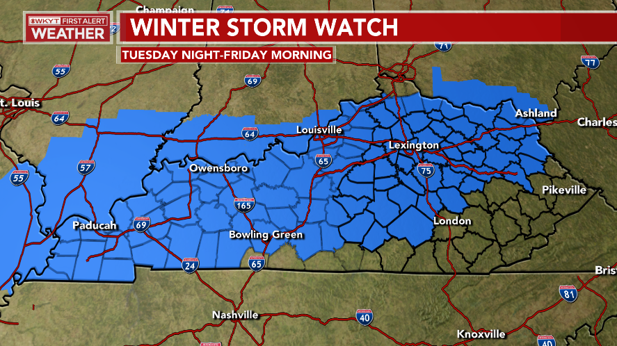
Southeastern Kentucky will likely get added to this as I’m fully on board with a little farther south focus courtesy of the strong arctic high to the north of us. I’m expecting a little more of a snow and sleet signal along and north of the Interstate 64 corridor, but it’s a fine line. I’m pushing the main area of freezing rain and sleet a bit south…
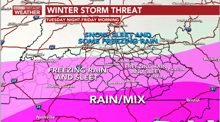
The EURO continues to paint the worst picture in terms of snow and ice. The freezing rain accumulation would cause some big issues…
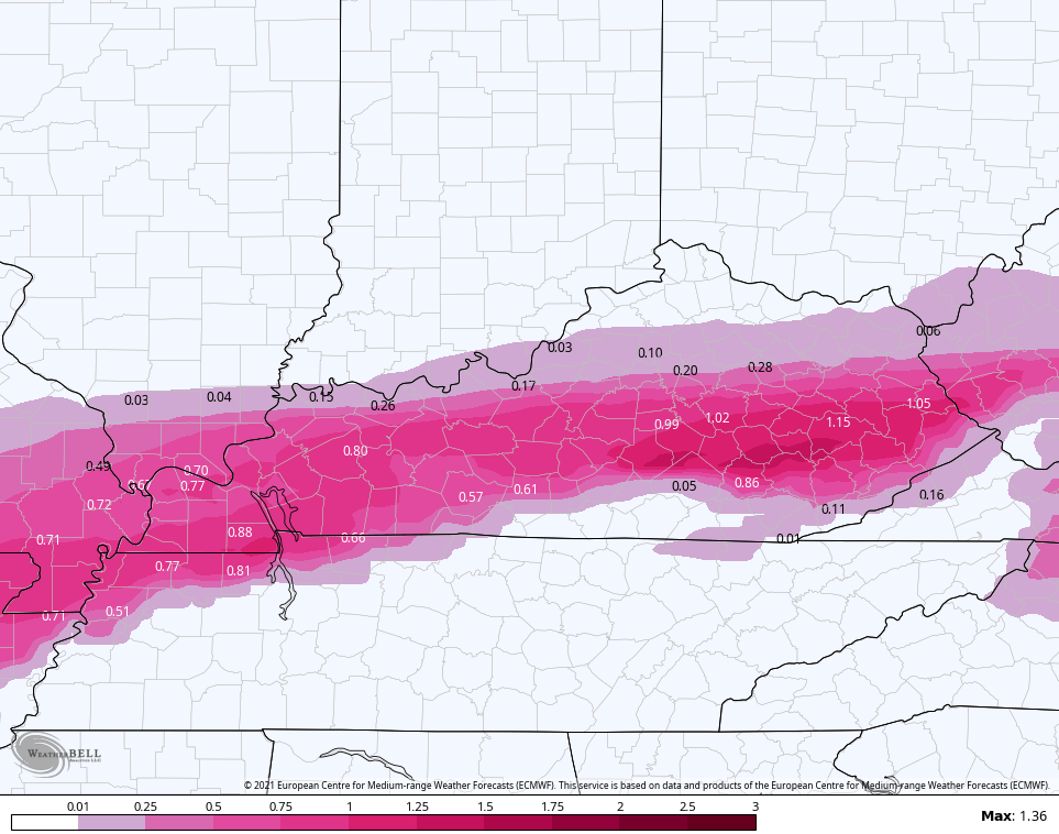
Notice how that matches up my thoughts on being farther south. That also includes the snow and sleet part of this as well…
SLEET

The snowfall includes tonight’s action in the far north…
I will have the latest on WKYT tonight at 11 and with a full blown KWC update later tonight. Until then, here are your radars to track the band of snow and light freezing rain…

Enjoy the evening and take care.

Definitely a challenging forecast.
I hope that the snow & sleet wins out for over the fz. rain.
This
It’s been over 2 years since we’ve had a Winter Storm Watch declared for Warren County, and they’ve picked a doozy! Meteorological science aside, I have a really bad feeling about this storm, which has a chance to rival the devastating 1998 ice storm. The storm brought down so many trees that the same power lines were broken in many places, causing people to lose power for weeks. Trees near power lines in my subdivision are trimmed regularly, but that doesn’t help if the grid feeding our area goes down.