Good Friday, everyone. With one ice/winter storm fully behind us, we can now focus fully on the Winter Storm THREAT Sunday night through Tuesday. This looks to play the part of a significant storm that brings snow, sleet and freezing rain back to the bluegrass state. This may then be followed up by another winter storm, potentially giving us 3 winter storms in the span of a week.
Before we get to that, we still have a little bit of winter weather to track. Low level moisture remains out there today and will keep clouds going for most of the area. Yes, some can see a little bit of sun, but the clouds may wind up winning the day.
There’s also the possibility of a touch of freezing drizzle or a few snowflakes showing up across central and eastern Kentucky. Here are your radars that will, admittedly, have a hard time finding those fine drops and flakes…

There’s a slight increase in the moisture tonight and this may lead to a little better shot at some freezing drizzle or very light snow across the central and east and this may continue into Saturday.
Our developing winter storm continues to slowly come into better focus. I’m seeing two distinct waves of the storm with the first arriving Sunday evening and lasting into Monday morning. After a bit of a break, the main wave of the storm looks to work in here late Monday through early Tuesday.
This system looks to have quite a bit of precipitation with it and it may be juicier than the one we just had. Significant amounts of snow, sleet and freezing rain are all possible. The exact amounts for any one location depend on the track of the low. Systems like this tend to take one low from the Gulf and work it across east Tennessee into West Virginia before transferring energy to another low along the east coast.
Here’s the deal… We want to do whatever it takes to avoid another ice storm. Period. End of story. Unfortunately, I cannot rule that out, especially across central and eastern Kentucky. Some areas will still have ice from the last storm and likely still some power outages by the time this next storm moves in.
Give us snow or sleet or make this a flat out miss.
The GFS shows the two waves of extensive winter weather, but it’s likely too flat and too far east with the surface low…
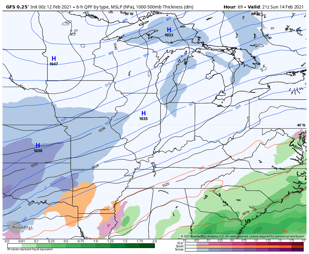
Taken at face value, the GFS has an ice storm in eastern Kentucky with a sleet/snowstorm for the rest of the state.
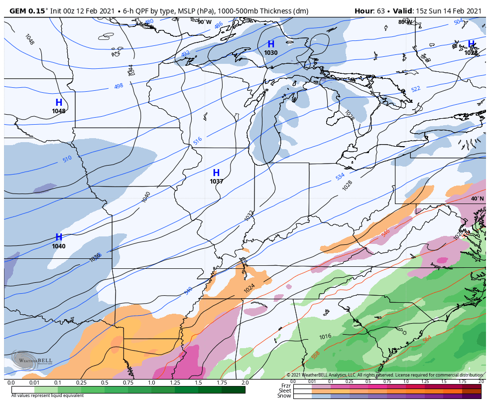
The Canadian Model hasn’t been performing well of late and really struggled with this last winter storm. That said, here’s hoping it’s right with the current one because it’s the coldest model and spits out mostly sleet and a snowstorm…
The latest run of the European Model shows a crushing ice storm for much of the state…
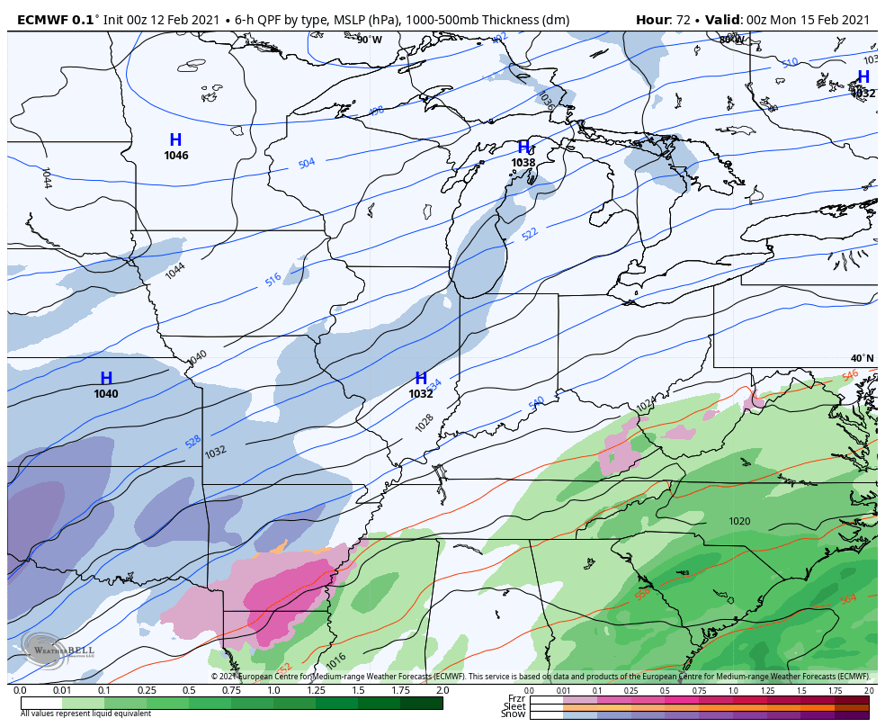
We want no part of that model run.
The new version of the GFS is showing much more wound up system than the GFS and is similar to the EURO, but it’s colder. The end result on this model is a major snowstorm for parts of central and western Kentucky…
It also has a major ice storm in the east…
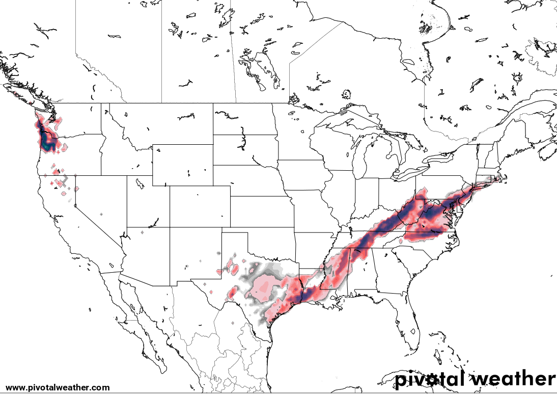
The UKMET offers more of a tame and colder solution that appears to be more similar to the Canadian…
As you can see, all models agree on a winter storm hitting this region, but differ on the magnitude and placement of the precipitation types.
I will try to put out a risk map with my next update around noon today. Oh and can y’all take it easy on my server until I can move to a different host? I spent a lot to upgrade the site and the server over the past several months, but this week has pushed it to the brink. Nearly 1.5 million page views will do that.😲 This has been the most traffic ever on the site and that’s saying something.
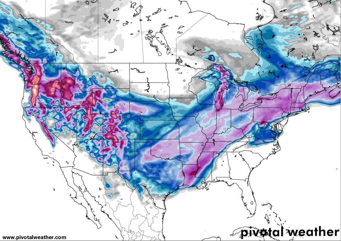
Oh, the models also have another winter storm a few days later but offer an even wider range with the possibilities.
I’ll see you guys back here later today. Have a good one and take care.

A combination of sparse moisture and late arriving cold helped Warren County luck out with the last storm. We’re hoping that our luck holds, but with a richer moisture source and entrenched cold, it’s highly unlikely. The snow deflecting “Bowling Green Bubble” may have met its match.
What is more insulting?
33 degrees with rain or 25 degrees with rain.
If it is not going to snow I hope this baby is made of sleet.
Thanks Chris, For All The Updates !
Have A Great Day !
The core of the Arctic air moved slightly to the west of the Chicago area Thursday, allowing temperatures to break 20 degrees for the first time in a week here! That being said, the high was only 21 degrees at O’Hare Airport, with similar high temps throughout the area, along with a scattering of light snow.
Our next significant snow is predicted to arrive Friday night into Saturday, with 3-6 inches possible, followed by a brutal blast of Arctic Air for Sunday into Monday.
No doubt the two winter storms next week will hit hard for many areas, as Winter Storm Watches are out already for much of Texas for Sunday into Monday, with 3-7 inches of snow predicted along with possible blizzard conditions and record cold temps for them.
Mike, Here In Central Kentucky We Are Once Again Under An ” Uncertainly Alert.”
Enjoy the Snowstorms Over The Next Several Days For Your Area.
You May Have To Get A New Snow Shovel As the One you Have Now May Wear Out. LOL
Take Care And Stay Warm And Keep Us Posted On The Snow Amounts.
We have a good coating of ice in my little area, Jenkins in Letcher Co But I’m thanking our Heavenly Father we have our electricity. We to never experience the really cold temperatures. That saved us ! Praying for those that lost there electricity that all stays safe.
Thank you Chris for the long hours and time spent to keep your weather weenies safe and updated.
You are appreciated!
If this comes to a fruitation looks like the dome will finally be busted here in Western, ky. As of now all models is agreeing snow here in my neck of woods
We need some above 32 and sun to get this ice off trees. Heck, 30 with sun would do it since the sun would warm the surface above freezing.
The longer this ice stays on power cables and trees, the more stressed they become, so any wind will help gravity out and then power’s out.
If the ice stays the power fragile areas would want sleet, since snow will stick and add weight as well- near same effect as ice for trees.
Could be interesting.