Good afternoon, everyone. A major winter storm is set to blast the bluegrass state from Saturday night through Tuesday. This will be another high impact storm that brings significant amounts of snow, sleet and freezing rain. This may lead to additional power outages across the region.
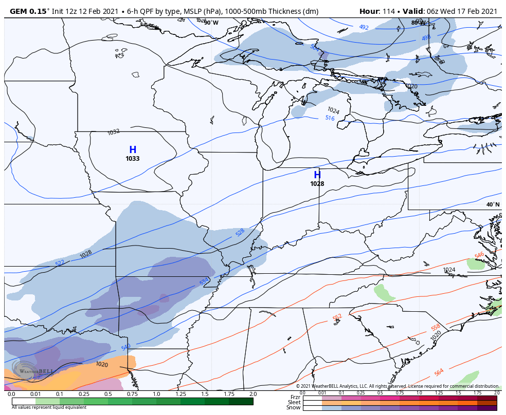
The track of the low will be key in determining just how much of each precipitation type falls for any one location. Here’s my early call rough estimate of how this works out…
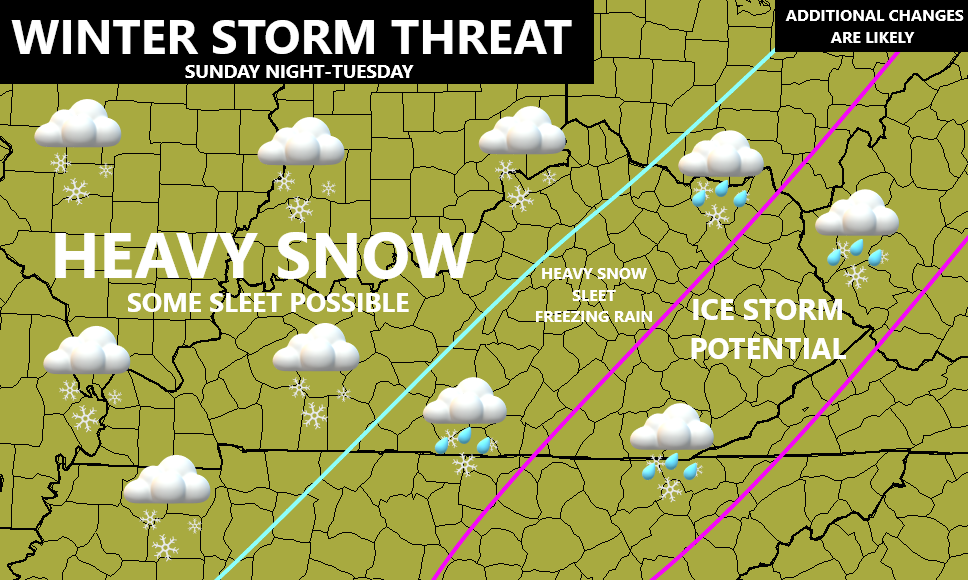
Let’s cut straight to the point here, with ice still on trees and power lines and some people likely to still be without electric, this has the potential to become a serious situation. Areas getting in on heavy freezing rain could have major issues with power outages.
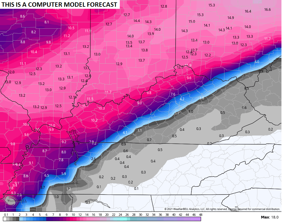
For areas seeing all snow, it’s going to be a lot.
In between the two is likely to be an area of heavy amounts of snow, sleet and freezing rain which could also cause power issues.
The exact placement of the precipitation types and amounts is a work in progress.
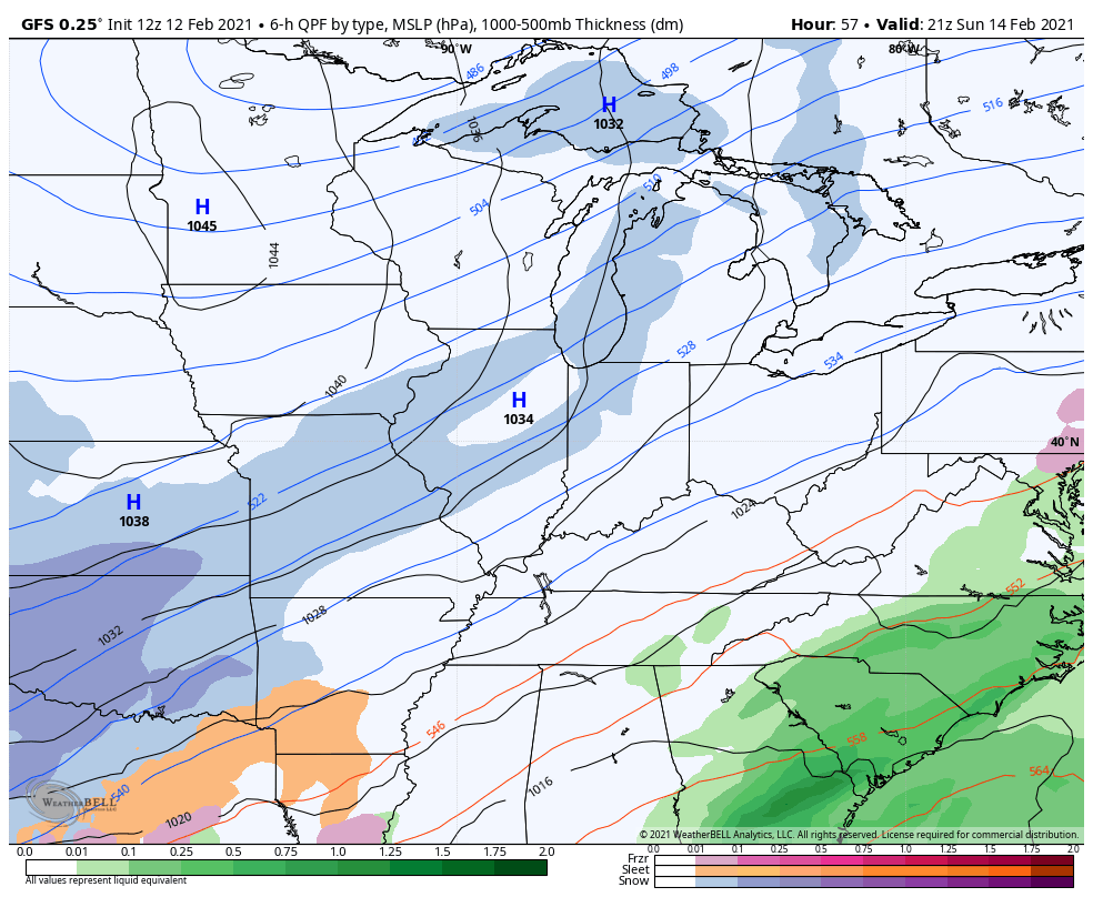
The GFS is seeing a possible shutdown storm…
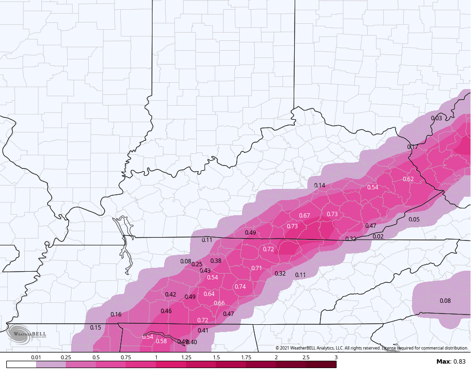
Freezing rain amounts…
Sleet
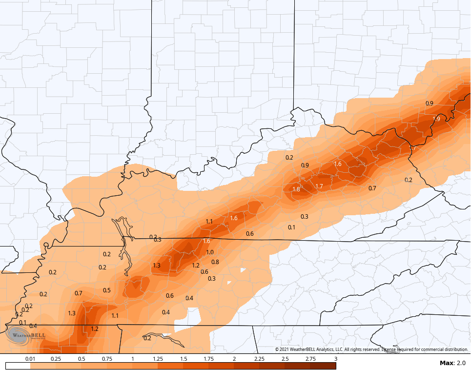
Snowfall
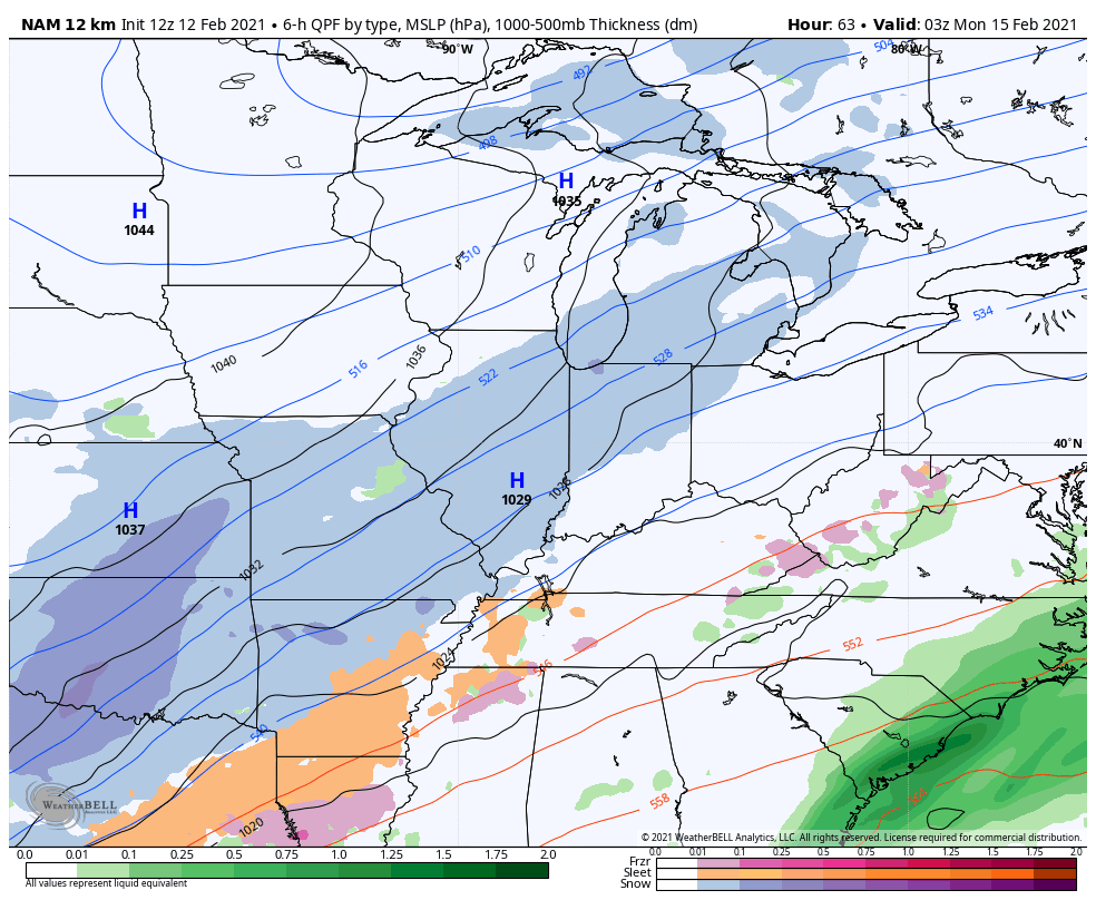
The NAM only goes through 7pm Monday, but appears to be in pretty good agreement with the GFS…
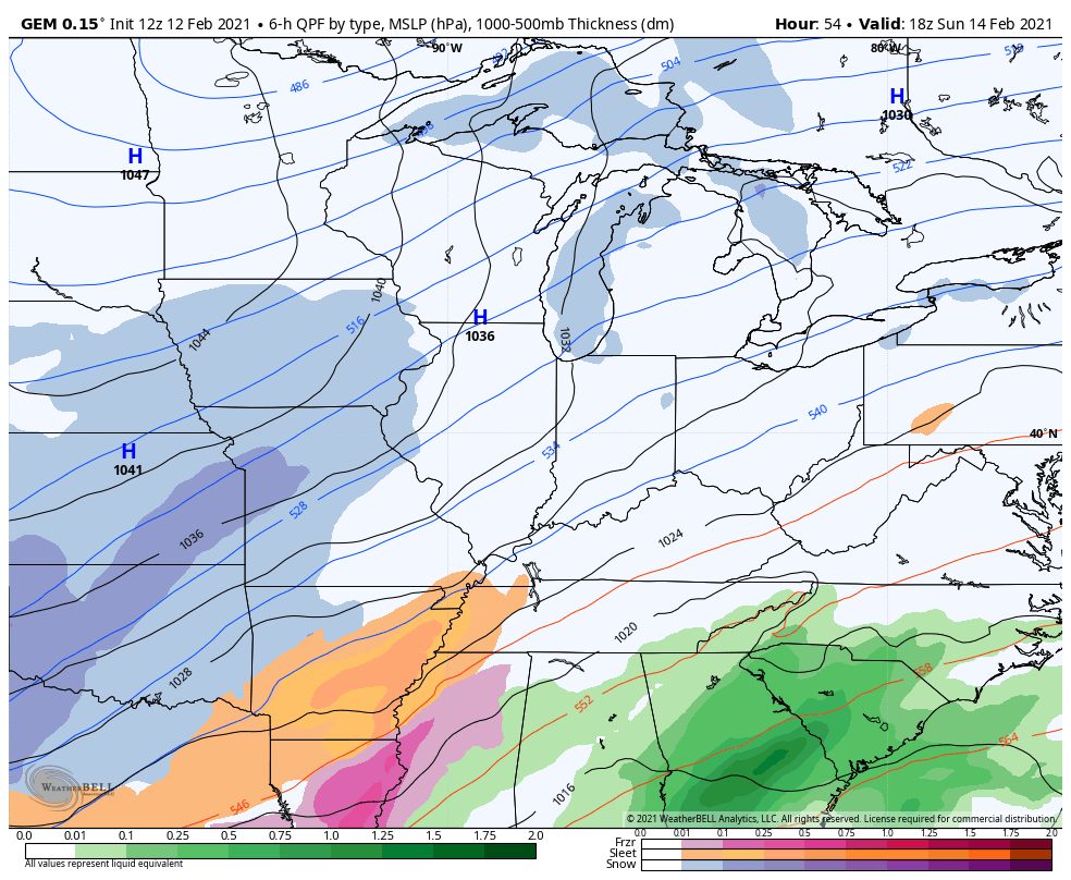
The Canadian Model is a little colder with less freezing rain…
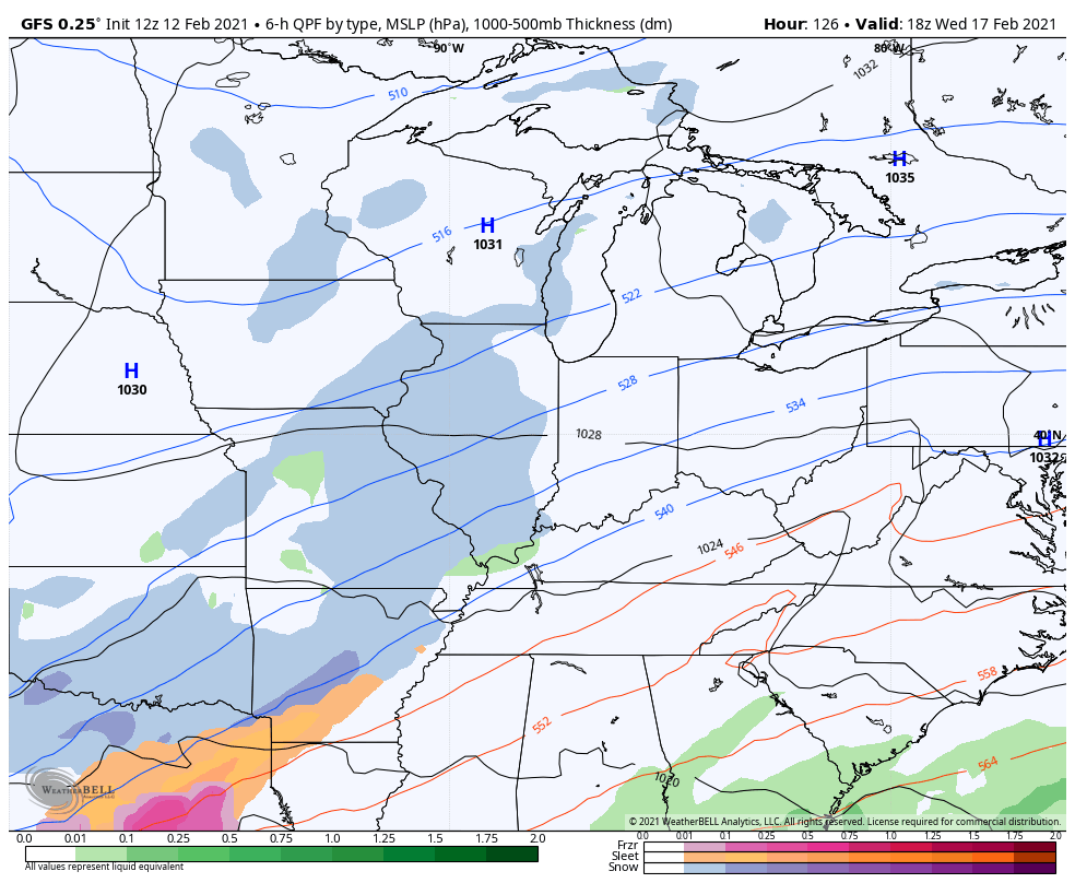
Following this up is another Winter Storm for late Wednesday through early Friday. The models will continue to waffle on the track and precipitation types…
GFS
Canadian
This storm could put down another round of significant amounts of snow, sleet and freezing rain.
I will have the very latest on WKYT starting at 4pm and with another update or two on KWC later today. Have a good one and take care.

Thanks Chris, For The Early Afternoon Update.
This could finally be the one I’ve been waiting on…it’s taken six years and hopefully it doesn’t fall apart like all the others have.
ECL2002, Up Home In Indiana They have 7 Inches Of Beautiful Snow On The Ground.
Don’t You Have The Same In Bloomington ?
I have 2.5″ of compacted snow left which is pretty good. I’m a little farther north and west of Bloomington and we didn’t get quite as much because it was such a sharp cut off. I did however measure 4.2″ of snow and that was the most I’ve seen in over 3 years.
I Checked On The Ventusky Snowfall Accumulation And Bloomington, Indiana Is Expecting 10 inches Of Snow By Tuesday Morning The 16th. This Site Is Pretty reliable.
It’s possible, but it is far from being a sure thing and the most recent run of the euro ensembles shifted the storm southeast a good amount and if correct will leave the heaviest snow over southeast Indiana. From my experience wherever the axis of heaviest snow is shown to be 3-4 days out is never where it ends up.
Yeah, You Are right. How Would Anyone Know Where And How Much Snow will Fall In Any Given Area.
We really didn’t get the coldest of temperatures this storm. I think that saved us from a lot of despair. What do you think the temperatures will be like this go around for Letcher Co ?
Rickie, I Don’t Know, But I Saw Where The Deepest Cold Arctic Air Will Stay To Our North And West, So That Means We Will Once Again Be In The Shallow End Of The Coldest Air.
The forecast low here in Union.co is 0 Sunday nite. Barr and bring on the snow were overdue.
You know what Old Man Winter, YOU SUCK!! You had all Winter to huff and puff. Now that people are ready for Spring, NOW you show up?? Naw. You just need to go back where you came from and learn to be more punctual.
Theres still hope eastern ky, its just a long shot
More specifically SE KY
I Hope This Storm Brings Us A Heavy Rain Event To Wash Off The Ice On The Trees And Then It Can Snow All It Wants.