Good early evening, folks. A Winter Storm WATCH has been issued for much of the state from Sunday night through Monday night. This is in advance of our developing storm that looks to bring significant amounts of snow and ice to the region.
This watch will get issued deeper into eastern Kentucky and West Virginia later tonight or Saturday. Tennessee will also likely get in on this…
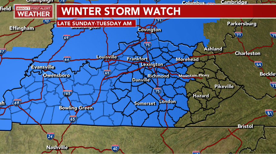
Here’s the early look at how this may play out…
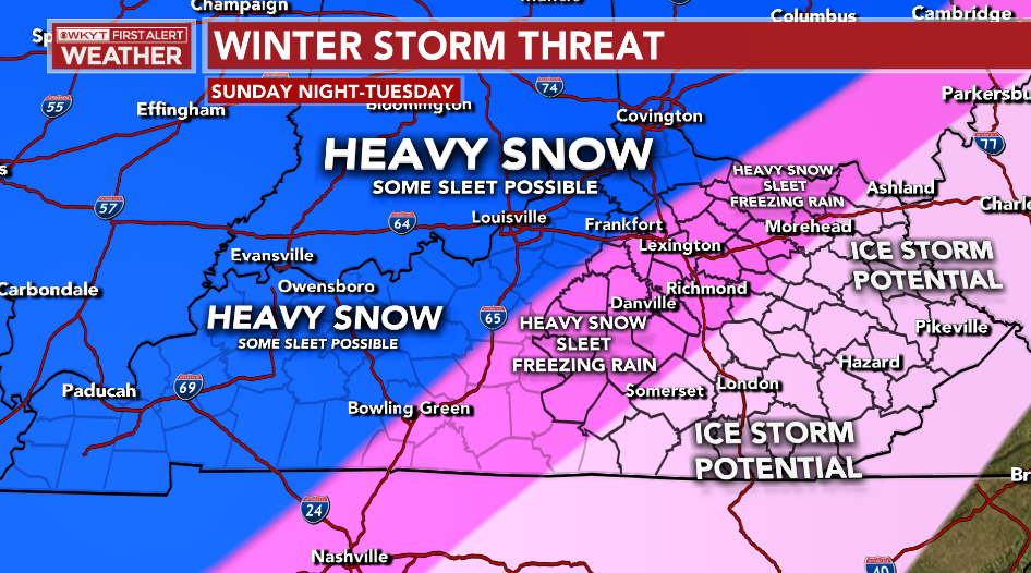
Again, the lines are approximate and could change depending on the track of the low.
The afternoon run of the EURO is a healthy hit for the entire region…
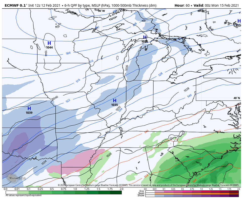
It’s much colder than some of the earlier runs and that’s a great thing. Still, it produces a lot of ice in the east…
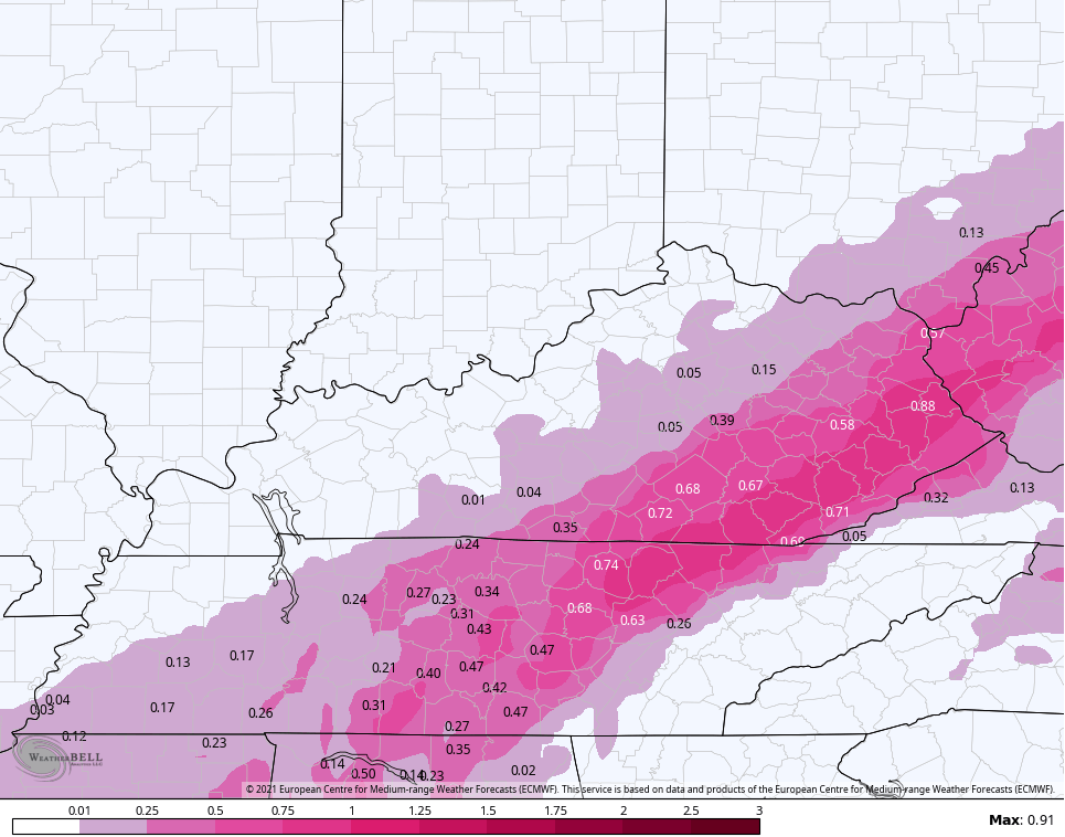
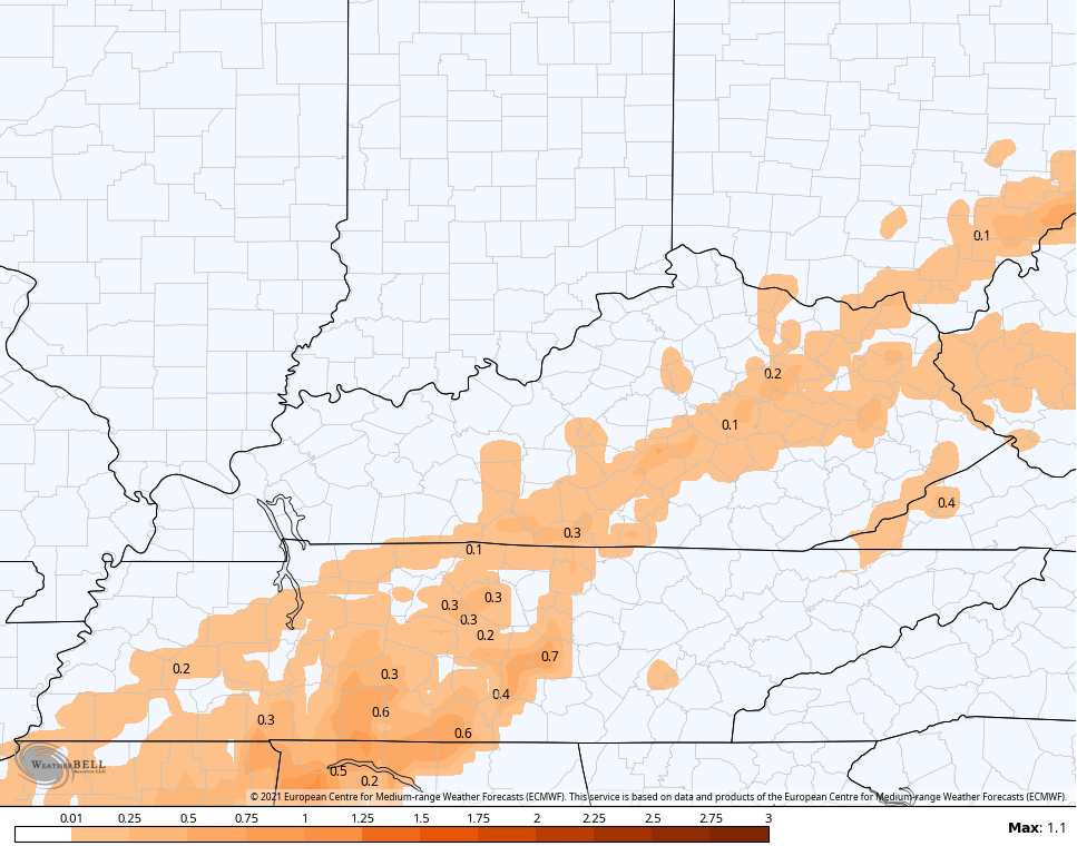
It doesn’t have much sleet…
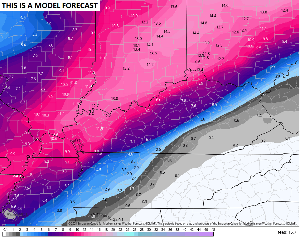
It does crank out a lot of snow…
The EURO then follows that up with another winter storm…
I will throw you another update later this evening. I’m actually taking the late evening shows off from work just to have a small break. 😫
Enjoy the evening and take care.

Thanks as always for the early warnings! This is looking very interesting! I’m flying from sunny California back home to Lexington Saturday night and I’m glad to get to watch this big system coming in.
What! You mean you weather be at home and enjoy the snow than the sunshine at California. Lol
Assuming this will move a bit do think the likelihood is greater that Lexington falls closer to a mostly freezing rain event or closer to the heavy snow event?
Thanks Chris for all what you do. You deserved that break . Don’t get me wrong I’m looking forward the snow here in western, ky but this could be more than we wish for the deep freeze and the winds that’s going to be involved hope it doesn’t become a full blown blizzard.
Winter Lover, Looks Like You Are Going To Receive The Most Snow Because You Are Closer To The Arctic Air To The West.
Evansville, Indiana Is Expecting A Lot Of Snow Next Week Too And On North To Washington, Indiana My Home Town. Now I’m Home Sick. LOL
Not Expecting Any Major Snow Event Here In Taylor county Mostly Garbage That We Had the Other Day.
The Snow Map Shows this Perfectly Where the Snow Cuts Off. Anything South Of That Line Is The Northern Edge Of That Southeast Ridge A Real Ice Maker.
I want my ‘reveal’ party to be ALL blue–NO more pink ice! But with the look of the models…looks like it will be a multicolor catastrophe! Dreading all weather for next week.
That’s a very, very bad look for eastern Kentucky.
I pray it doesn’t happen.
This snow lover has decided she needs to move north.
Warren County’s been down this road time after time… Historically, the only instances where we’ve picked up meaningful accumulations of snow, is when the models indicate monster forecast totals. This indirectly points to the unreliability of most forecast models (who’s algorithms seem to be swamped by chaos) to predict “local” weather. Trends are one thing, but estimating how many inches will accumulate in our backyards is the knowledgeable meteorologists bailiwick!
Love your new blog, CB. Also love that you’ve monetized it. You work so hard and I’m glad you’re making some money here!
One thing I miss is the time stamp on posts – any way to turn that on? Or maybe just put the time at the top of your post? Thanks for all of your hard work. It’s much appreciated!