Good evening, everyone. I wanted to drop by for one more update today as some of the late afternoon model data went toward a colder and snowier winter storm Sunday night through Tuesday. That would, obviously, be the best outcome, but it’s still too early to say it’s a true trend.
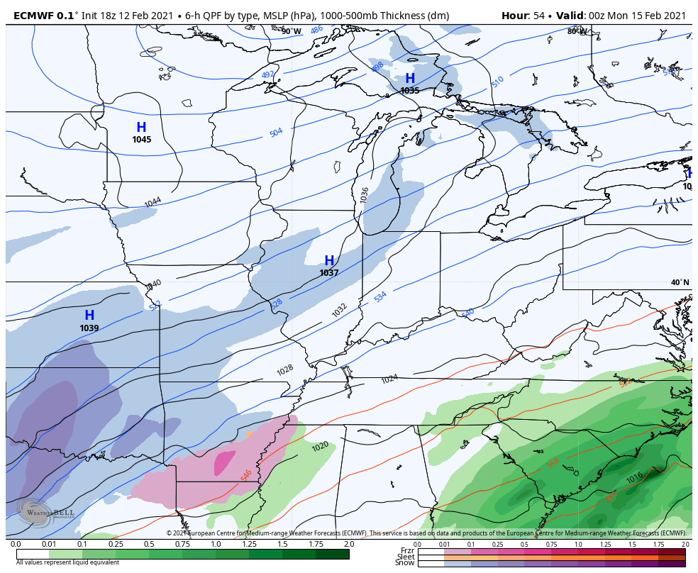
The afternoon GFS looks like this…
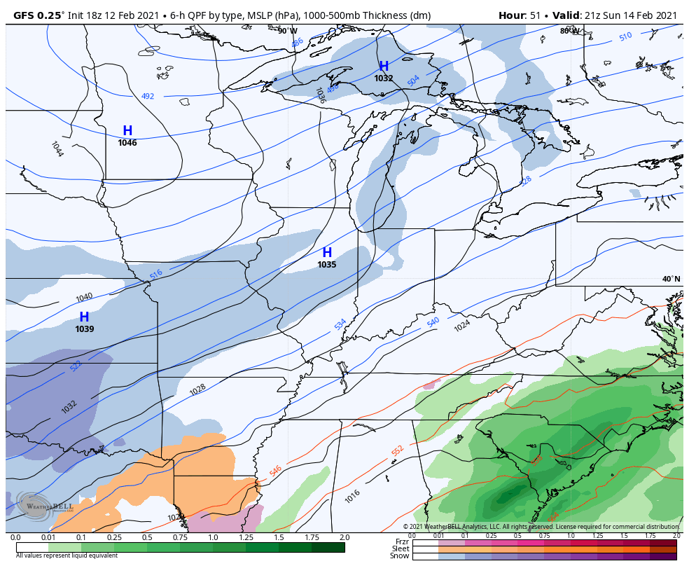
That’s colder and a little farther east with the low.
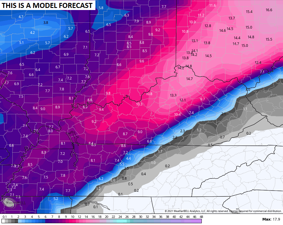
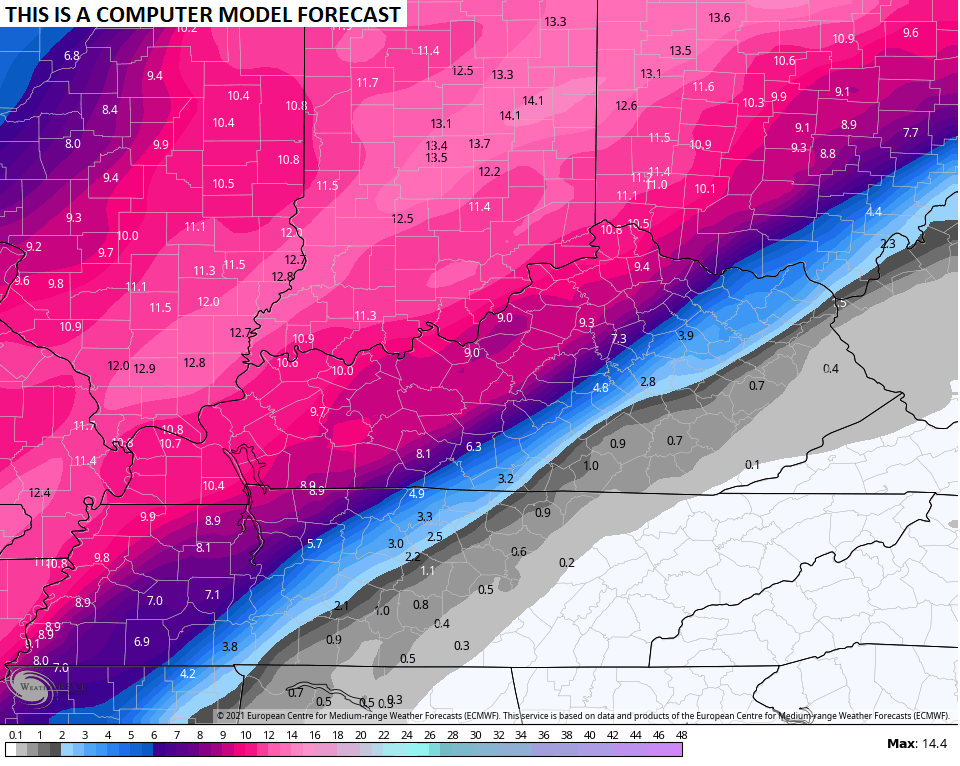
Here’s the snowfall forecast from that run…
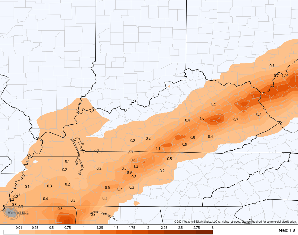
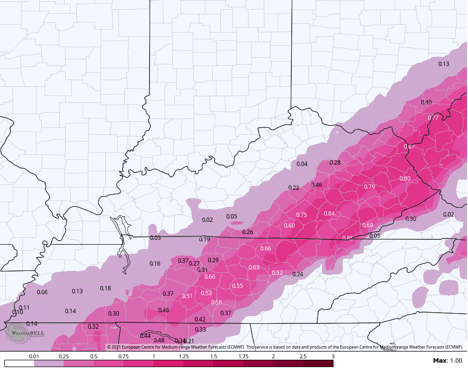
Sleet…
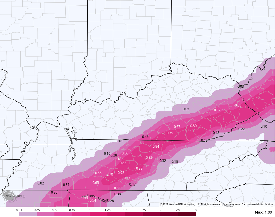
Freezing rain…
This matches more of what the new version of the GFS has been suggesting. The following map likely is too high because it includes some sleet in there…
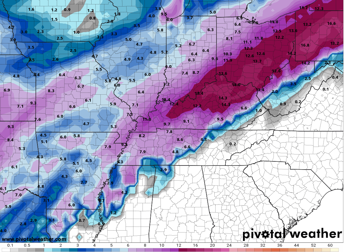
The average snowfall from the 21 member GFS Ensembles (based on 10-1 ratio) look like this…
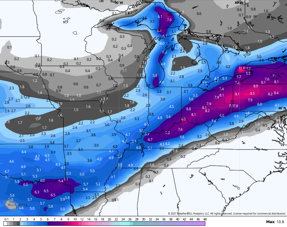
Here’s the average snowfall (10-1 ratio) from the 51 member EURO Ensembles…
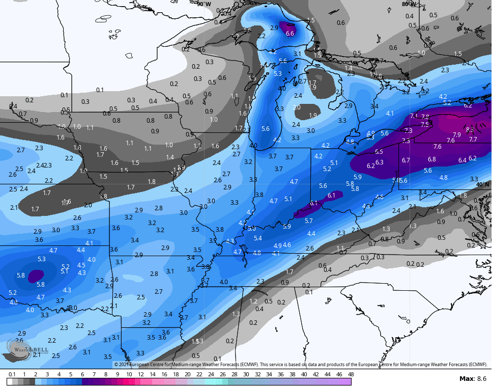
EURO Control…
Again, the ensembles are based on a 10-1 ratio which this will not be. This will be at least 15-1 for many.
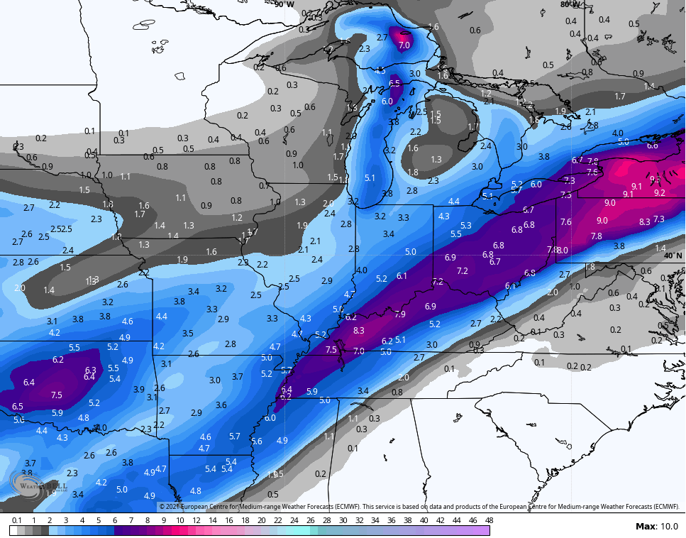
The late afternoon run from the EURO only goes through 7am Tuesday…
Snowfall…
Freezing rain…
The ice potential in the east and into West Virginia could get really, really ugly. How in the world are these areas NOT included in the Winter Storm WATCH?
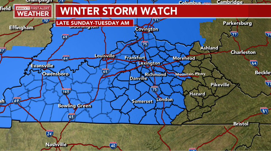
I’m already getting folks in those areas thinking this isn’t going to have an impact on them. Many within the NWS simply do not understand how to properly convey the weather message to the general public. Folks in eastern KY and WV should NOT be seeing this map and thinking they’re out of the woods. Period.
BTW… pockets of light snow and light freezing rain continue across areas of central and eastern Kentucky right now and will through tonight.
Enjoy the rest of your evening and take care.

The average of the models overall shows north of 64 is the main heavier snow action. Given the ice already on the trees, they can have it.
Bubba, the temps will be in the 20s. If it does snow it is going to be dry. Chris thinks the snow ratio could be high as 15to1.
Are Winter Storm Watches issued by the SPC or the local NWS? Seems like to me they should come from the SPC to avoid just the kind of stuff Chris is talking about here. It’s obvious the whole state is going to get a mess, so there is no reason for individual NWS offices to confuse people by working on different time frames.
Still looking good for Western parts of the state.Hoping they get hammered.
https://www.pivotalweather.com/model.php?m=nam&p=snku_acc&rh=2021021300&fh=84&r=us_ov&dpdt=&mc=
Oh No.GFS is East.Don’t like the trends for WKY.
New GFS much better.Big hit incoming for WKY.Lots of precipitation.
https://www.tropicaltidbits.com/analysis/models/gfs/2021021300/gfs_asnow_neus_15.png
Latest GFS snowfall map.
The models are trending better and better for Warren County. Unlike previous years, any snow that falls will definitely stick on road surfaces. It’s been several years since we’ve had such a consistent stretch of cold weather in South Central Kentucky.
more water for spring flood