Good evening, folks. After a quick trip to the Queen City, your friendly weatherdude is back in the saddle and ready to buckle down on this upcoming winter storm. This is a major storm that will cause all kinds of disruptions across the state and region.
A Winter Storm Watch is out for the entire state and most of the region. This will be upgraded to a warning by morning.
As I mentioned in my last update, today’s temps were busting the models by as much as 10 degrees in many areas as the arctic air combined with our snow and ice pack to do some work. This likely signals a colder storm that comes at us in two waves. The first arrives Sunday evening into early Monday. The second wave is the strongest and most widespread and moves in Monday afternoon through Tuesday morning.
Given the colder solution showing up, let’s throw a little more snow into the equation and nudge things a bit east. For the sake of not being as complex as my last map, here’s a much easier to read New Call For Ice and Snowfall…
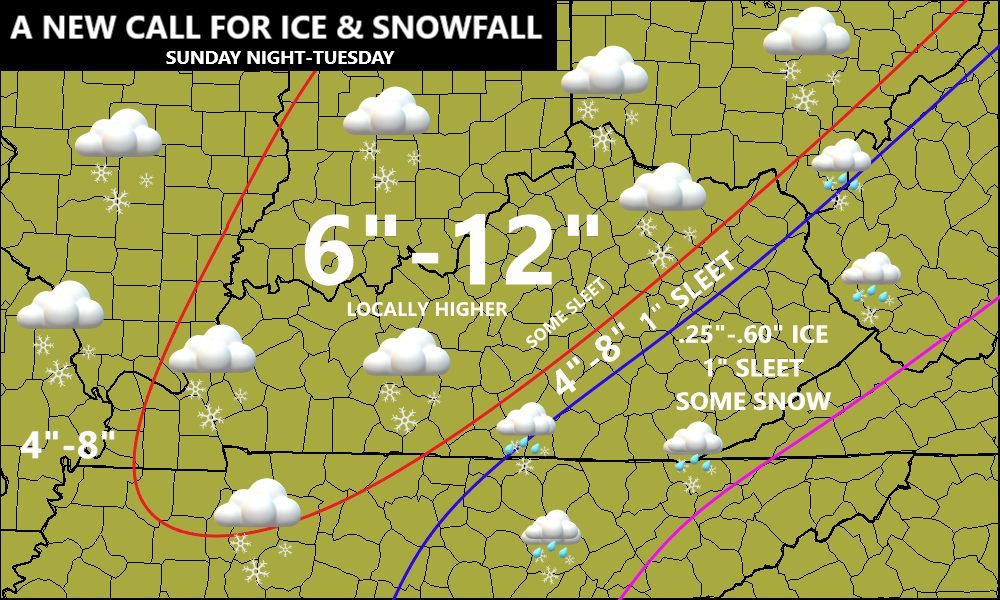
For the areas in the mostly snow or full snow, the cold air will help increase the ratios. Normally, 1 inch of rain would equal 10 inches of snow (10-1 ratio). With colder air, the ratio climbs to 15-1 or maybe a touch better.
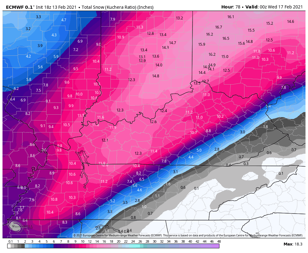
The EURO continues to drop the snow hammer…
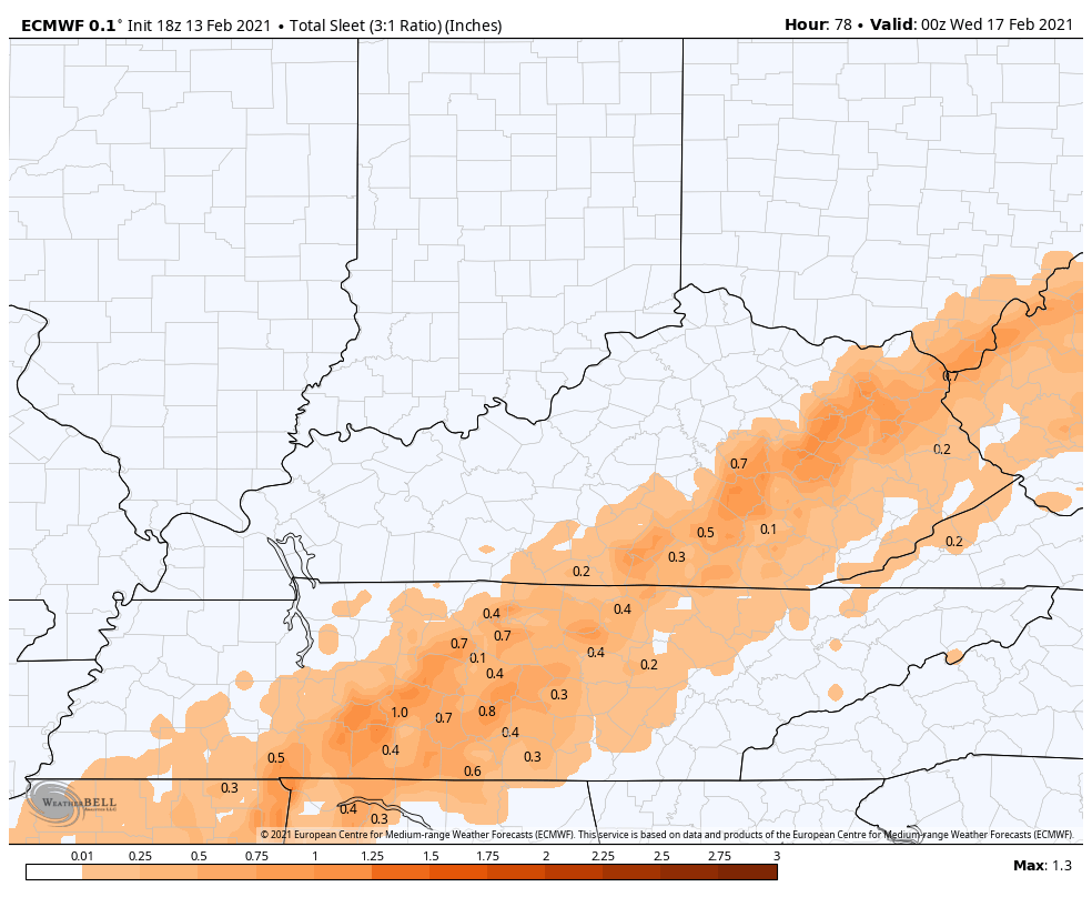
EURO SLEET
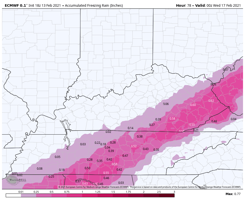
EURO FREEZING RAIN
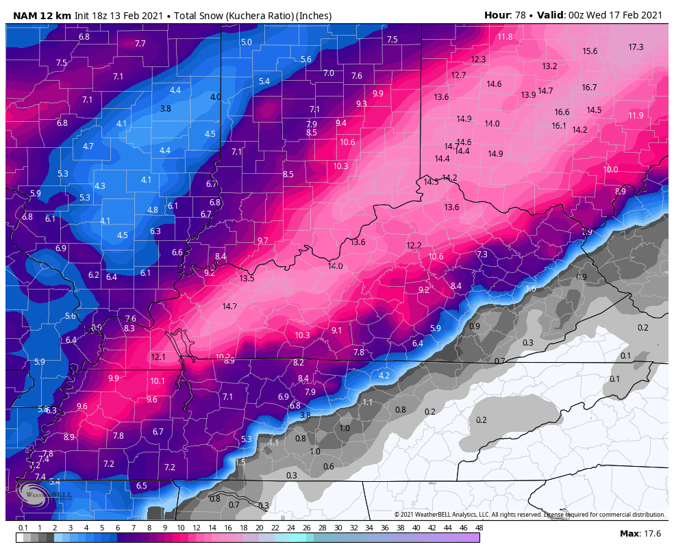
The NAM continues to be similar with the snow amounts…
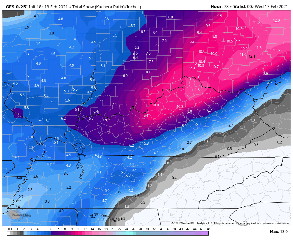
The GFS isn’t as robust, but it’s still a major snowstorm…
With many areas still with trees and power lines caked in ice, power outages may become a big problem once again. That goes for those getting snow and certainly those getting more freezing rain. Take all necessary precautions.
I will have updates as needed and with the full post later tonight. Have a good one and take care.

Too much ice on our trees in Richmond (twice as much as Lexington), so I’m hooping the main action is sleet. All that snow and 25 MPH winds means a lot of branches and trees would go down.
Hooping, hoping… Kind of same thing. You hope the ball goes in the hoop.
Heard a couple of trees fall today behind the house.Fog and mist has really stuck to trees today on top of the glaze of ice already on them.Any amount of ice in EKY will be trouble.