Good afternoon, everyone. A powerful winter storm is ready to blast the bluegrass state with significant amounts of snow, sleet and freezing rain. This is going to cause all kinds of problems over the next few days. This is our winter storm ALERT. A Winter Storm THEAT is now out for the next storm moving in Wednesday-Friday. That is also likely to bring significant amounts of snow, sleet and freezing rain.
Overall, the next several days may rival some of the worst periods of winter on record around here.
Here’s a look at the current Winter Weather Alerts:
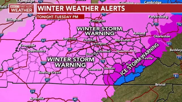
The main headlines with this storm remain the same:
PREPARE FOR A MAJOR WINTER STORM TONIGHT THROUGH TUESDAY
SIGNIFICANT AMOUNTS OF SNOW AND ICE WILL LIKELY CLOSE SOME ROADS
POWER OUTAGES ARE LIKELY AND MAY EXCEED THE NUMBERS FROM THE LAST STORM
This comes at us in two waves with the lighter wave tonight and Monday morning. The heaviest wave arrives Monday afternoon through Tuesday morning.
As I continue to hone in on where the precipitation types set up, it’s still a work in progress. Eastern and, especially southeastern Kentucky should prepare for an ice storm. Areas of central and western Kentucky should prepare for a snowstorm. The buffer zone in between is where the battle is going to show up with all precipitation types. Does any one particular type win the battle? Do they share the stage equally? I can’t answer that at this point.
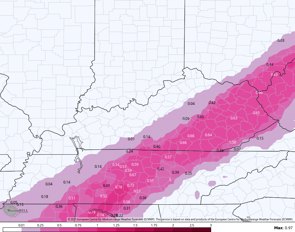
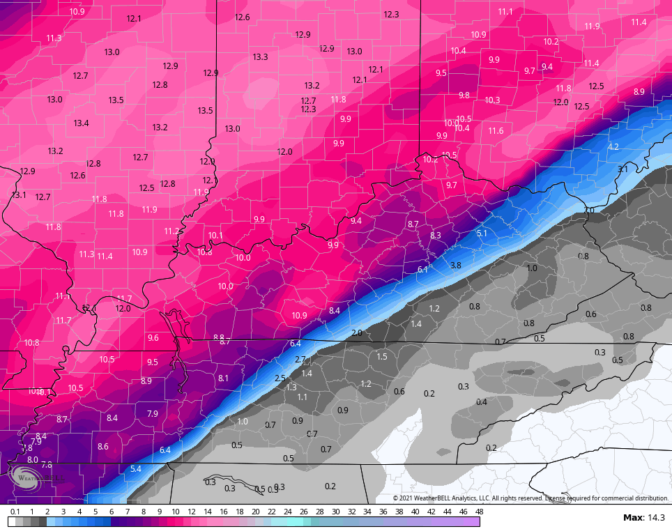
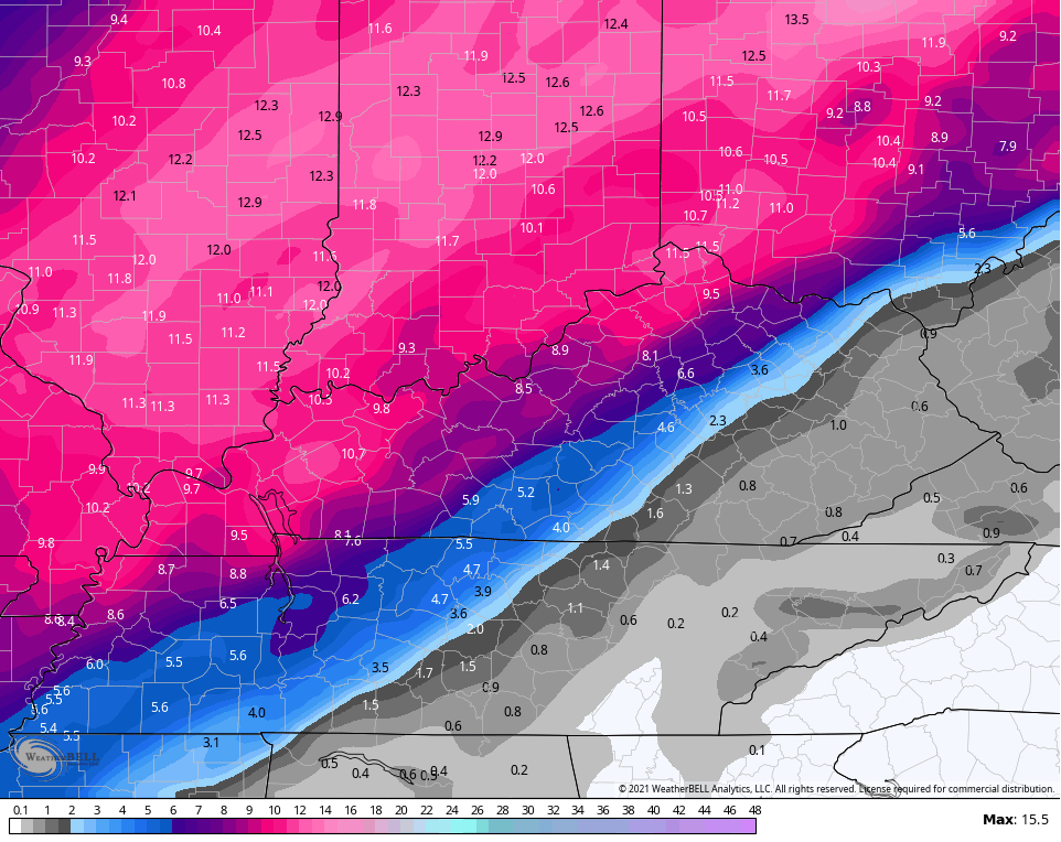
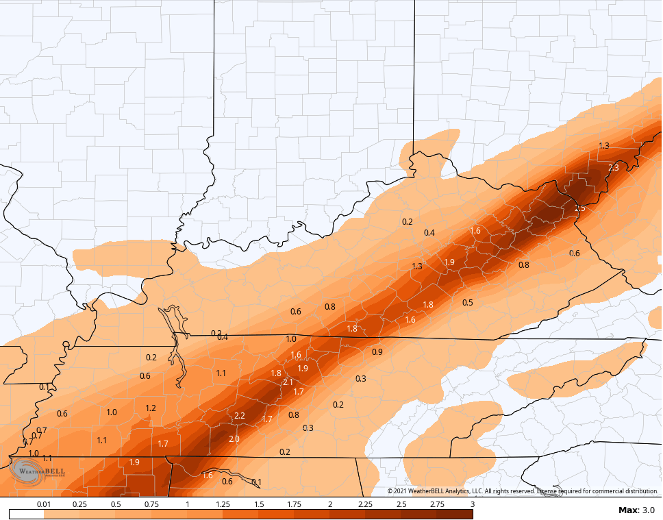
Given the question marks with the buffer zone, I’ve made a few changes with the NEW CALL FOR ICE AND SNOWFALL. This map is still very much a work in progress…
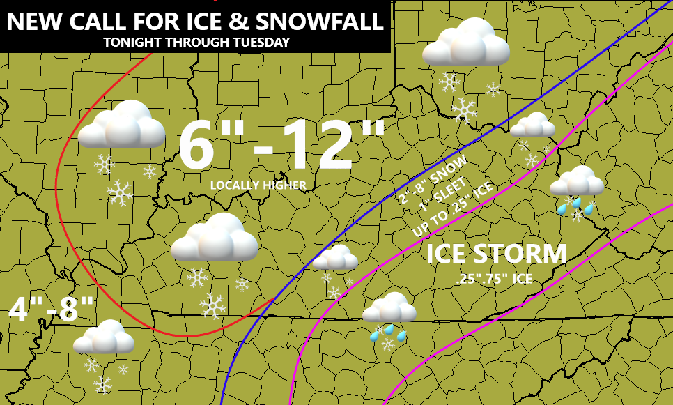
No one wants any kind of ice. No one. Here’s hoping the sleet and snow signatures win the battle. Eastern and southeastern Kentucky could be in for a major ice hit, so prepare now. Even areas where it’s snow could be talking about power problems because of the ice still on the trees and power lines.
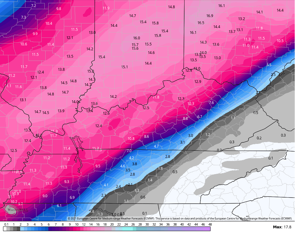
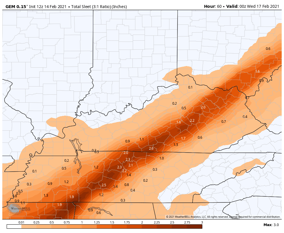
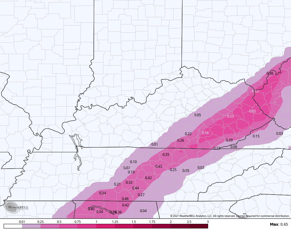
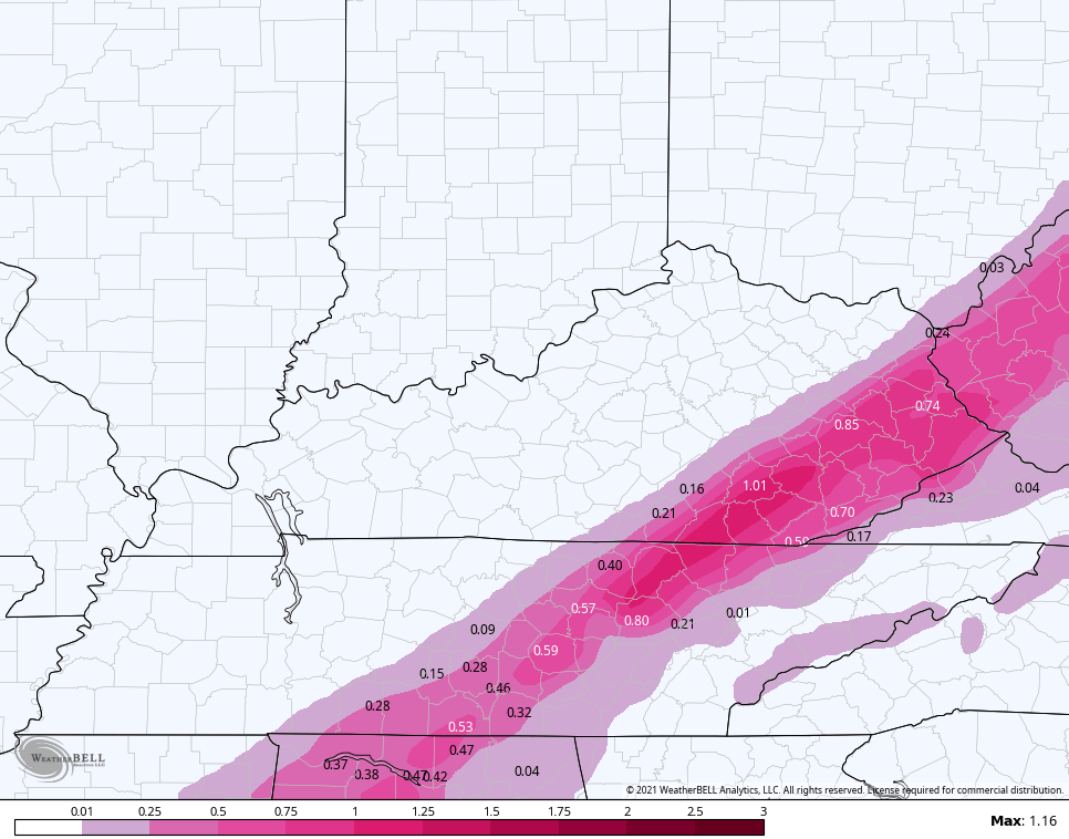
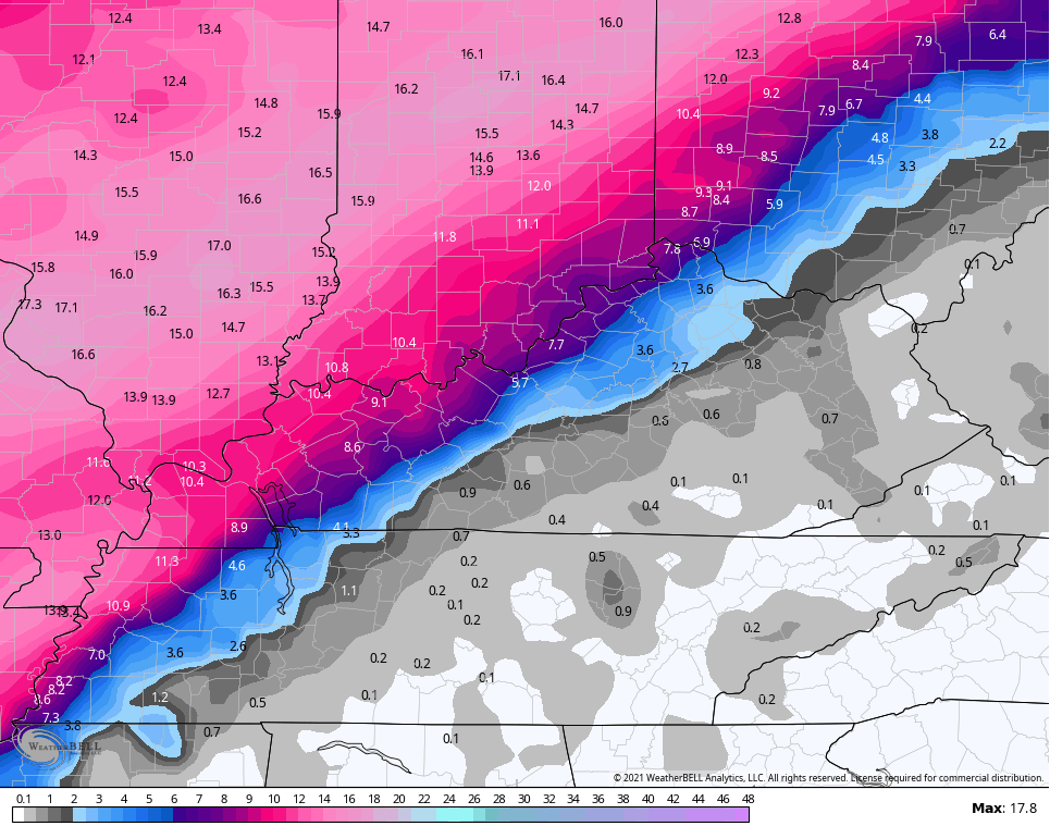
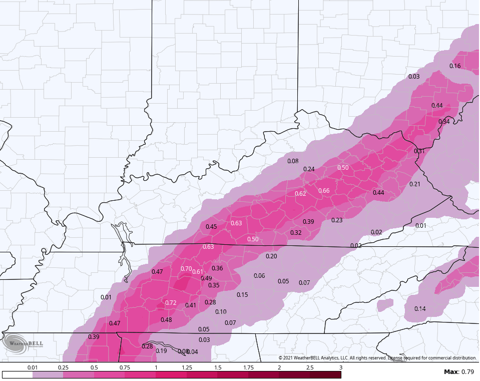
Let’s take a look at the latest models that show the crazy battle zone well…
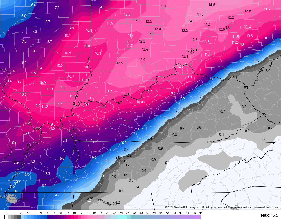
EURO SNOW
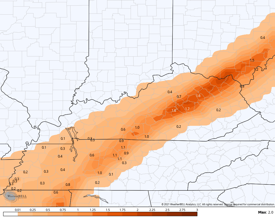
EURO SLEET
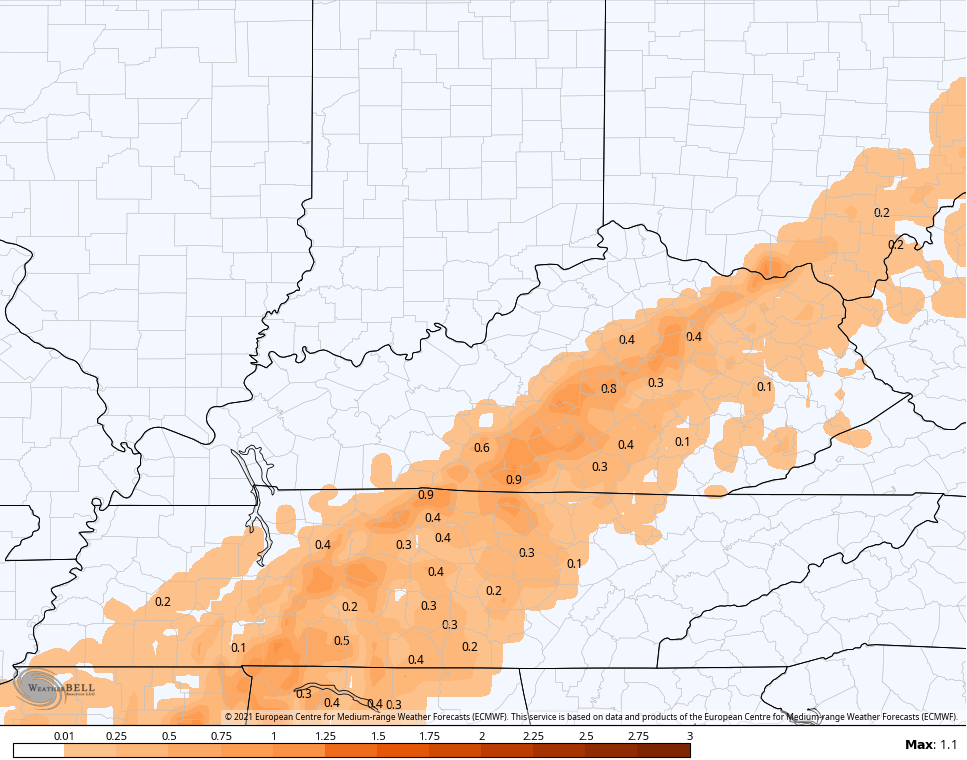
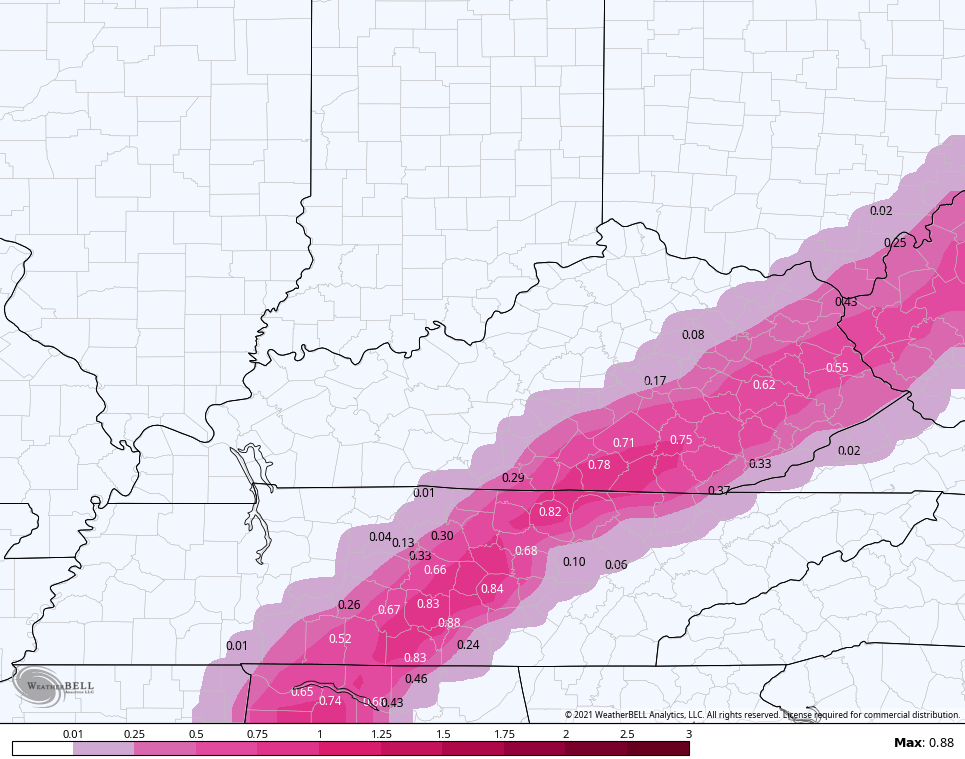
EURO FREEZING RAIN
GFS SNOW
GFS SLEET
GFS FREEZING RAIN
CANADIAN SNOW
CANADIAN SLEET
CANADIAN FREEZING RAIN
SHORT RANGE CANADIAN SNOW
CANADIAN SLEET
SHORT RANGE CANADIAN FREEZING RAIN
The NAM is the farthest west of all the models, but it has a history of overdoing warm air advection which pushes it all west…
NAM SNOW
NAM SLEET

NAM FREEZING RAIN
Gusty winds will create some blowing and drifting of snow. Those winds will also create single digit wind chills that can also drop below zero at times. Actually lows may challenge zero in the north and west by Tuesday and Wednesday mornings.
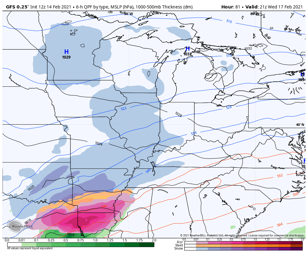
This brings us to our Winter Storm THREAT for late Wednesday through Friday. Significant amounts of snow, sleet and freezing rain…
I will update things later today. Have a good one and take care.

ah hell lets push this fence set up out of here.
Seems ice may be more a factor for more folks. The warm air dominated the last system, so we got ice instead of snow. A trend favoring a more northern shift of the main snow might not be done. Warm air plays moisture tennis with cold air and uses Kentucky as the fence. Warm air has been doing a lot of winning over the last five years.
I am back in the ice again. I was hoping for the 12 inches of snow!
Looks like Chris’s bold prediction could pan out toward the end of the week.
That “snot” storm Wed-Thu. looks a bit messy! Hahahaha!! J/K, Chris! Thanks for the update. Nelson still looks like it’s right on the edge of the nastiness this go round, but think we should see more snow than anything. Hoping everyone has all their precautions taken care of and will stay safe. This is going to be a rough week for sure!
It got down to 5 degrees below zero this morning at Chicago’s O’Hare Airport, and 7 degrees below zero in the SW suburbs at the NWS forecast office, with the coldest wind chills around 24 below zero. Temps are in the low single digits above zero throughout the area now.
Winter Storm Watches are in effect for Chicago and Cook County for a significant lake effect snow event Monday and Monday night. This appears to be an ideal lake snow setup for Chicago, which doesn’t happen very often at all. Usually when there’s a significant lake snow event, it affects NW Indiana and SW Lower Michigan.
A Friend Of Mine, Who lives in Saugatuck, Michigan A Few Years Back Called Me And Gave Me The Current Snow Depth In His Backyard, Eight Feet Was that’s Weeks Total Snowfall. Wow !
My Local Weather Forecast Is Calling for An Inch Of Ice On Top Of What We Had The Other Day. If this Happens We will loose Our Electrical Power And Substantial Damage to Trees.
If We Get the Ice Here In Taylor County Maybe Eastern Kentucky Will Get Just Plain Rain With Above Freezing Temperatures And Be Spared The Damage and Electrical Power Failures.
Looks like most models have keyed on a certain area for the heaviest ice.Pretty much like the ice warning from NWS.Pike,Knott,Perry,Leslie and a few others could be in for a long week.Hopefully the warm nose wins out and pushes farther North.Been without power for 3 week’s before and as everyone knows it’s no fun especially in winter.
The models seem to be trending slightly north with the snow and the basically warm air wins again with the Wednesday system. Oh well.
Said in my previous post that we might luck out and get just rain but temps have busted hard here today. Currently 25 and the forecast high was 31.
Same here in Perry Co. We had a forecast high of 30, but the temp hasn’t cracked 27 on my porch or my remote weather sensor. We’ve also had freezing drizzle all day. Everything is frozen solid.
The ice storm could be a very serious situation for folks here in the hills. Power outages are bad enough and will cause many to be without heat. The icing of roads in the area is the more worrisome problem, as emergency situations will inevitably arise. And more ice coming Wednesday? I love winter, but I seriously hate this pattern.we’ve had ice covering everything for days now.
Stay safe, all.
15 degrees here in western.ky waiting on the snow to arrived. Back to back storms could cripple our world. Stay safe everyone.
Just want SNOW!
Yep! As long as no ice already on the trees, since a lot of snow stuck to icy trees and 25MPH winds means trouble. Sleet would be preferred then. That said, if we get the one behind this as ice- kind of doesn’t matter. Trouble gets a lot of us anyway then.