Good evening, everyone. Our winter storm/ice storm continues across the region. Roads are a mess with several roads that have been closed at some point or another. Power outages are well over 80,000 and climbing right now as the ice storm does a number on eastern and southeastern Kentucky.
This storm has been a bear to forecast because of the layer of above freezing air just a few thousand feet up. The freezing rain and sleet have been overperformers while the snow has been an underperformer because of it. I kept pushing everything west this afternoon on WKYT and ended up pretty good, but the snow part of it from the past few days was kinda not good. On the slip side, a true sleet storm in central Kentucky was amazing to see. It’s not often you get to see 3″ of sleet in some areas.
Freezing rain, sleet and snow continue right now with a thumper snow for some. Here are your radars to follow the worst of the storm out of the state…

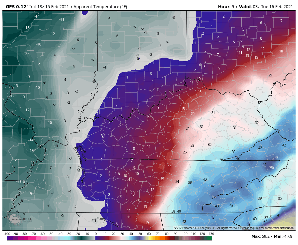
Light snow and flurries will be with us into Tuesday and should put down light accumulations. Arctic air takes control as western Kentucky tries to drop below zero tonight with much of the state making a run at zero Tuesday night.
And those wind chills the next few days are brutal…
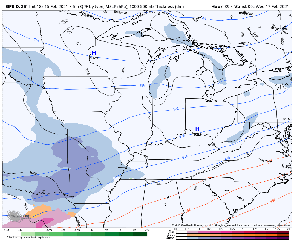
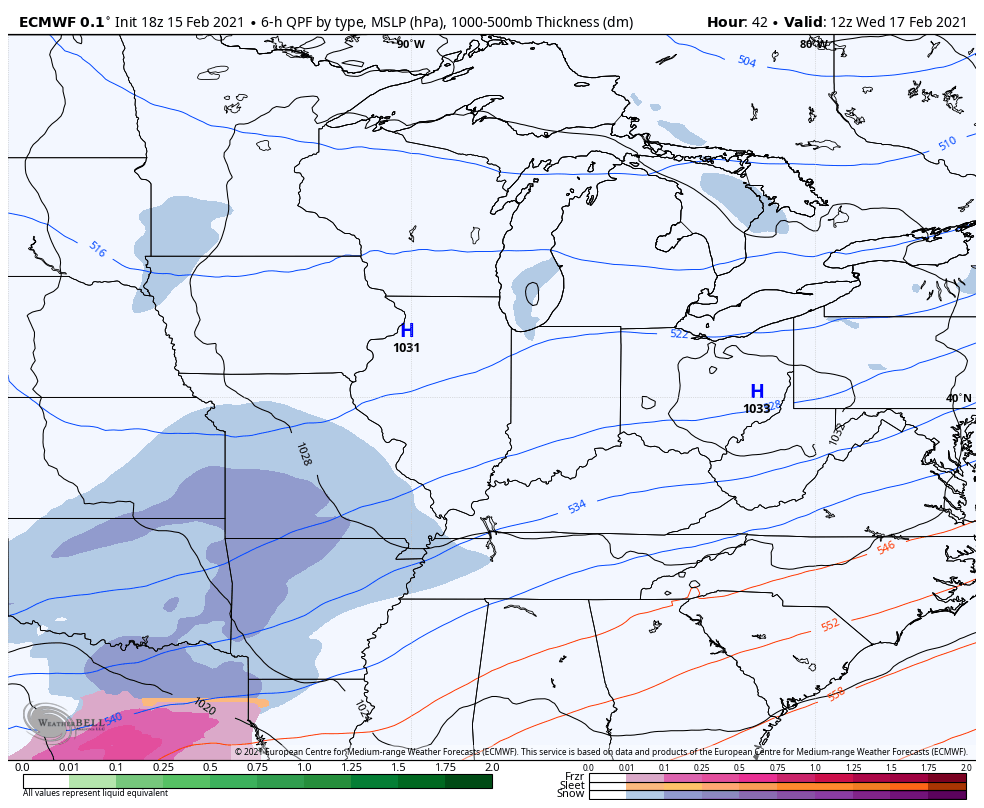
The next winter storm moves in with snow on Wednesday then snow, sleet and freezing rain Thursday, followed by arctic air and snow on Friday…
GFS
EURO
This is a Winter Storm Threat that will be upgraded to another Winter Storm ALERT soon.
Enjoy the evening and take care.

Sleet it was in my part of Richmond – 2 to 3 inches of sleet and a layer of ice on top of that… Absolutely nuts and terrible to drive in! Should have stayed home…. I was warned – I just didn’t listen. Give me six inches of snow on top of this for a week or so and I will and even this winter lover will be ready for spring.
NAM is already on board for another round of ice for this coming week.
This next storm, will it be as significant as this one? We are getting hammered here in Ashland. Trees down everywhere.