Good evening, folks. The bluegrass state is in the deep freeze as light snow and snow showers continue to drop accumulations on the snow and ice we already have. A State Of Emergency continues and local SOE’s have been declared due to massive power outs and trees down. Now comes our next winter storm from later Wednesday through Friday.
Before we get to that, light snow and snow showers continue to be widespread and may drop another inch in some areas. This stuff is very fluffy and is blowing around a bit. Here are your radars…

Temps tonight will be in the single digits and could even drop below zero if we get any kind of clearing. Wind chills will be below zero.
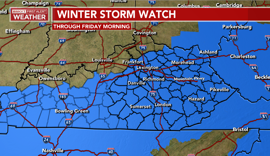
A Winter Storm Watch has been issued for much of Kentucky for this next storm…
Could this get pushed a little farther back to the northwest? Maybe.
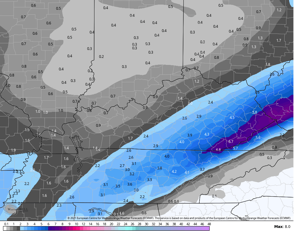
Here’s my First Call for Ice and Snowfall…
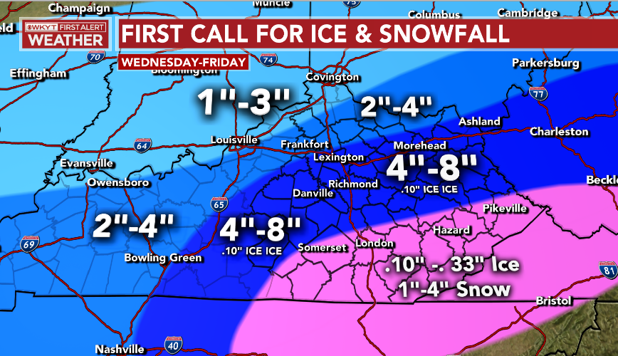
Remember, this is just the First Call and the forecast is always a work in progress. I will have additional updates to that tonight into Wednesday.
This system doesn’t look to have any sleet to complicate the snow forecast and the freezing rain potential isn’t looking nearly as high. If I continue to see less freezing rain, the snow numbers would increase in the southeast. Folks, at this point, even heavy snow is going to cause more power outages and tree damage.
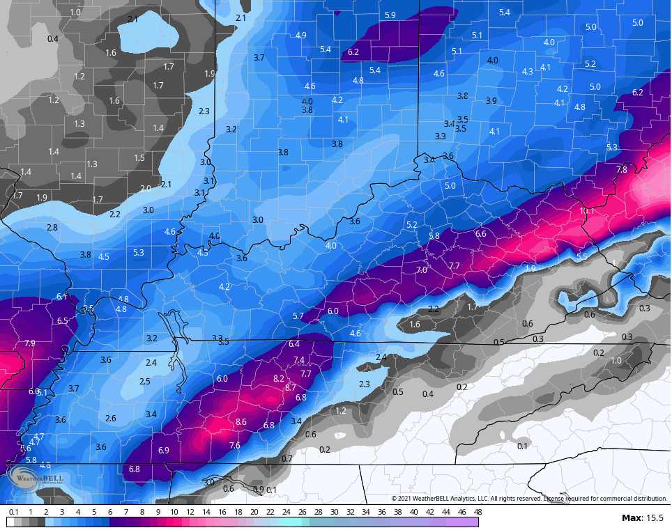
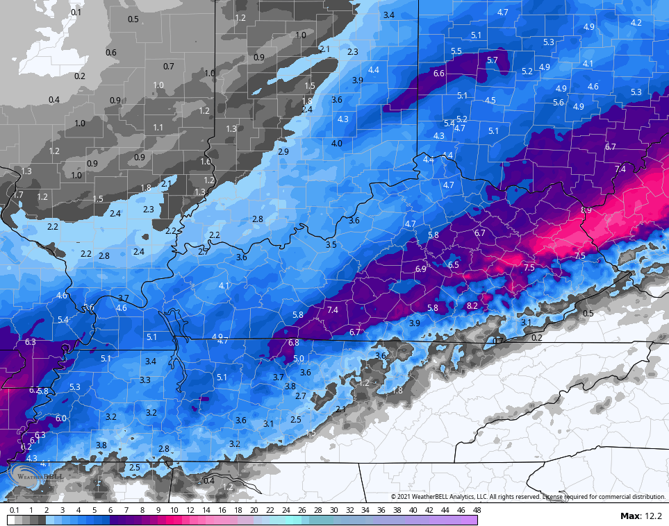
The NAM is the absolute snowiest…
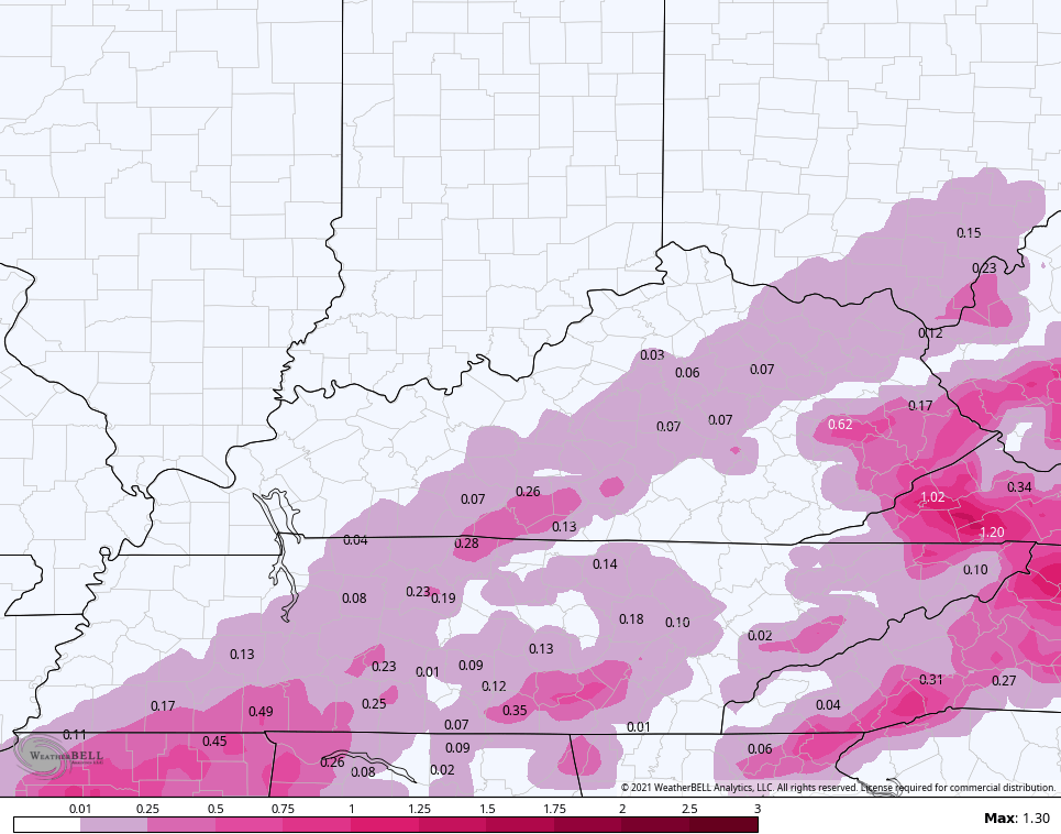
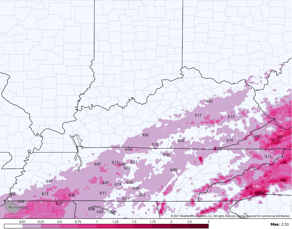
It does have some pockets of freezing rain…
The Hi Res NAM is in similar shape as the NAM…
The model does have less freezing rain…
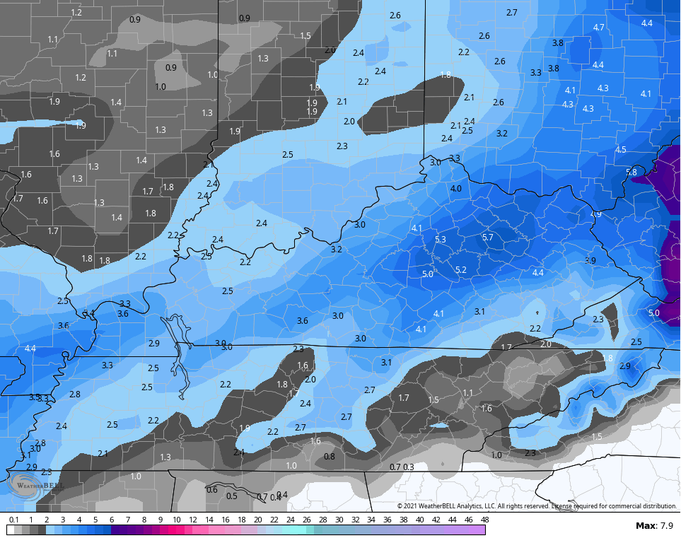
The GFS has a broad and light to moderate snowfall…
It also has just a small bit of freezing rain…

The new version of the GFS has even less freezing rain and has more snow…
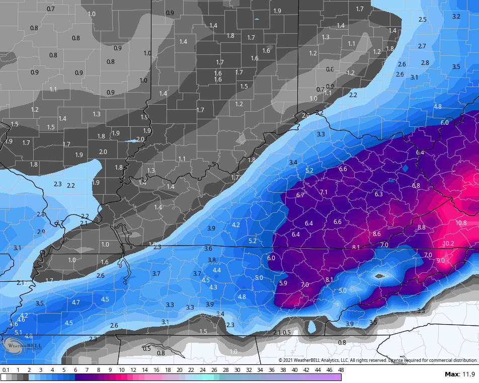
The EURO continues to be the farthest southeast with this system…
Obviously, the EURO had the same problem with the last storm and didn’t catch the northwest adjustment until very late in the game.
I will have a New Call for Ice and Snowfall tonight at 11 on WKYT and here on KWC later tonight. Stay safe, stay warm and take care.

No Mas No Mas,I give ,Uncle ,Tap Out.No want to see anymore Snow,Sleet,Zr..Please give me some 70’s.
Seems the average is the way maybe to go. A western shift would probably be showing at least with the NAM by now, since about 24 hours in. If this pans out, this could over achieve, since has an icy snowy surface to fall on (nothing wasted). It would also have some extra staying power, also since has that thick ice layer to insulate.
FWIW, seems the map is good, pending any NW shenanigans.
The dry Snows will not damage trees. I would like to see just one Big Snow sometime before Spring.
Looks like a bit of a southeast shift on the models:
https://www.tropicaltidbits.com/analysis/models/gem/2021021700/gem_asnow_neus_8.png Canadian
https://www.tropicaltidbits.com/analysis/models/nam3km/2021021700/nam3km_asnow_neus_36.png NAM high res