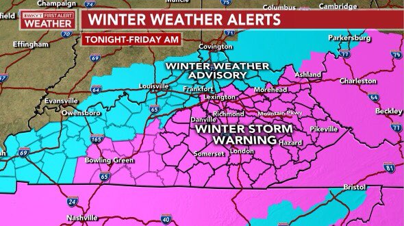
Good afternoon, everyone. A Winter Storm Warning has been issued for much of the state as the third winter storm in a week moves into the Commonwealth. This will bring mainly snow, but should still produce a bit of a mix in the southeast.
Here’s a look at the Winter Storm Warning and Winter Weather Advisory to the north of that…
I really have no changes to make to the ongoing forecast. Nothing I’ve seen so far today has been enough for me to deviate much from what I already have out there…
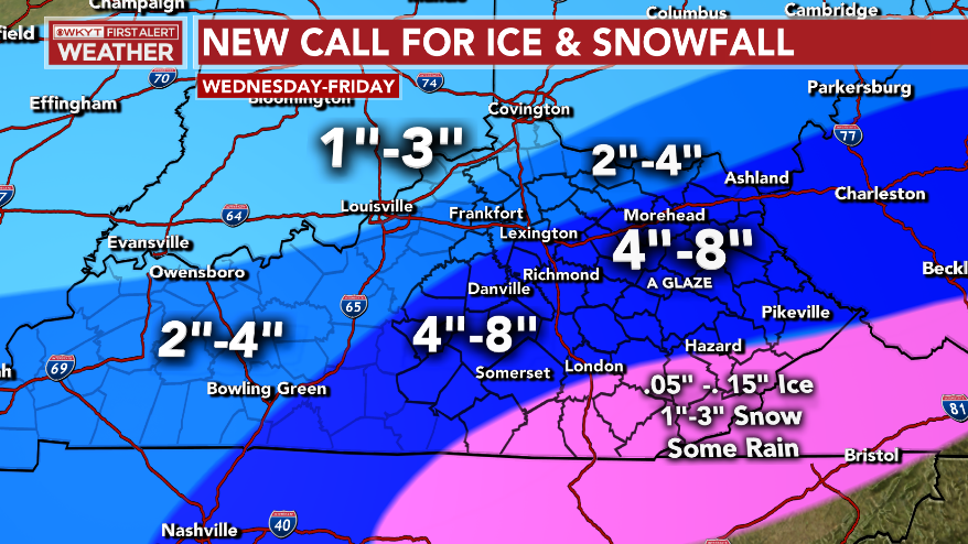
I’m really liking that widespread 2″-4″ swath I have out. The one area I’m going to probably change later today will be in the southeast. As this continues to look more like a mostly snow maker here, I’m probably going to beef up the snowfall and drop the ice down a bit. That will come your way on WKYT starting at 4pm.
Given the fact we have so much of the region already caked in ice, several inches of snow will likely cause additional power outages and more trees to come down. We are already in a State of Emergency and the National Guard has been called out to help. Things may get worse before they get better.
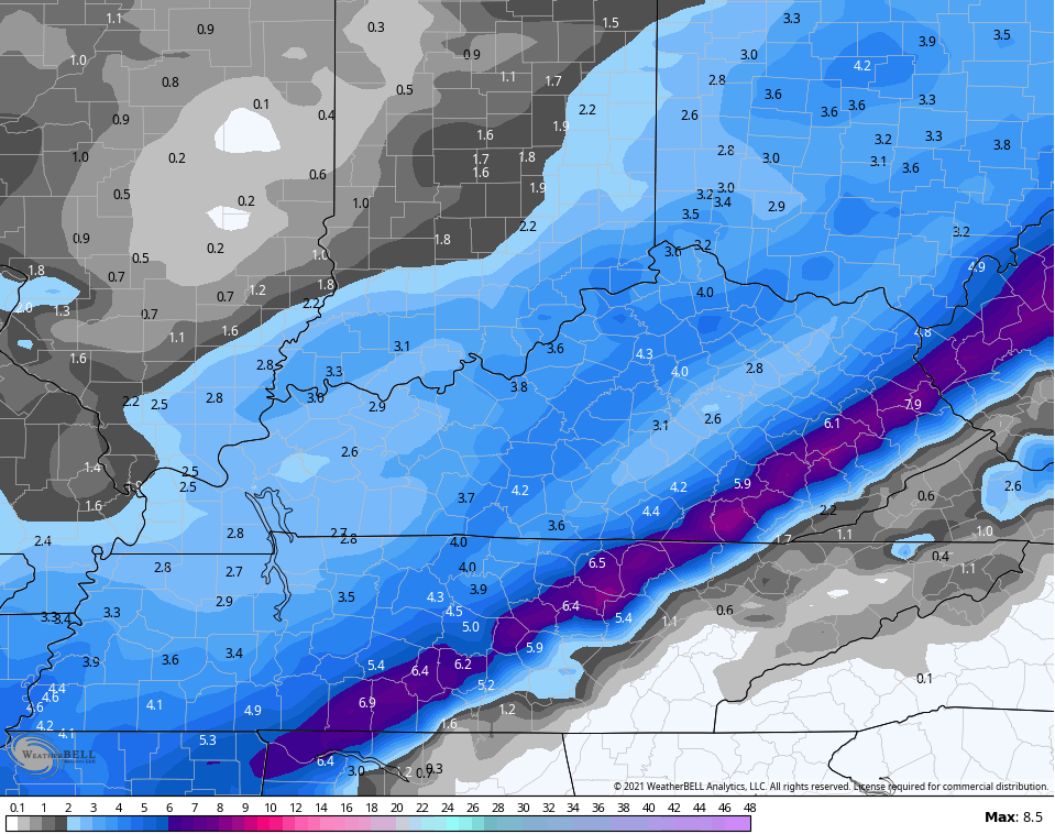
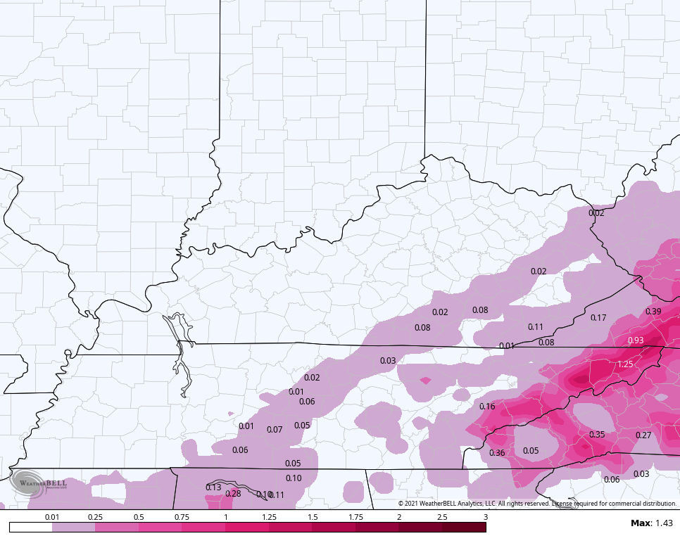
Let’s do a quick scan of the model forecasts…
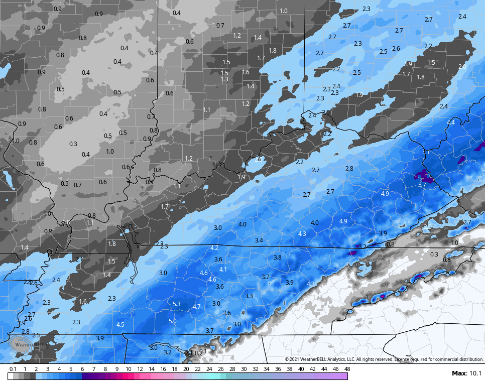
NAM SNOWFALL
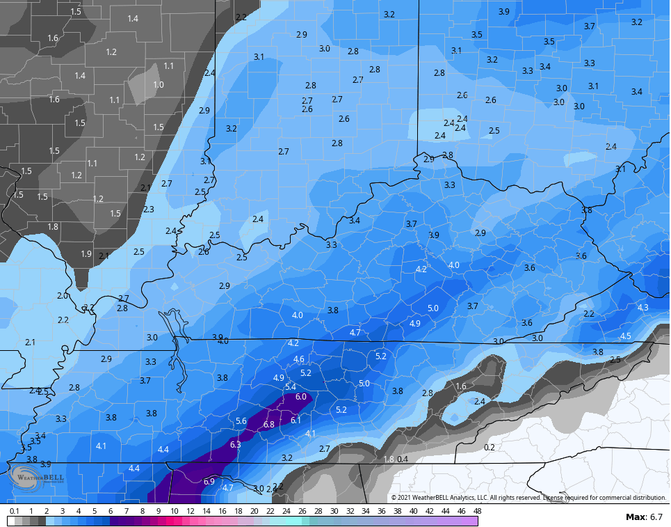
NAM FREEZING RAIN
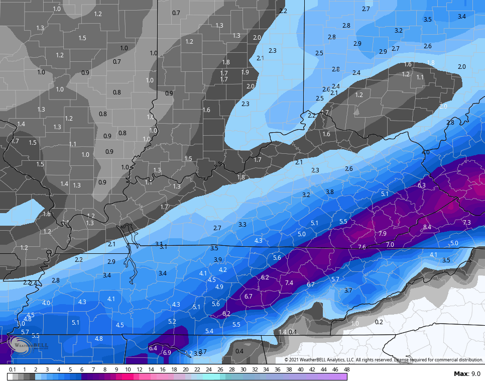
HI RES NAM SNOWFALL
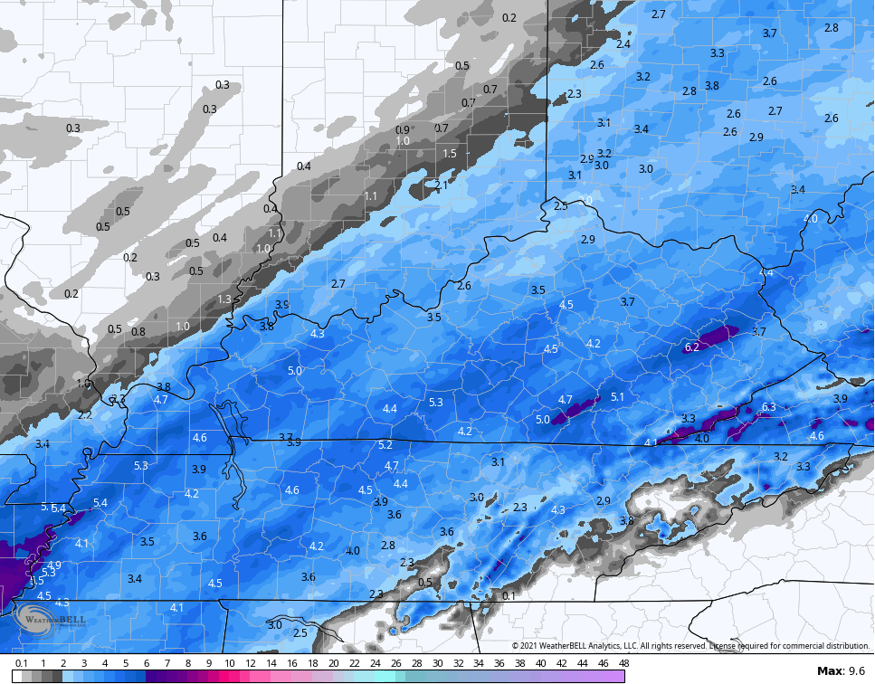
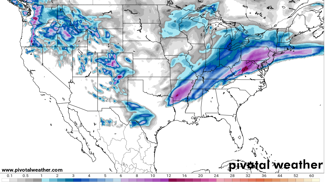
GFS SNOWFALL
NEW VERSION OF THE GFS SNOWFALL
HRRR SNOWFALL
RAP SNOWFALL
You can see how most of the models do have some 4″+ amounts pretty far west and northwest. That’s why I’m glad I already had that 2″-4″ swath in those areas.
I will see you on WKYT starting at 4 and with additional KWC updates later today. Here are your radars for the afternoon…

Have a good one and take care.

Looks like the higher snow totals have shifted SE some overall. Less snow, maybe less chance for power to go out again. Richmond has several inches of solid ice-sleet-snow mix. It’s almost like another layer of the ground.
#TeamSpring
Looks like we went to about 1/3 of what was expected yesterday. Main spot went from 6 to 12″, to 2-4″. I did not expect that, since with all the cold surface and ice in place, I was expecting at least the map to hold up. For snow fans another ironic letdown, but for power-on fans, good news.