Good Thursday, everyone. The final act in a trio of winter storms continues to put it down across the bluegrass state. Several inches of fresh snow are on top of several inches of ice and snow from earlier storms. As we roll through the day, things look to taper off from west to east as more arctic cold air moves back in here for a few days.
Several areas are going to check in on the high end of of the snowfall forecast of around 6″. Can we get a spot or two to exceed that? I can’t totally rule that out across areas of eastern Kentucky.
Roads are snow covered once again and it’s another crippling system for travel here in the Commonwealth. Here are your radars…

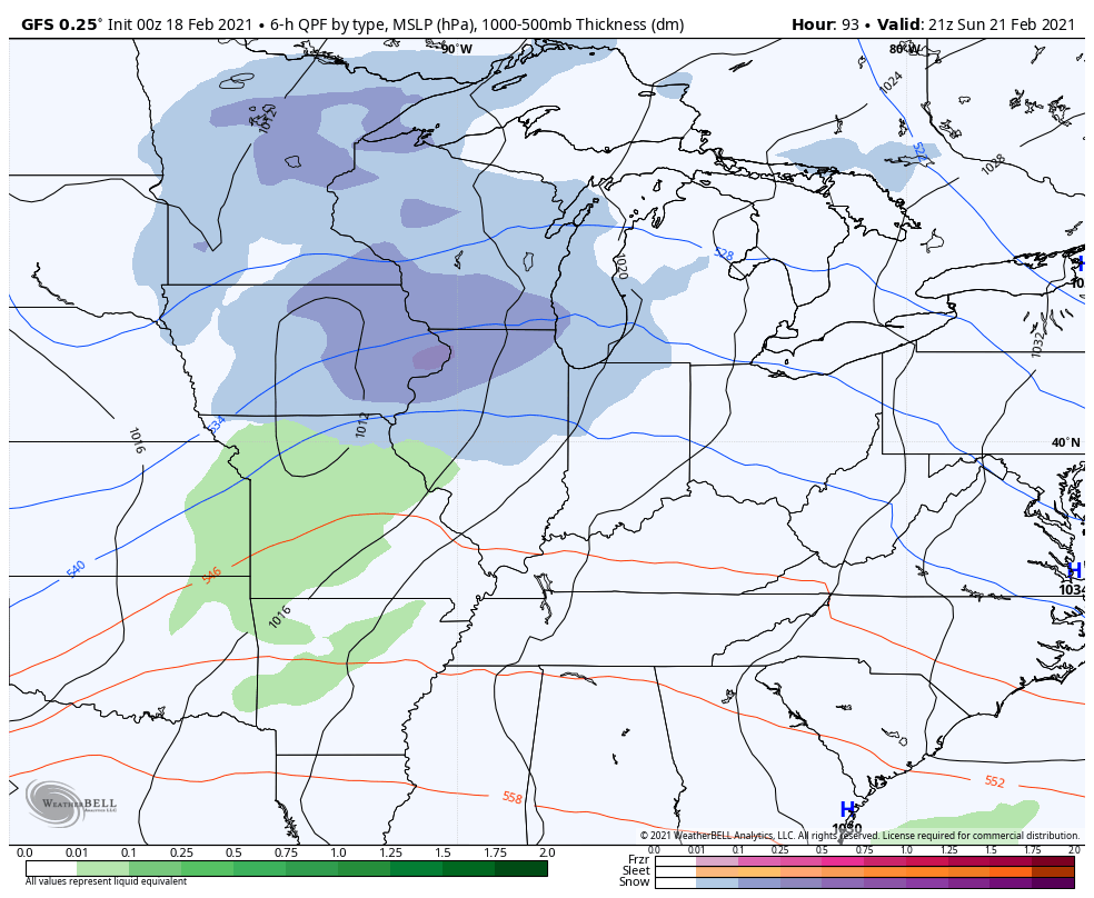
One more band of light snow works through this today and tapers from west to east this evening.
How quickly can skies clear tonight? With snow on the ground, temps could absolutely tank if we see stars. Single digits are likely for many, but the new version of the GFS takes the numbers below zero for some…
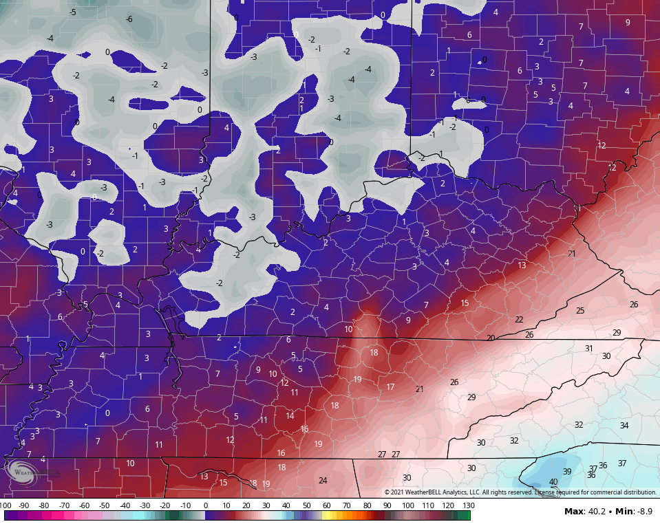
It does the same thing Saturday morning…
Bitterly cold air is not what we need with so many folks still without electric.
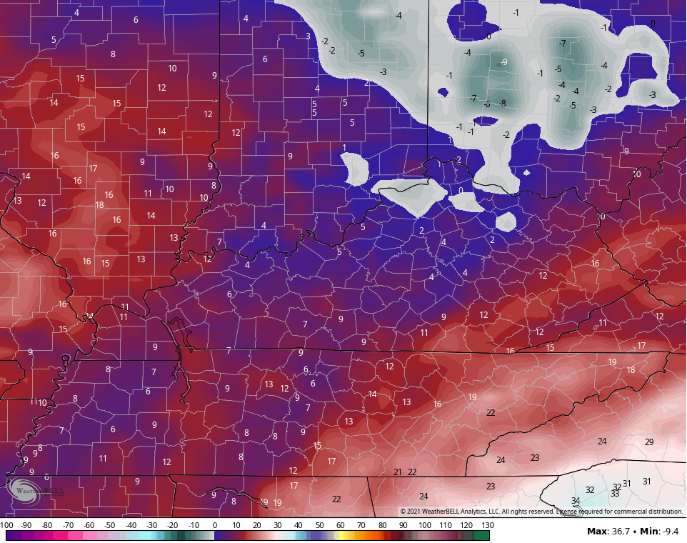
Temps recover over the weekend and should finally go above freezing on Sunday. This is ahead of another cold front dropping in here by Monday, but this one looks like mainly a rain maker…
Temps behind this don’t really cool down much. As a matter of fact, we are very likely to make a run into the 50s by the middle of the week. You know what I say about what? BRING. IT. ON. #TeamSpring is hurting right now.
I will have updates on where the overall pattern goes from here coming up later today. Have a good one and take care.

Roads are crap in Louisville and Bardstown.
Bardstown/Nelson Co roads haven’t looked at all good since last weekend. Plow has been down our street twice since Monday. They act like it’s gonna kill ’em if they put that blade down! Lol
It took 2 days for them to plow our road. ♂️
Poor Bubba’s dome busted again. 😉
LOL- that was obliterated five years ago. On a positive, we could have got a lot more ice with the last one and if this event was as much snow as outlooked a few days ago- a LOT more folks would be without power and for a lot longer.
No measurable snowfall was recorded at Chicago’s O’Hare Airport on Wednesday, the first day since February 7th that there was no measurable snow recorded (0.1 inches or greater).
The nine consecutive days of measurable snowfall ties Chicago’s all-time record for the most consecutive days of measurable snowfall, which was last set in February of 2018.
Light snow is falling throughout the area this morning though, with modest accumulations of around a half-inch expected. It’s currently 16 degrees out, not as cold as recent mornings.
Monday looks to be Mother Natures free car wash day.
A lot of snow removal chemicals need to be washed off automobiles.
Thanks Chris, Just a few inches of Snow here in North Taylor County last night. (around 4 inches)
I’m sure the roads are very slick and dangerous as nothing has been done since the Ice Storm.
My guess is it just didn’t get that bad to clear the roads in rural areas of my county.
Mother Nature hopefully will clear it for us by Monday.
So far I have recorded about 7 inches of Snow to date in my backyard.
Another below normal year for Snow unless we get more than 6 inches in March or early April.
The Ice on the Trees and the new fallen Snow from last night makes the landscape around my cabin absolutely beautiful ! ( add this to the above post.)
Several inches of snow + sleet + rain has created a concrete like goop that’s almost impossible to shovel.
I measured around 4/5 inches of snow before the changeover started to happen.