Good afternoon, everyone. As our winter storm slowly fades, we have one more band of snow to go through this afternoon and evening. This will put down additional light accumulations across central and eastern Kentucky and will be followed up by a couple of bitterly cold mornings.
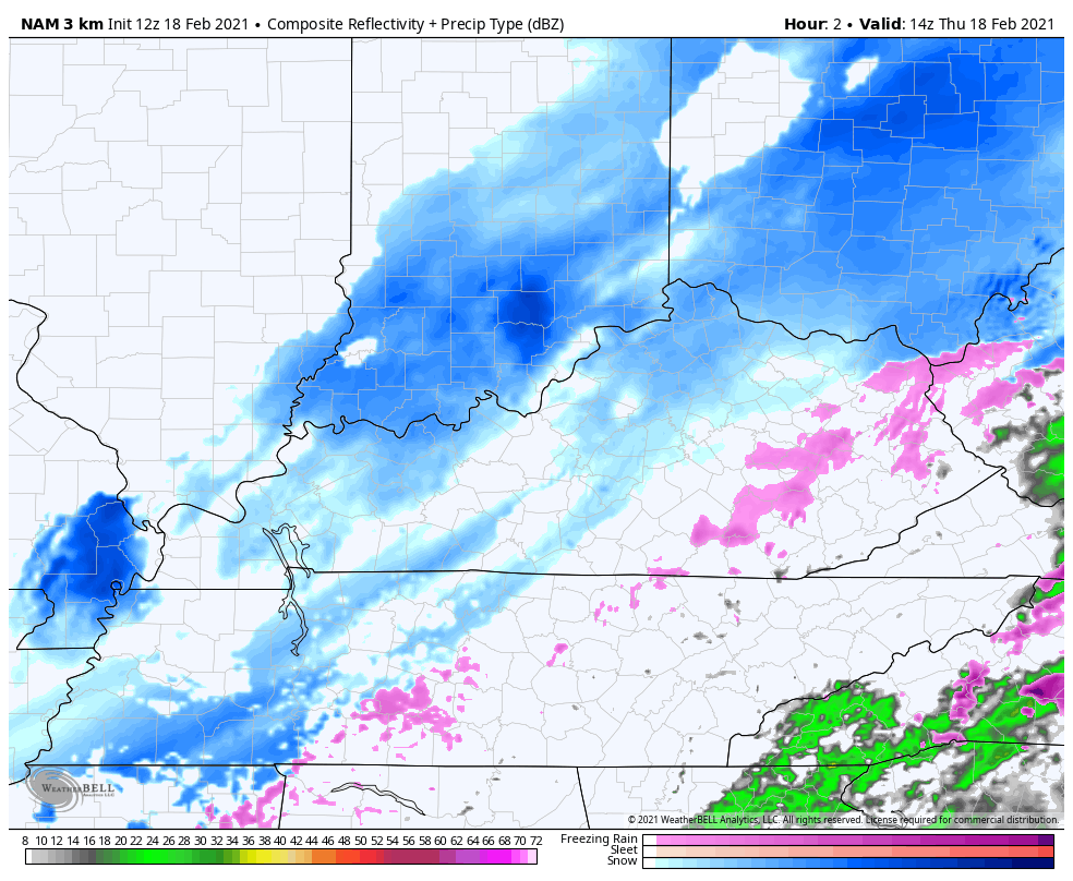
Up to an inch or so of additional snowfall is possible with this next band that develops right on top of central Kentucky this afternoon. From there, it works across eastern Kentucky into the early evening. You can see this on the future radar from the Hi Res NAM…
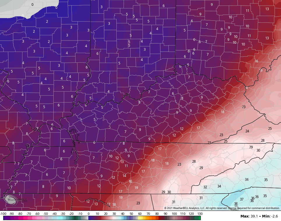
I’m not totally convinced skies clear tonight, but if they do, temps will drop into the single digits and threaten to go below zero. That’s something the new version of the GFS has been showing. The current GFS is only singles tonight…
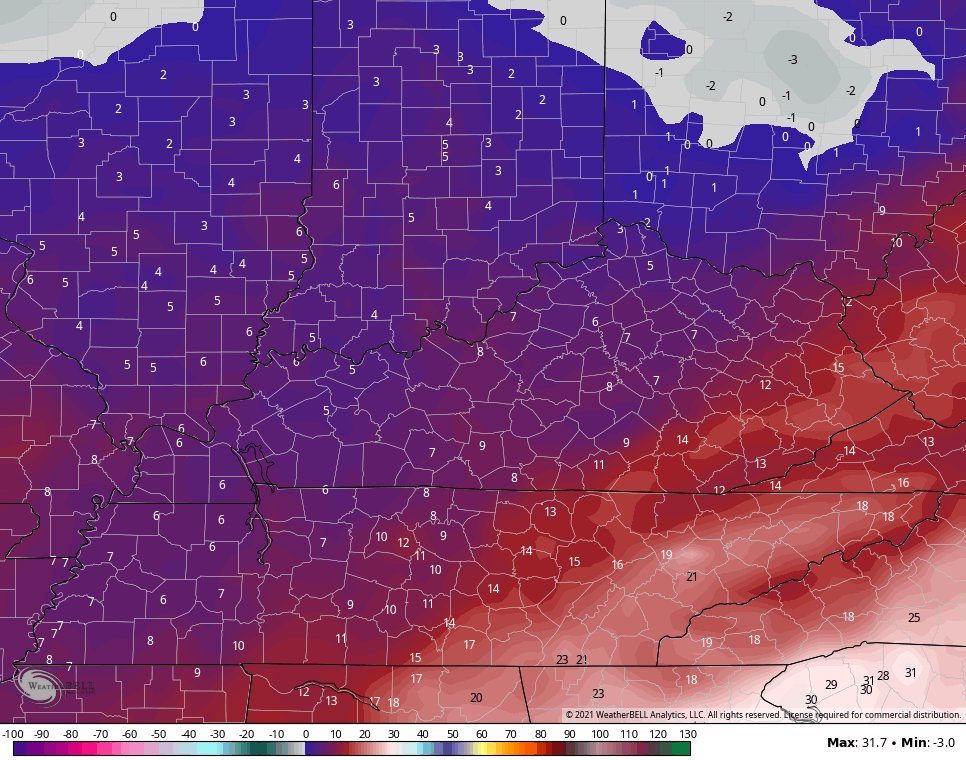
There’s a better chance for clearing Friday night…
I’m really just now starting to look ahead on the upcoming pattern to end February and kick off March. My first thoughts for March:
- Winter isn’t done just yet.
- Some major temp swings are likely to show up. Days of well below normal and well above normal look to show up. Who wants to be normal anyway?
- The pattern looks active with above normal precipitation.
- This could feature another WST and some severe weather.
Here are your radars to track today’s snow band…

I’ll see you guys for an evening update. Stay safe, stay warm and take care.

Darn, huge temp swings this time of year can be really bad.
An emotional roller coaster.
Yup. Anything from severe weather to late freezes.
Damn good effort this week!
March can have all four seasons of weather, especially in the Ohio Valley.
Coming down again in my part of Richmond. Started around 2 and looks like it will keep going for a while…. I LOVE WINTERS LIKE THIS! I know, it’s mid Feb so the days are numbered… Longer day, higher sun, temps edging up… Soon it will be spring….
I definitely look forward to this time of year. After this winter, I seriously believe I will never complain about the heat ever again, lol, unless it becomes 200°F then I’ll complain.