Good Friday, everybody. Our history making run of harsh winter weather is finally coming to an end, but it’s leaving behind a frozen bluegrass state and nation. Once we get into the weekend, we can see the light at the end of the tunnel as much milder air gets set to take control, especially into the middle of next week.
In terms of this current pattern, it’s been historic. Anyone arguing that has zero weather perspective. We just had 3 winter storms to hit the region in one week, knocking power out to hundreds of thousands of folks at one point or another.
In addition to the winter storms, the cold has been historic in western Kentucky…
The high temperature today reached 29 degrees in Paducah, KY. This marks the 8th straight day where temperatures remained below 30 degrees, breaking the all-time record which was set twice in 1978. The duration of this arctic cold blast has been mighty impressive! pic.twitter.com/PhMshLfRYz
— NWS Paducah, KY (@NWSPaducah) February 18, 2021
Anytime a record from the brutal winter of 1977/78 is broken, you know it’s serious. Overall, this has been a harsh winter for much of the area, especially central and eastern Kentucky.
Let’s get to the weather of the present and the future. Our day starts with single digit lows for areas with clearing and into the mid and upper teens for those with clouds. Highs today will generally be in the 20s for many and we still could be seeing a few flakes show up…

Lows tonight into Saturday morning are generally in the single digits for much of the state if skies are clear.
The weekend weather looks much better with temps inching above freezing for many on Saturday. Those numbers should really jump on Sunday with the 40s waiting on us. That’s ahead of another cold front working quickly in here with some showers Sunday night. Some of that may mix with snow before ending early Monday…

There really isn’t much cold air behind this quick-hitting front. As a matter of fact, some milder air moves in for the middle of the week. Highs reach the 50s for Tuesday and Wednesday…
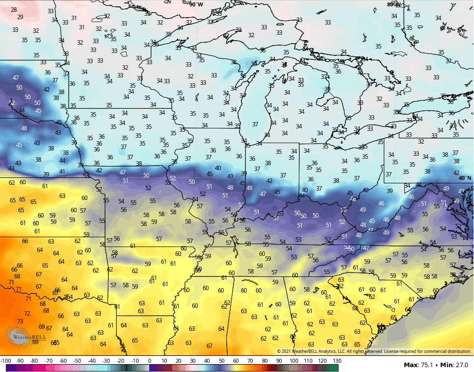
TUESDAY
WEDNESDAY
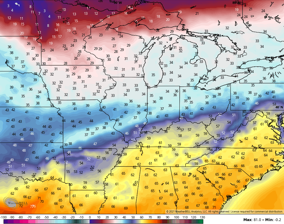
Is that a 60?
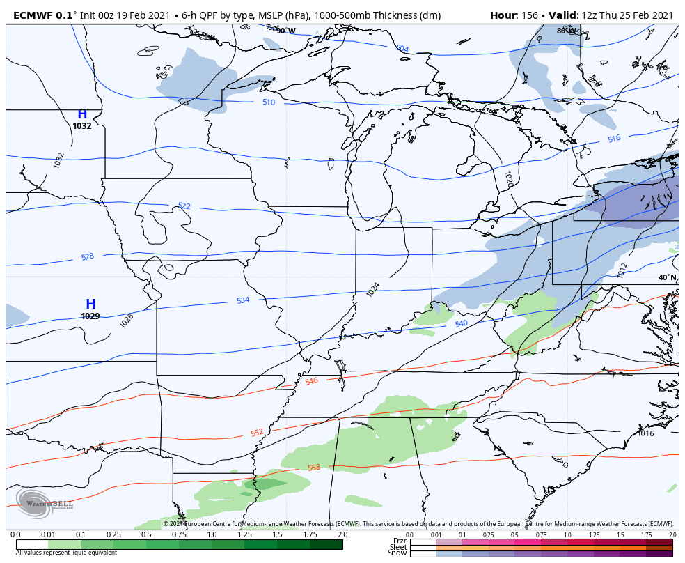
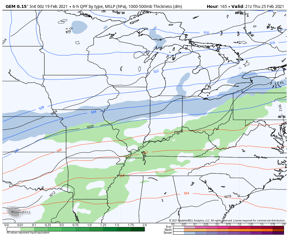
Notice how the colder air isn’t too far away to the north. This colder air likely presses south behind a Thursday cold front and it may have a wave of low pressure along it. Several models develop a fast-moving winter weather maker…
EURO
CANADIAN
This will be followed up by another temp jump, but this isn’t a pattern that is going to just snap straight into spring. The pattern into early March can feature more winter action and the overall setup has a stormy look to it. #TeamSpring ain’t happy about it.
I will have another update later today and on WKYT starting at 4. Have a good one and take care.

Thanks Chris, Glad to see the words “freezing rain” taking out of the 7 day forecast. This past week really wasn’t that impressive in my area of Kentucky. I recorded a low temperature of 10 degrees in my backyard a couple of nights and the highs were only in the upper 20’s. More Ice than Snow accumulated in my backyard and the Snow only accumulated to about 4 inches. The lack of Sunshine and the cloudy warm air aloft caused by high pressure to our Southeast day after day was depressing. The worse thing about this period was waiting for the electrical power to fail and trees coming down destroying the value of the property. Happy to say we didn’t loose power through the period and there isn’t any damage to property cause by falling trees and limbs. Around us however and especially east of my area it was a disaster and I hope everyone affected gets their lives back to normal very soon. May the Good Lord be with them.
I have to bring this up for the finally time, this recent week of winter weather is no way near what I experience in 1976 to 1978. High temperatures below zero for more than a week with a snow pack up to 20 plus inches that stayed on the ground from January through March.
#TeamSpring is all I am thinking about. It was nice to see the sun for the first time in about 9 days.