Good afternoon, everyone. It’s a day of melting across Kentucky as temps take off ahead of a cold front zipping in later tonight. This brings some honest to goodness rain to the region for the first time in a long time. Temps do surge even more by the middle of the week as our harsh pattern fully breaks.
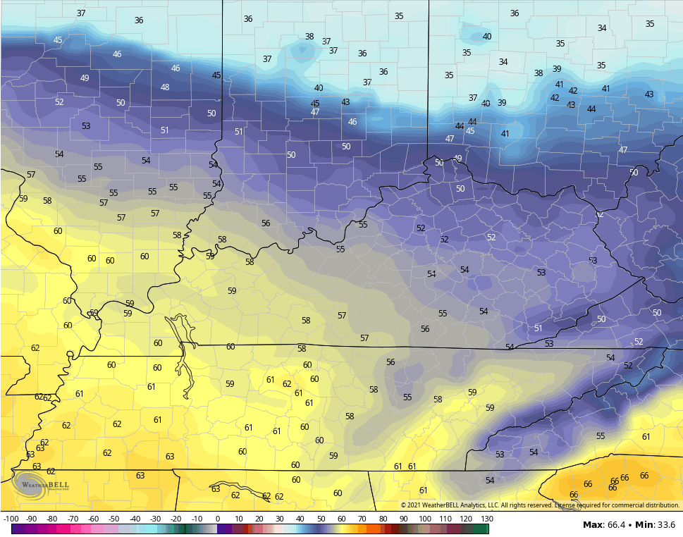
Temps this afternoon are into the upper 30s and low 40s north to the low 50s in the far south and west. Drip, drip, drip.
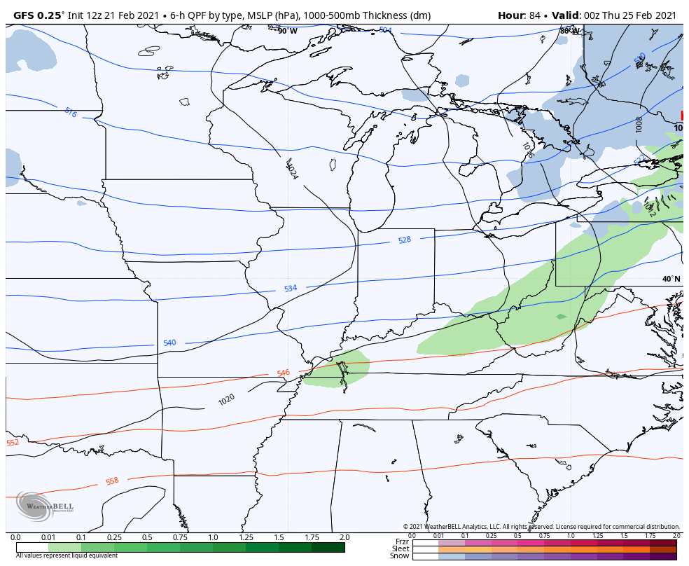
Showers will move into western Kentucky by evening and will work from west to east across the state overnight and early Monday. Here are your radars to follow along…

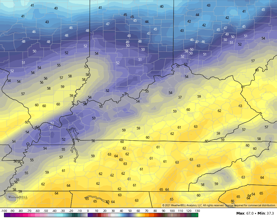
The rain clears out quickly on Monday as temps dip a little from today, but there really isn’t much cold air coming in behind this.
By the time we get into Tuesday and Wednesday, temps look much, much better. Highs can make a run at 60 in a few spots.
TUESDAY
WEDNESDAY
A cold front moves in behind this Wednesday night and Thursday, but the models are now diverging on how much cold air comes in behind this. The current trend is for milder air and another big storm later in the weekend and into the start of March…
GFS
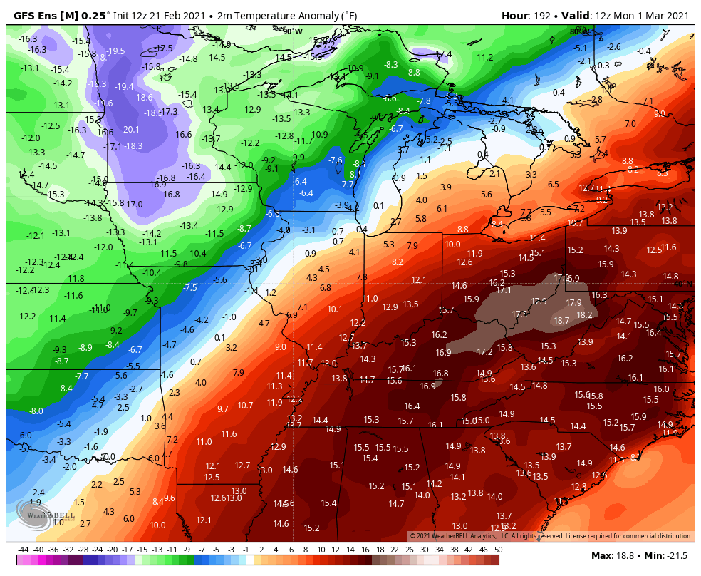
Looking deeper into early March, the GFS Ensembles have one cold shot before a milder trend…
Enjoy the rest of the day and take care.

where is the water going? UP
Looking through the models, none of them really show anything more than a passing flurry through the middle of March – looks like we are full steam ahead into spring.