Good Monday, folks. We’ve made it to the final week of what has been a brutal February across the region and much of the country. This harsh setup is now a thing of the past as our temp pattern turns much milder in the coming days and this puts a smile on the face of everyone on #TeamSpring.
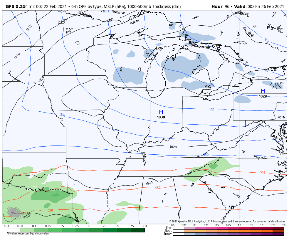
Let us kick things off with how things are shaping up for our Monday. A cold front is zipping through here, bringing a band of gusty showers along and ahead of it. This action looks to end fairly quickly by midday…

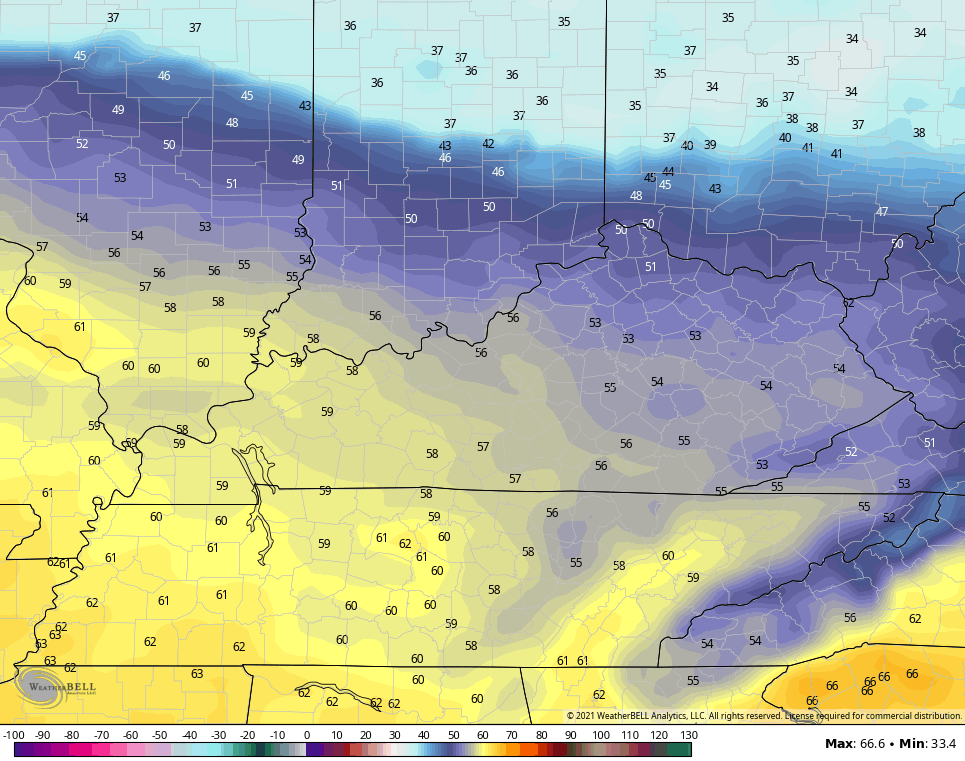
Some rays of sun may even show up this afternoon across central and western parts of the state. Temps will come down just a bit from Sunday, but will still be well above freezing and may not drop too far below freezing tonight.
Much milder air then surges in for Tuesday and Wednesday and this is when some of us may be able to tickle the 60 degree mark.
TUESDAY
WEDNESDAY

This sets up an active setup behind this with a couple of systems rolling our way this weekend and early next week…
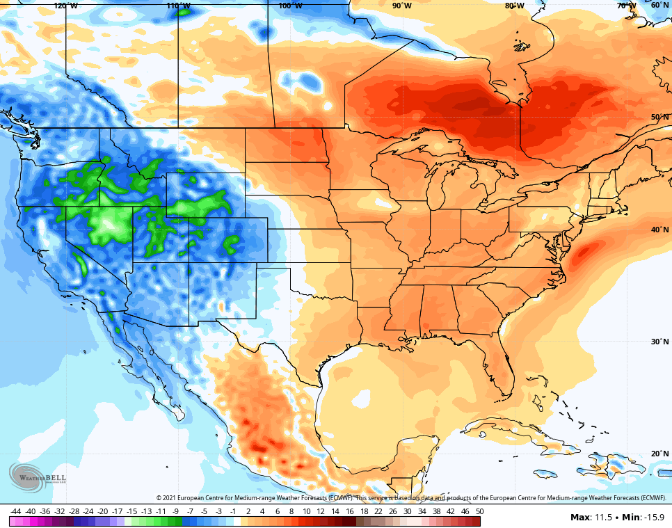
The EURO Ensembles continue to indicate a milder than normal pattern as we close the month and go into the first week of March. Here’s the 10 day average temp departure from normal…
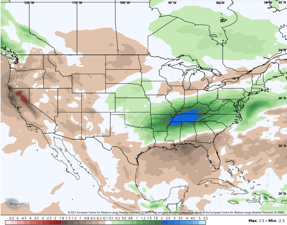
It also shows a much wetter than normal pattern during the same time…
Yay!!! March mud!! 🙄
I will have another update later today. Have a magnificent Monday and take care.

I bet we go over 100° this summer at the rate we’re going.
The temperature made it all the way up to 37 degrees at Chicago’s O’Hare Airport on Sunday evening, breaking a 16-consecutive day streak of below-freezing temperatures, which is remarkable for February. 1.2 inches of wet snow also fell, and 0.5 inches in the SW suburbs before changing to a little drizzle and melting.
No snow is in the forecast at all through next Sunday here, with temps predicted to make to the low 40s area-wide here on Tuesday, so there will be considerable melting of our deep snowpack.
That looks like a very interesting storm on the GFS model for the Chicago area in about a week. We only need around four more inches of snow to break 50 inches for the season. I’m sure March will be good for at least one major winter storm here.
Bring on Spring, Thunderstorms, longer day light, warmth and all.