Good afternoon, everyone. This morning’s round of heavy rain and thunderstorms drenched areas of southern and southeastern Kentucky, causing flooding issues. With much more rain on the way tonight and Sunday, major flooding issues may very well develop in these areas.
The flooding threat isn’t confined to just southeastern Kentucky as rounds of heavy rain and thunderstorms overspread the rest of the state as well. An additional 2″-4″ of rain is possible across the entire region. Anything close to that across the southeast could result in life-threatening flooding. Please take precautions now.
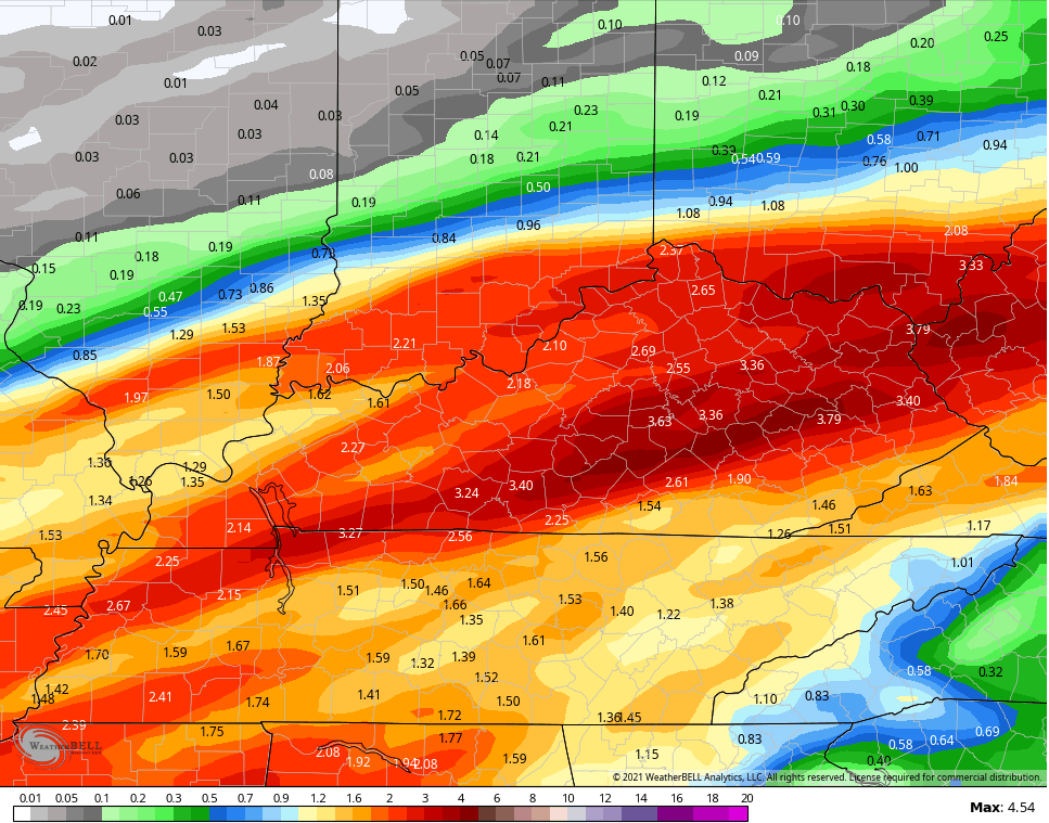
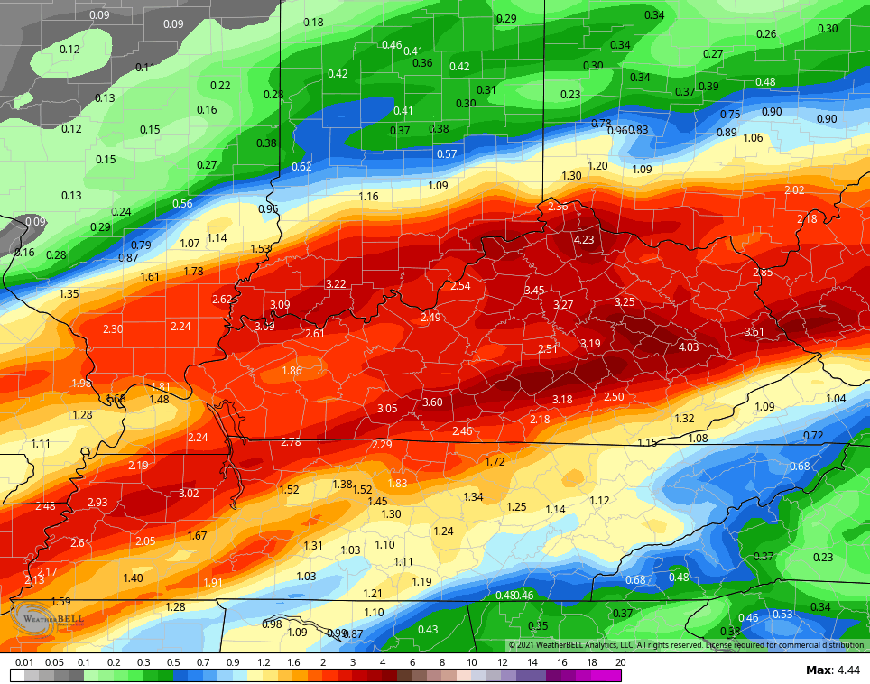
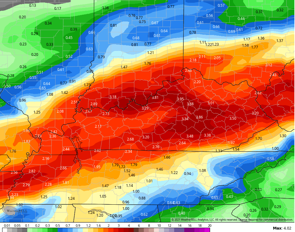
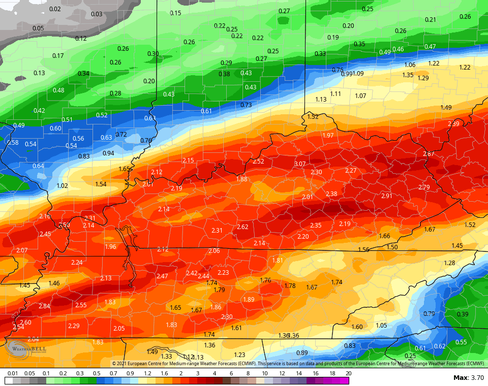
The models continue to show a lot of additional rainfall…
GFS

NEW GFS
SHORT RANGE CANADIAN
CANADIAN
EURO
In addition to the flooding potential, a few strong to severe storms will be possible. The Storm Prediction Center is highlighting western Kentucky for a low-end severe threat into this evening…

That risk develops farther east across the state for Sunday…

Updates come your way as needed today. I leave you with your storm and rain tracking tools…

Current watches

Possible Watch Areas

Have a good one and take care.

dropped the ball on this morning rain!!!!! nobody said anything but saturday night thru sunday flood watch. so admitt when you and the whole team drop the ball!!!!
This is just not true. From Friday morning’s post.
“Heavier downpours will show up tonight into Saturday morning, especially across southeastern Kentucky. This is where a quick 1″-2″ will be possible in some areas, leading to the potential for local high water.”
Ready for spring but not the severe weather.
It would not surprise me to see that Marginal Risk area upgraded to Slight Risk on Sunday, especially if the sun poked through for an hour or two tomorrow.
People should really bother reading posts before accusing Chris of dropping the ball on anything.