Good afternoon, everyone. Significant flooding issues are ongoing across much of the state and this will only worsen as we go through the rest of the day into tonight. Rounds of showers and thunderstorms will continue to work across some of the same areas, putting down more in the way of heavy rainfall.
Many counties are currently under Flood Warnings or Flash Flood Warnings. Most rivers and major creeks are also under warnings and that includes the Ohio River. River flooding will be an issue for days to come.
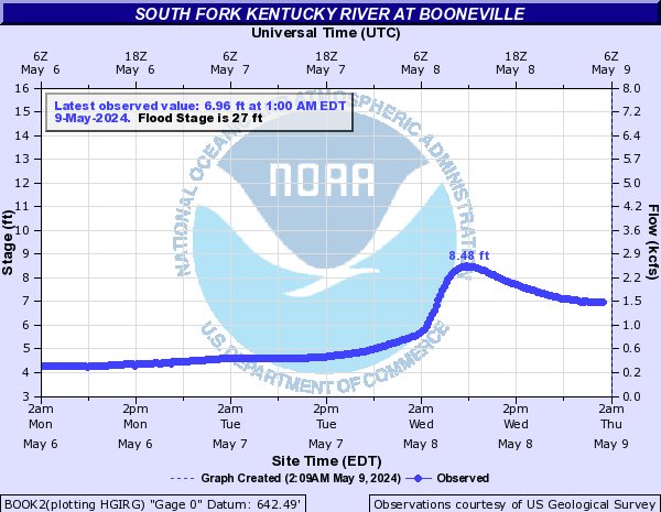
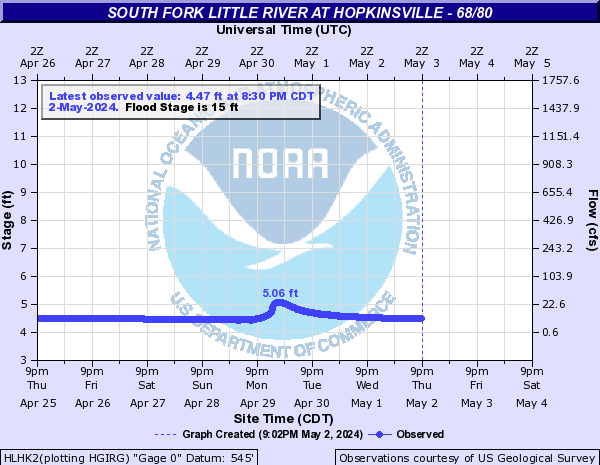
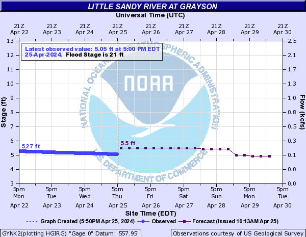
For the rest of the day into tonight, the greatest risk for additional flooding is now across the southern half of the state. Another 1″-3″ will be possible in this area through tonight, leading to major flooding issues. Here are some of the highest forecast levels on various waterways…


Please have a plan of action if flooding impacts where you are.
In addition to the flooding, the threat for strong to severe storms is still there. The greatest risk is across the southern and southwestern parts of the state…

Damaging wind is the primary threat with any of the storms that go up.
The setup calms down with drier and cooler air for Monday. A passing system may bring some showers late Tuesday and Wednesday, but this doesn’t look like a big deal. A seasonable blast of cold is likely for the rest of the week into next weekend.
I leave you with your Sunday storm tracking tools…

Current watches

Possible Watch Areas

Enjoy the rest of your day and take care.

as long as we don’t get any heavy rain in Dickerson Co. VA an Pike county the Levisa fork should be ok