Good evening, everyone. Major flooding continues across much of the state, but the rains have ended and we are looking at a much calmer pattern in the days ahead. The temps will eventually turn seasonably chilly for a spell, but who cares as long as it’s dry.
The flooding is historic in many areas of the state and this is coming on the heels of historic ice storms. The South Fork of the Kentucky River is cresting at the highest point in recorded history…
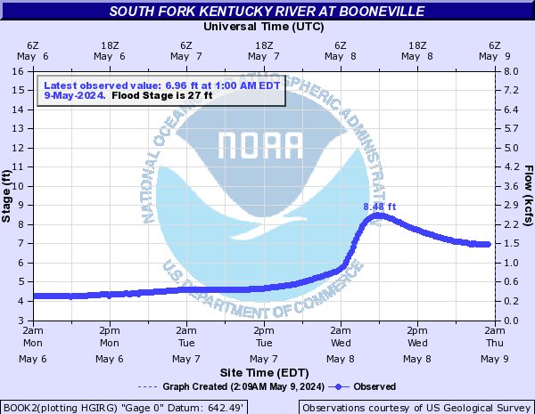
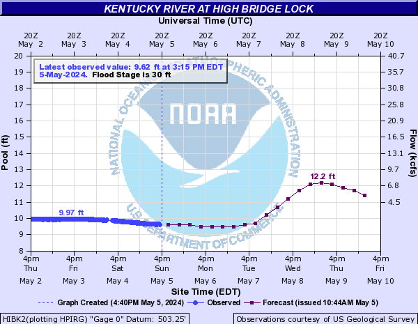
Major flooding will then continue well downstream…


Flooding along the Red River is threatening the record level there too…

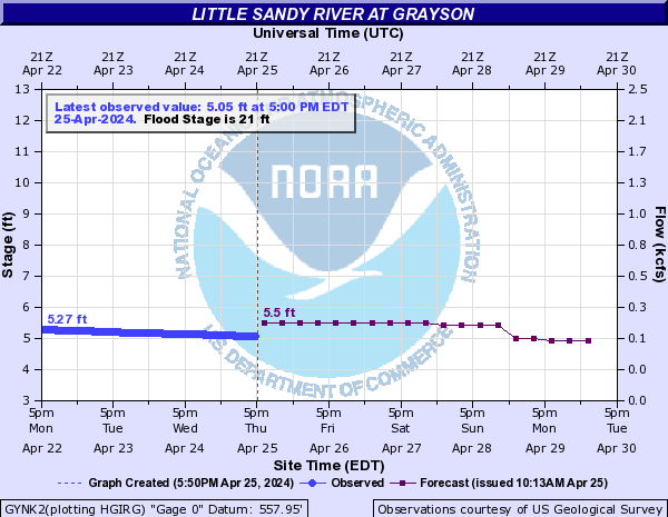
Major flooding is also occurring along the Little Sandy River…
That’s just a sampling of some of the Rivers currently in flood.
This extreme weather of the past 3 weeks is hard to put into perspective. It’s historic and something we’ve never seen around here.
Tuesday is a seasonably chilly day before we turn much milder for Wednesday. After that, another round of seasonable chill comes in for the end of the week and weekend. That will be followed up by above normal temps early next week…

That milder air may be accompanied by an increase in thunderstorms next week…

Severe weather makers may show up into the middle of the month.
Enjoy the rest of the day and take care.

Paintsville Levisa Fork Crest at 39.55FT. forecast was for 40.6 FT. the ground is still full of water any rain is going to be problems. Flash flooding was as bad as I have seen. We have had flash flooding in places I haven’t seen flood most of this was caused by filling in and drains not being big enough. All of the building in the flood plain has pushed the water into places it had not been and slowed runoff. I will shut up