Good Wednesday, everyone. It’s another very warm day across Kentucky as we watch a system rolling our way from this west. This can touch off scattered storms this afternoon, with the potential for a few strong to severe storms in the west. This is part of an increasingly active pattern likely to carry us through next week.
Today’s temps are generally in the 75-80 degree range, but a few spots may top out in the low 80s. A few storms may fire up this afternoon across central and western parts of the state.
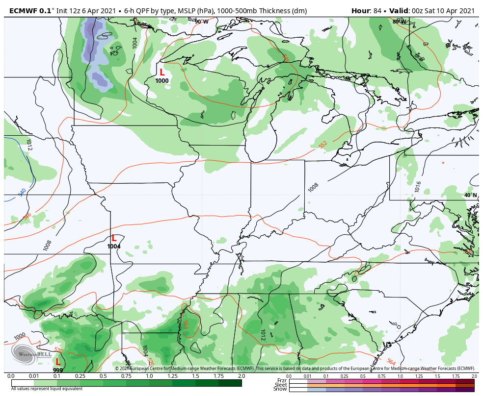
The main line of storms will develop and move into western Kentucky this evening and then it moves through the rest of the state tonight and early Thursday. The Storm Prediction Center is highlighting areas of western Kentucky in a low-end severe storms risk…

That line weakens as it moves into eastern Kentucky Thursday. Skies will clear behind this as winds gust up around the upper low spinning to our northwest. This can also crank out a few more scattered storms across central and eastern Kentucky. As of now, the SPC isn’t overly excited with the severe potential…

Once that blows through, Friday looks like a windy and very warm day. There’s just the smallest risk for a shower or storm.
The next low spins through the region on Saturday and brings a better opportunity for some stronger storms by the afternoon and evening…
Another system follows that up early next week and this may unleash the round of chilly mid-April temps I’ve been talking about. Watch how quickly the numbers go below normal next week…
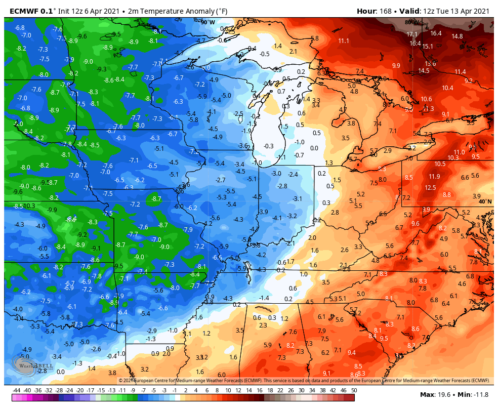
That could bring a late week frost threat into the region. Once again… Slow your roll, green thumbs!!
I will have updates as needed through the day. Until then, I have you all set to do some storm tracking…

Current watches

Possible Watch Areas

Make it a great day and take care.

We had our first 80-degree day of the year yesterday in the Chicago area, with a high of 81 at O’Hare Airport, which was just three degrees short of the all-time record for the day. This was our first 80-degree day since October 9th, nearly six months ago.
I actually turned on my AC in my auto yesterday.
Has not hit 80 degrees here in my area of Taylor County, but the trees are really leafing out, especially the Tulip Poplar.
Hoping the storms will stay away and we just get April showers.