Good Friday, folks. We are in between storm systems today, but the window of dry closes quickly as showers and storms increase from the southwest by evening. This comes from another wrapped up low spinning through the Ohio Valley into the upcoming weekend.
Today is a very windy and warm day as south to southwest winds crank. Highs are generally in the 75-80 degree range for most of the Commonwealth with a few spots into the low 80s. Isolated storms will try to develop later in the day across central and western Kentucky as the next low works closer. The Storm Prediction Center has a low-end severe weather risk across the far southwest…

This low the lifts northward into the western Ohio Valley tonight and Saturday and brings rounds of showers and storms across our region. A few of these storms may be strong or severe as they spiral around the low and the SPC has the severe risk into our region tomorrow…

The damaging wind threat looks like the main player from these storms. Even without thunderstorms, winds are going to crank and may reach 40mph with gusts.
Sunday is a windy and cooler day with temps in the 60s, but we do get a mix of sun and clouds. Those clouds will be a little thicker in the north.
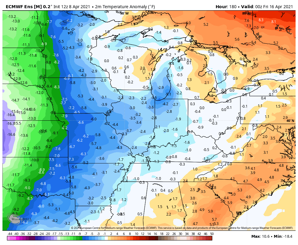
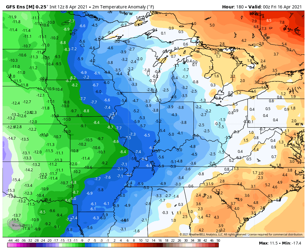
The overall setup for the second half of next week and beyond is for below normal temps to become the norm through the middle of the month. The Ensembles show just how far below normal things can get…
EURO
GFS
Frost threats will likely show up during this time, so slow that roll, green thumbs. 🥶🌷🌼❌
I leave you with your Friday storm trackers…

Current watches

Possible Watch Areas

Have a great day and take care.

Thanks Chris, So far only 0.14 inches of rainfall in my backyard. Not dry yet, but we could use an inch or so of rain showers for the budding plant life.
Dogwoods and Red buds trees are in full glory.
Hope next weeks predicted low temperatures don’t cause too much damage to the cool season crops.