Good Saturday, folks. We have another low spinning into the region today and it’s bringing the potential for a few strong to severe thunderstorms. Once this action spins through here, the focus shifts toward a cooler overall pattern taking shape for the middle of the month.
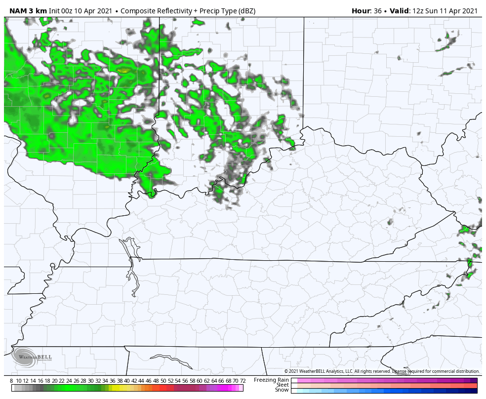
Our Saturday starts with a few thunderstorms rolling in from the west and southwest. By the middle of the day, we should see a few bands of thunderstorms developing and that brings the best opportunity for a few strong and severe storms. This action will be moving in similar fashion as the Thursday severe storms, from south-southwest to north-northeast.
The Storm Prediction Center has much of the Commonwealth in a low-end risk for severe storms…

This doesn’t look like a widespread severe event here, but areas of damaging winds and large hail may show up. The tornado threat isn’t very high, but it’s not zero, either.
A the low wraps up to our north, some backwash clouds and a few showers may dive back in here on Sunday. The best chance for some gusty showers will be across the northern half of the state…
That will mean a nasty temp gradient setting up from north to south. Check out the forecast highs from the Hi Res NAM…
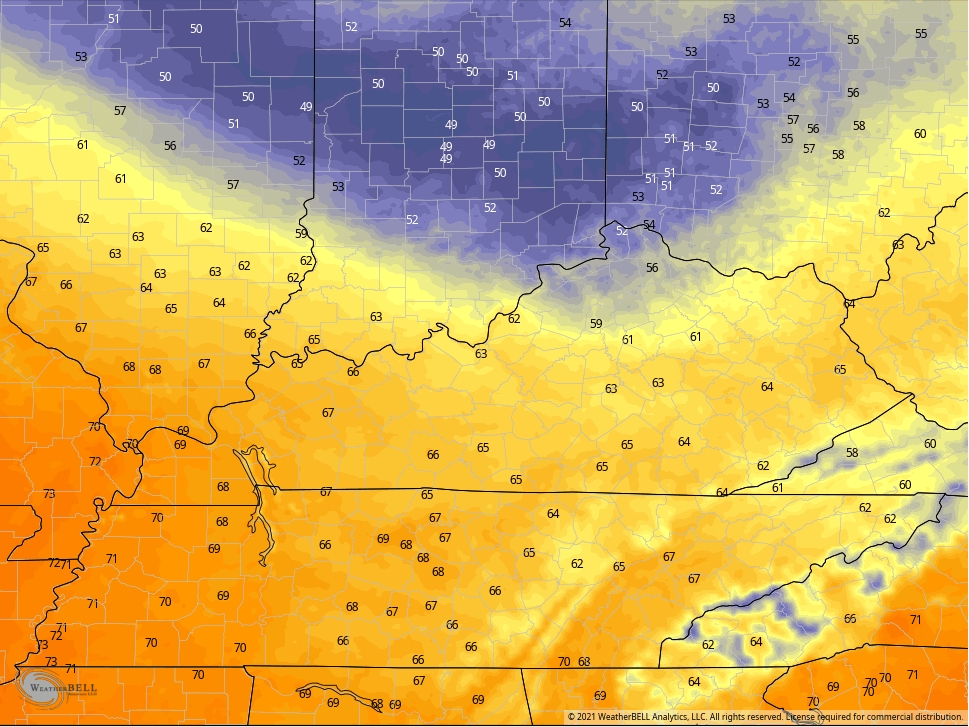
If those showers wind up a bit farther south, then the cooler numbers will do the same.
Monday is a windy day with temps hitting the low 70s for what may be the last time for a while. Some late day showers and storms will be possible ahead of a front that knocks the numbers down for Tuesday and Wednesday. This kicks off a much colder than normal pattern that will carry us through next weekend and into the following week.
I will have updates as needed, so check back. I leave you with your Saturday storm trackers…

Current watches

Possible Watch Areas

Make it a great day and take care.

The rain has put a damper on my sunny disposition.
Maybe there will be plenty of cool Sunshine late next week ?
My kind of weather !