Good Tuesday, everyone. We have a weak system moving into the region today and it’s bringing the potential for a few showers with it. The main focus of the forecast continues to be on a much cooler pattern taking shape for the foreseeable future. #TeamSpring deserves better. 🤬
As mentioned, a band of showers zips across the state today, but it’s not going to impact the entire region. Because of this band, temps are likely to exhibit a wide range with 50s in the rain and 60s outside of it. Here are your radars to follow today’s showers…

Another band of showers may move into parts of the south and southeast on Wednesday as a cold front drops in. A similar temp trend will be noted ahead of a cold front dropping in from the northwest.
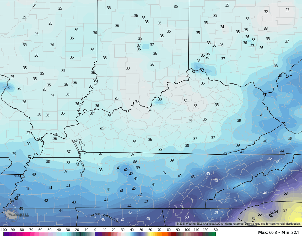
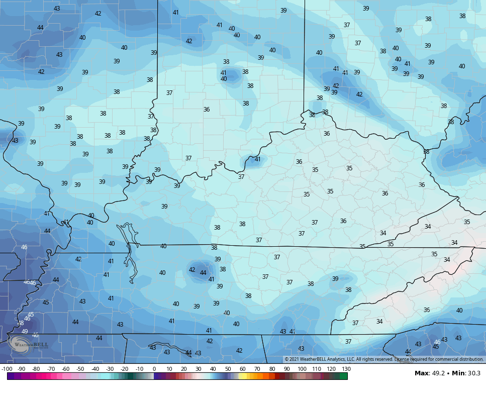
This will usher in well below normal temps for Thursday and Friday. Highs on Thursday may stay in the low and middle 50s for many. Temps by Thursday and Friday mornings may drop into the frosty low and middle 30s…
THURSDAY
FRIDAY
Temps rebound a bit this weekend ahead of another system diving in here from the northwest. This is continues to be one of many cool/chilly shots lining up deep into the second half of the month.
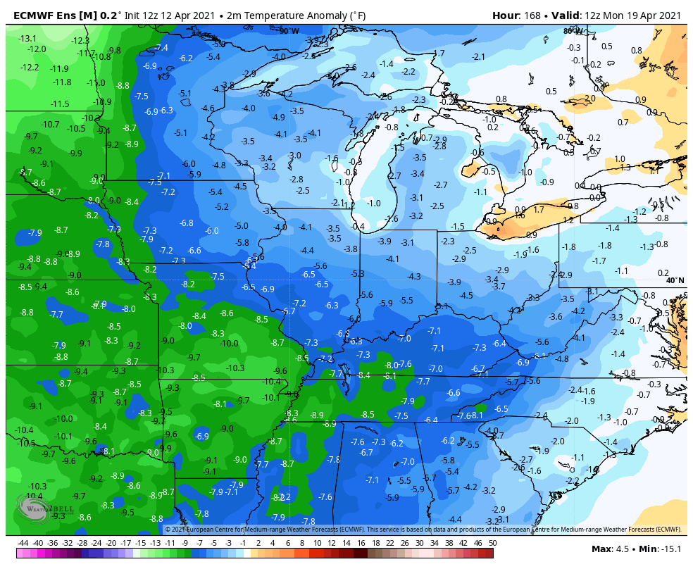
The EURO Ensembles are made up of 51 members and the average of those get negated as we get deeper in time, but the average temp departures are not good for true spring lovers…
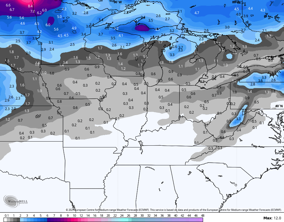
The Ensembles even see the potential for a flake impacting the region at some point in the next two weeks…
Colder than normal springs are just as bad as warmer than normal Decembers in my book. 🤬🤬
Make it a great day and take care.

So far this Spring it’s only been up to eighty degrees once in my backyard and I’m enjoying all the beautiful early Spring trees and shrubs in bud and bloom and the absents of severe weather.
So glad we are not getting any severe weather this week!
Nothing like a northwest flow during the Spring.
Northwest flow makes it hard for severe storms to develop.
I am by no means an educated meterologist, but I wonder if there is a measure for Severe weather potential during a season like there has recently been measures of hurricane/ts potential during hurricane season and that potential builds if not released by actual storms. I just have to wonder if the post poning of Severe weather will cause a more severe situation when the next outbreak does occur.