Good Saturday, everyone. It’s another below normal weekend across the Commonwealth as we track a few showers through the state. This continues to be part of a pattern skewed colder than normal and it’s one that may even throw a touch of winter weather our way in the week ahead. 👀
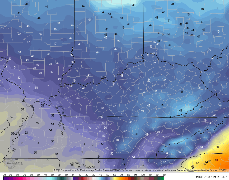
Let’s begin with today and roll forward. Highs are in the 50s with a couple of showers moving from west to east. This isn’t all day type rains, but you should keep the umbrella handy if you’re heading out. Here are your radars for the day…

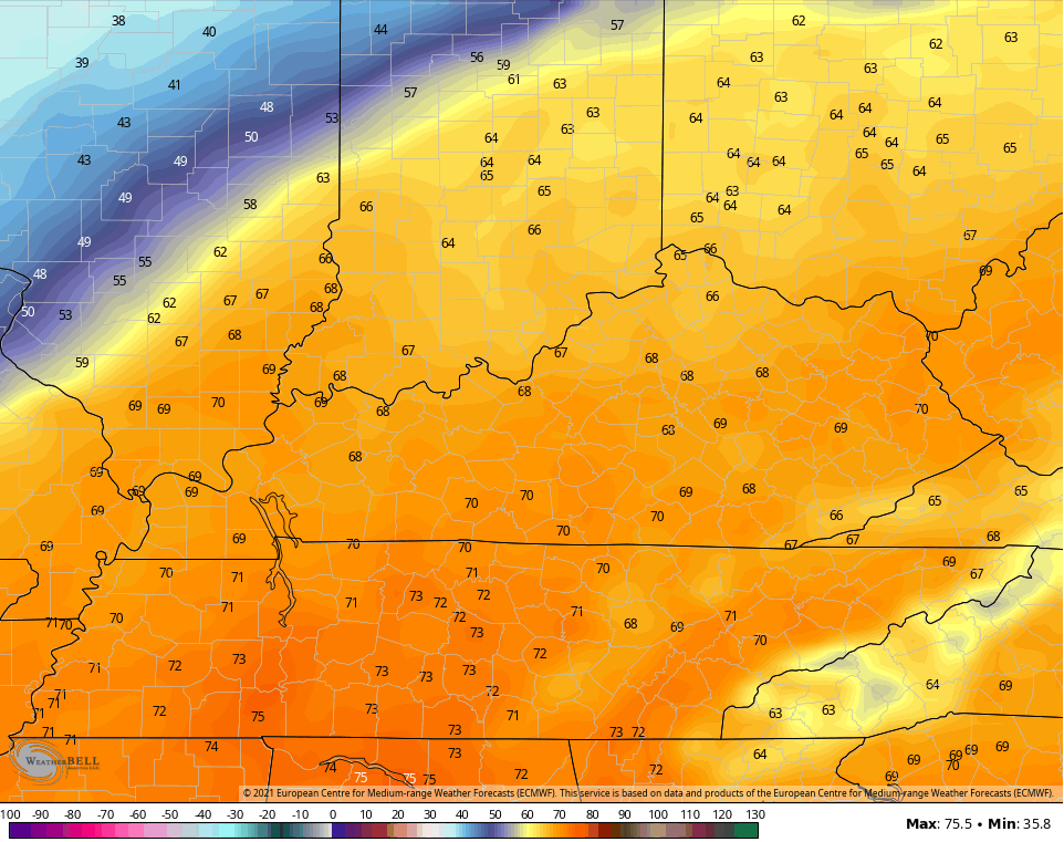
A shower or two may also fire up on Sunday, but this action doesn’t look terribly widespread. Highs will be a little better than today and range from the upper 50s to low 60s for many.
The best weather of the second half of the month may come our way Monday and Tuesday with temps hitting the low 60s Monday before surging deeper into the 60s for Tuesday…
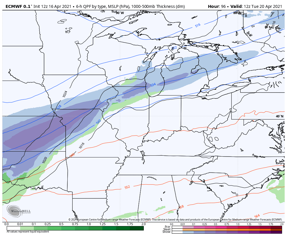
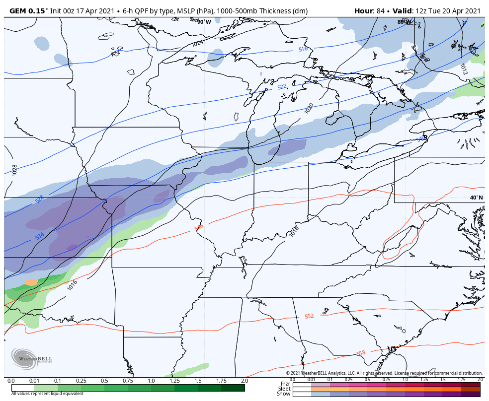
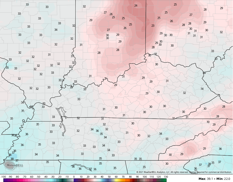
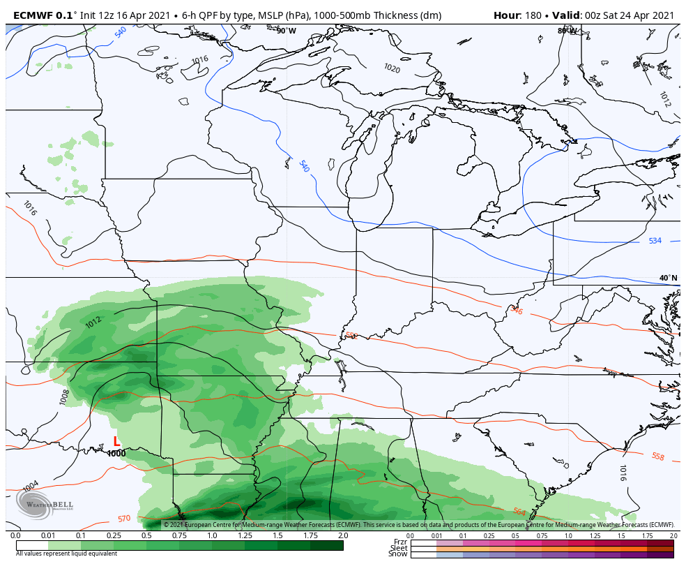
That’s ahead of a strong cold front dropping in from the northwest Tuesday night. Temps drop some 30 degrees behind the front with the chance for rain changing to a little bit of snow into early Wednesday…
EURO
CANADIAN
GFS
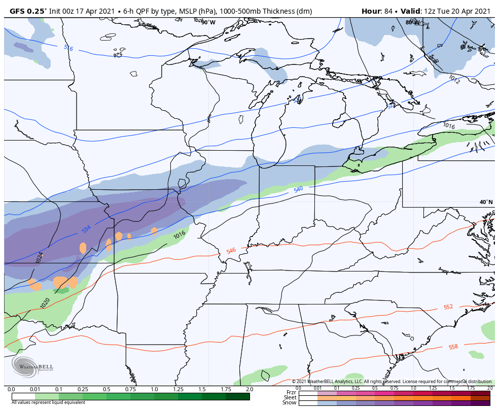
That’s insane and would offer up the latest flake action in Lexington since April of 2005.
Highs on Wednesday likely stay in the 40s for many…
Temps by Thursday morning will likely dip into the upper 20s…
Looking deeper down the road, the EURO has one more deep trough following this and even tries to bring another flake chance…
That seems to be an outlier right now and I’m expecting this pattern to come out of this in the final week of the month with a warm and stormy may taking shape.
I will drop by for another update later today, so check back. Make it a good one and take care.

I am quite concerned that we’re likely to see significant severe weather as we move into May. Severe storms usually impact the deep south from mid-February through March, but this year’s February cold snap delayed that by about a month, and we saw several tornado outbreaks in that region during the mid-March/early April period. Cold air remains entrenched over the northern tier of states into Canada, suppressing the Gulf moisture to our south. But as that warmer air starts to creep northward, we could see a “Battle of the Air Masses” breakout right over Kentucky. It would resemble conditions similar to what took place during the Spring of 1974. A repeat of THAT scenario is the last thing we need to see around here!
Wow ! unbelievable #teamsummer