Good Sunday, everyone. We have a wild weather setup on the way for the week ahead. It’s one that features a powerful cold front ready to sweep in here with spring in front of it and a touch of winter behind it. Yes, we have the chance for a few late April snowflakes to show up.
Today’s weather is decent with a mix of sun and clouds and temps ranging from the upper 50s to low 60s. There’s still the chance for a shower or two, but most stay dry…

Monday may be a slow starter with some clouds and a leftover shower before the partly sunny skies take over. Temps hit the 60s.
The cold front moving in Tuesday night is slowing down just enough to allow our Tuesday temps to make a run at 70…

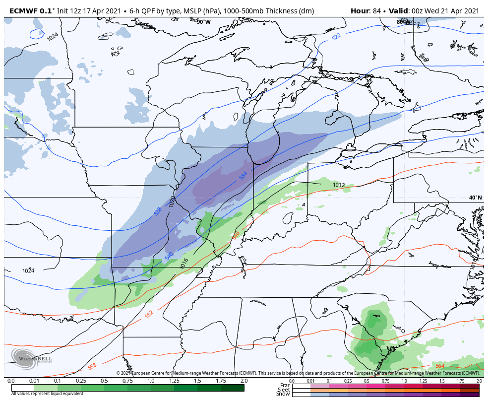
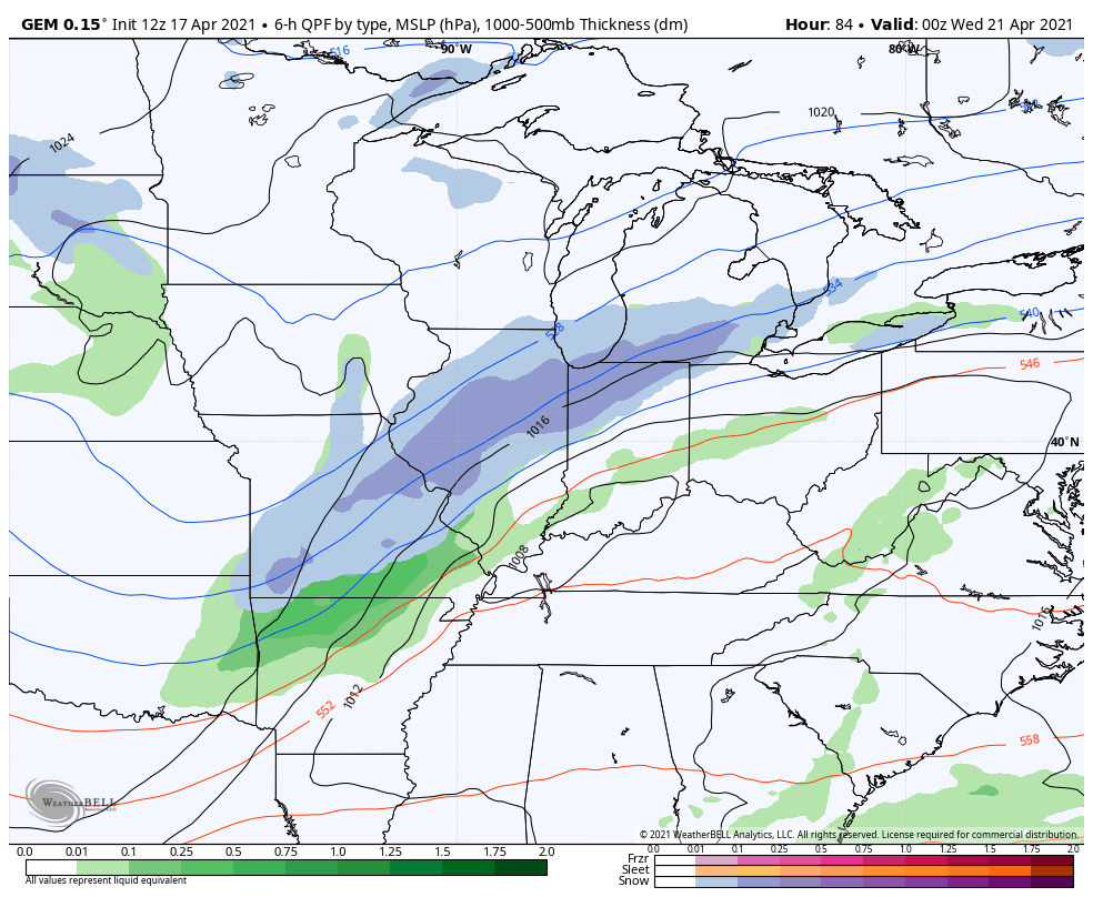
As the front slams in Tuesday night, temps tank into the low 30s with showers that may end as a touch of light snow or flurries. A northwest wind could then send a few rain or snow showers in here early Wednesday…
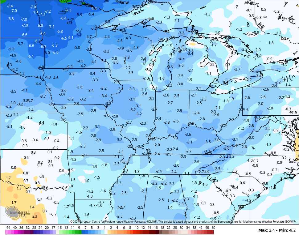
EURO
CANADIAN
The GFS Ensembles show the flake threat well…
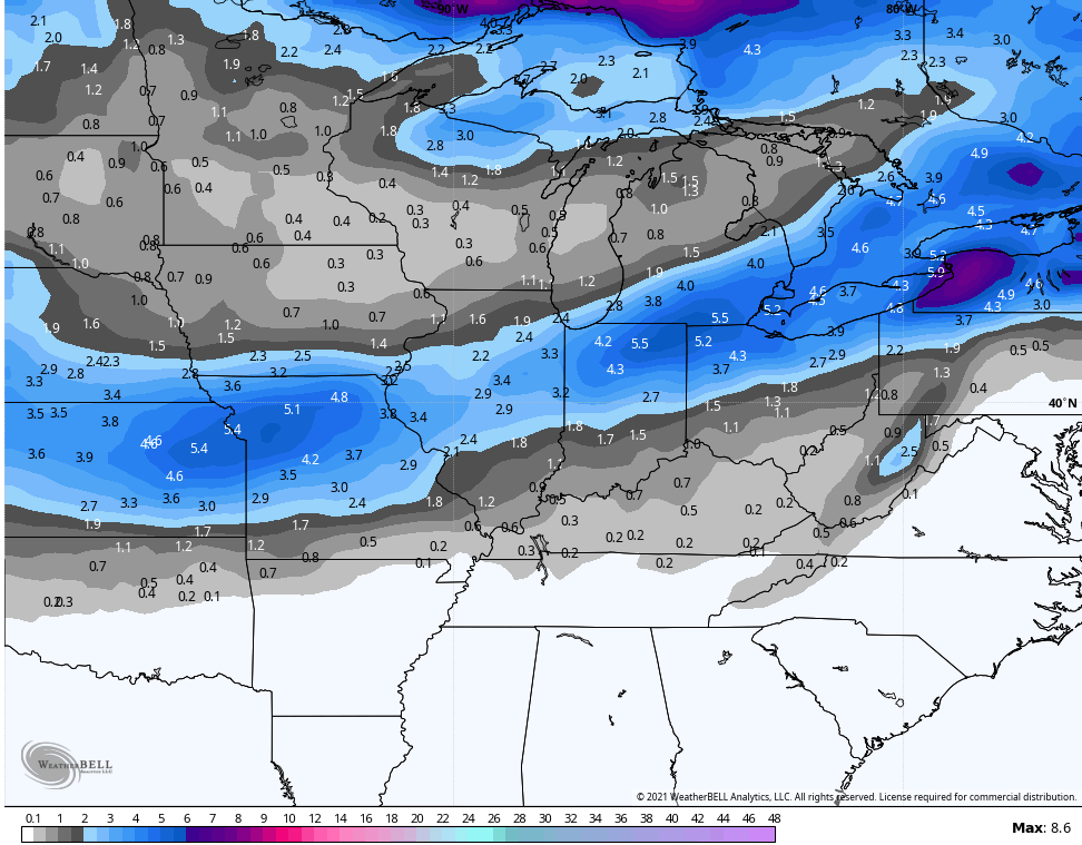
As you can see, areas to the north of Kentucky are in line for accumulating snow from this. That’s actually a heck of a look for this late in Spring.
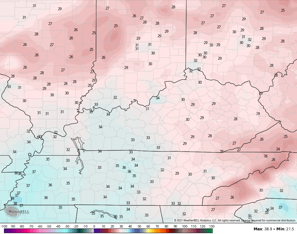
Highs for Wednesday afternoon may not get out of the low and middle 40s for some…
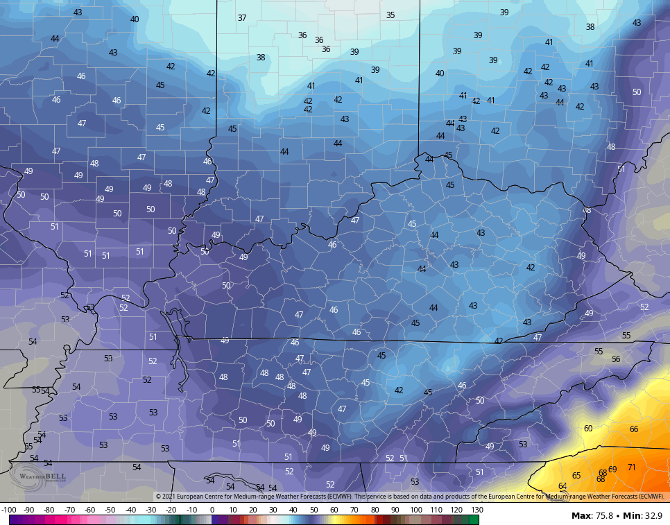
This sets the stage for a freeze by Thursday morning with temps in the upper 20s…
The next systems follow all this up next weekend into early the following week. The EURO has a milder look on the latest run…

For the final week of April, we are seeing some disagreement among the various Ensembles. The EURO 7 day average continues to be pretty chilly…
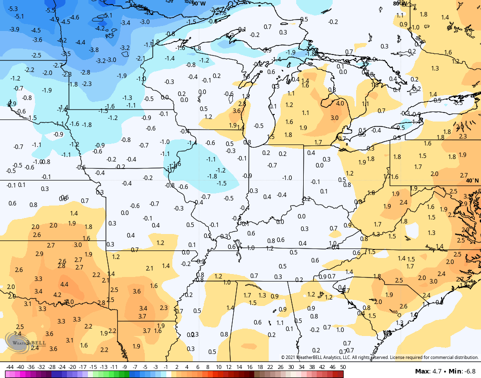
The GFS during the same time is closer to normal…

So is the Canadian…
#TeamSpring is firmly anti-Euro at the moment. 😎
Again, the flip to a warm and stormy May is likely and this should bring a busy severe weather period into our region.
Enjoy your day and take care.

I am glad I didn’t plant early.
My grass is still growing.
Will have to mow it today.
Just as we had a “back-loaded” Winter, I am concerned that we will have a back-loaded severe weather season. This has already played out across the deep South, where severe weather that usually manifests itself in February was delayed by the February cold snap. There are some historical climatetological models that are comparing the current setup with conditions that presented during the first week of April in 1974, which is a scenario that we would most definitely NOT want to see repeated!
In that case lets hope we keep the current weather pattern through the Summer followed by a colder Fall and Winter.
Test. My previous comments have been lost somewhere in cyberspace.