Good Tuesday, folks. The month of May continues to be on a record cold pace for many areas of the Commonwealth. This is a continuation of the overall pattern from late winter and it isn’t ready to give up just yet. There are signs next week turns much milder, but let’s believe it when we see it.
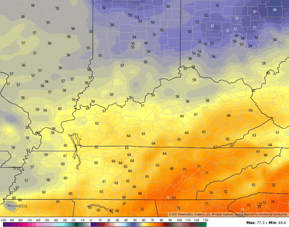
We have a mix of sun and clouds out there today as we keep the well below normal temperatures with highs ranging from the upper 50s to middle 60s.
There’s the potential for a touch of frost tonight across the northern half of the state. That’s where temps can drop into the 30s by Wednesday morning…

Highs on Wednesday look like this…
Thursday looks even cooler…
LOWS

HIGHS

As we look ahead toward the weekend, we find warmer air trying to fight back in here, but it’s likely to produce some showers and a few thunderstorms. That would act to keep below normal temps rolling along. Once temps respond early next week, a few more showers and storms look to join in…

If there’s any good news going forward, it’s that temps really cannot average any cooler than what we are seeing out there this week. See… I’m always looking at the bright side of life. 😎
We will be diving into the summer outlook in the days ahead.
Make it a good one and take care.

May 2002 was cold too.
No complaints from me.
Me either !