Good Thursday, folks. Our colder than normal May continues for a few more days, but we are getting closer to flipping things to warmer. With the warmer pattern, things will also be turning rather stormy as we head into the second half of the month. Spring lovers may actually get some warmth after all. 😎
Today isn’t one of those warm days, but it’s still going to look pretty darn nice. Skies are mostly sunny with highs reaching the low and middle 60s for many. The day may actually start with a touch of frost in the north as lows hit the upper 30s.
Friday will be a few degrees warmer than today, but still solidly below normal.
The warmer air starts to fight back in here over the weekend and this could lead to some scattered showers and thunderstorms by Sunday. This kicks off a pattern likely to feature clusters of storms making a run at us next week…

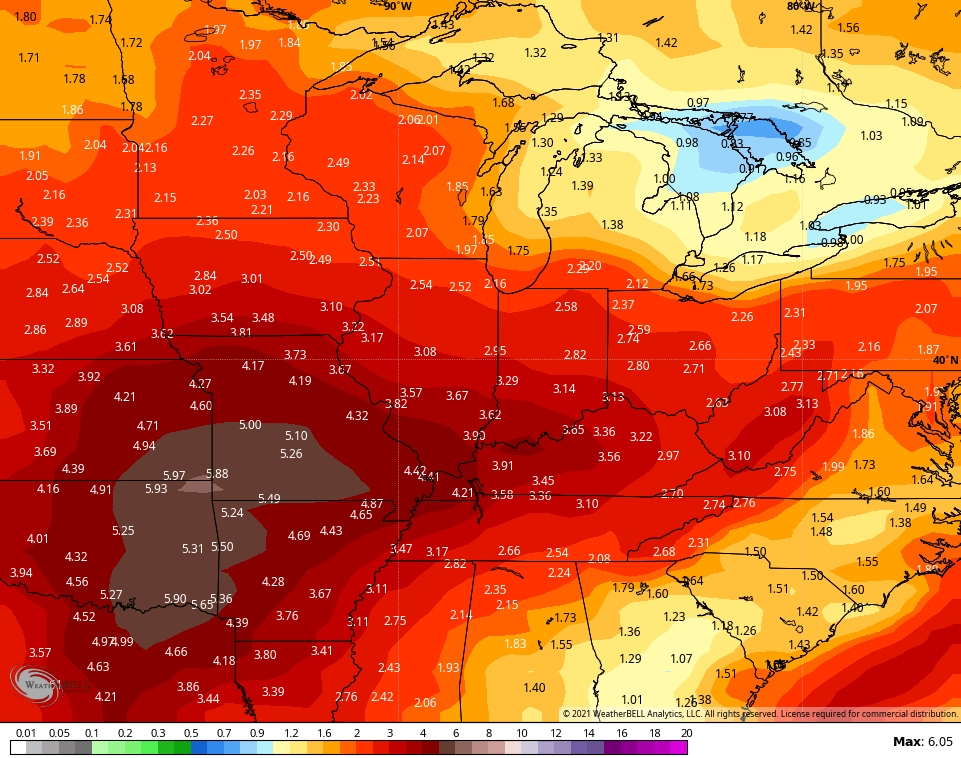
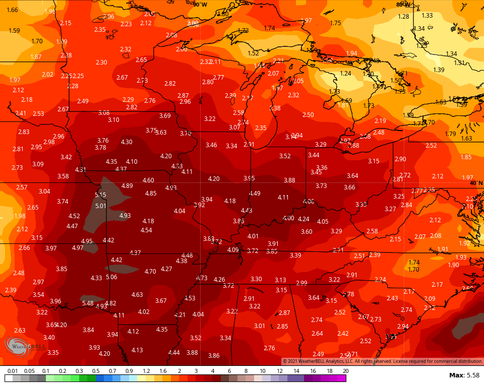
The various ensembles are hinting at a very active storm setup from the plains into our region over the next 2 weeks. That’s reflected in the rainfall numbers…
GFS ENSEMBLES
CANADIAN ENSEMBLES
Have a terrific Thursday and take care.

I don’t know what is there to be gained if all it’s going to do is rain all the time when it warms up.
I personally think that this weeks weather has been near perfect.
I could live with this type of weather all year long.
Not me I like four seasons with lots of Snow during our Winter months.
Just noticed the NWS is starting to use normal temperatures from 1991 to 2020 in their daily climate reports. It will be interesting to see how this changes the monthly departure from average temperatures for the region.
i desperately need warm/hot weather. im most comfortable with 70+ all year round. give me H-H-H over frost warnings anytime! always seems we cant have warm weather without constant rain. seems it rains an awful lot more than it used to when i was a kid. the last few years my lawn was a sponge all summer long. hope this summer is balanced. ive told my wife the last few years i need to move to a warmer climate. id be happy in a dry hot desert. but it wasnt long after that we seen snow forecast in phoenix. so yeah. seems there no escaping it anywhere 🙂