Good Friday, folks. It’s another below normal day in the bluegrass state (Drink!🍻 ), but the pattern is set to flip to much warmer in the coming days. This warmer pattern will also feature an increase in stormy weather from later this weekend into next week.
Temps today are a little better off then recent days as highs hit the mid and upper 60s for most of the state. Skies stay partly to mostly sunny.
Warmer air fights back in here over the weekend and will have some showers and storms on the leading edge of it. The arrival of these storm clusters is still in question as the models differ on when to bring the first round into the west. The NAM brings the action in Saturday night and increases it into Sunday…

This kicks off a pattern featuring rounds of showers and thunderstorms rolling across our region. This will likely be common into much of next week…

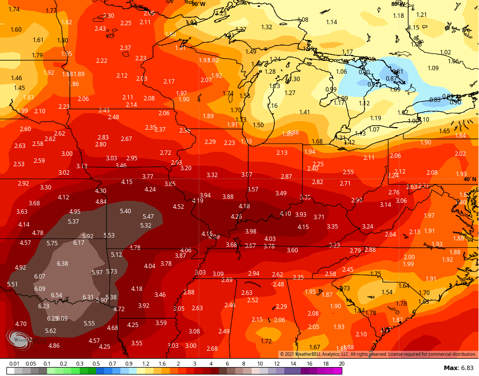
This setup could mean strong storms and heavy rainfall around here. Some of the recent GFS runs are really cranking out some big rains during this time…
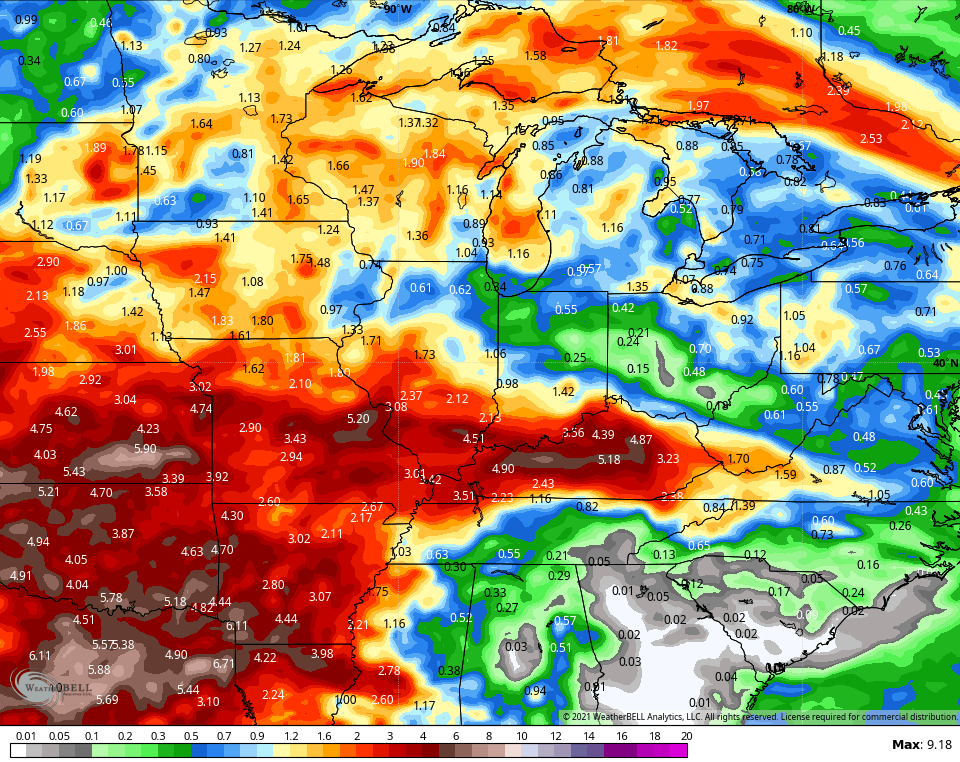
The GFS Ensembles have been hinting at this setup for a while and you can still see how it’s leading the charge…
I leave you with a little Friday music mojo to get ya ready for the weekend…
Make it a fantastic Friday and take care.
