Good Sunday, folks. The first half of May finds some areas on pace for the coldest May on record. As we begin the second half of the month, the pattern is flipping to a surge of summer. Temps are likely to surge into the 80s on more than one occasion and there’s the outside chance to push 90 in a few spots by next weekend. What the what!?!!😮
Let’s begin with today and then roll toward the summer surge.
Highs today are below Saturday’s in many areas because of a few showers and storms. Highs generally range from the upper 60s to middle 70s based on the placement of any shower and storm action. This doesn’t look too widespread and whatever is out there will show up here…

The storm action will be with us on and off over the next few days, but the action is looking less widespread than before…

This is because our late week ridge of high pressure is trying to flex a little sooner. It’s also showing up stronger and stronger as we get closer…
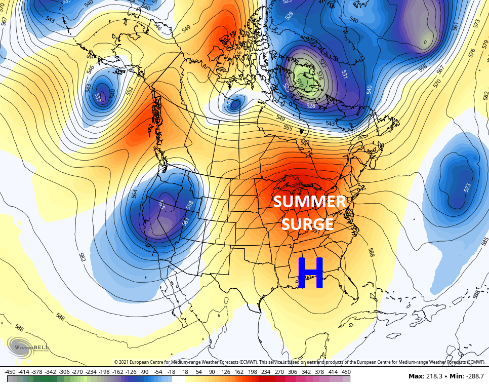
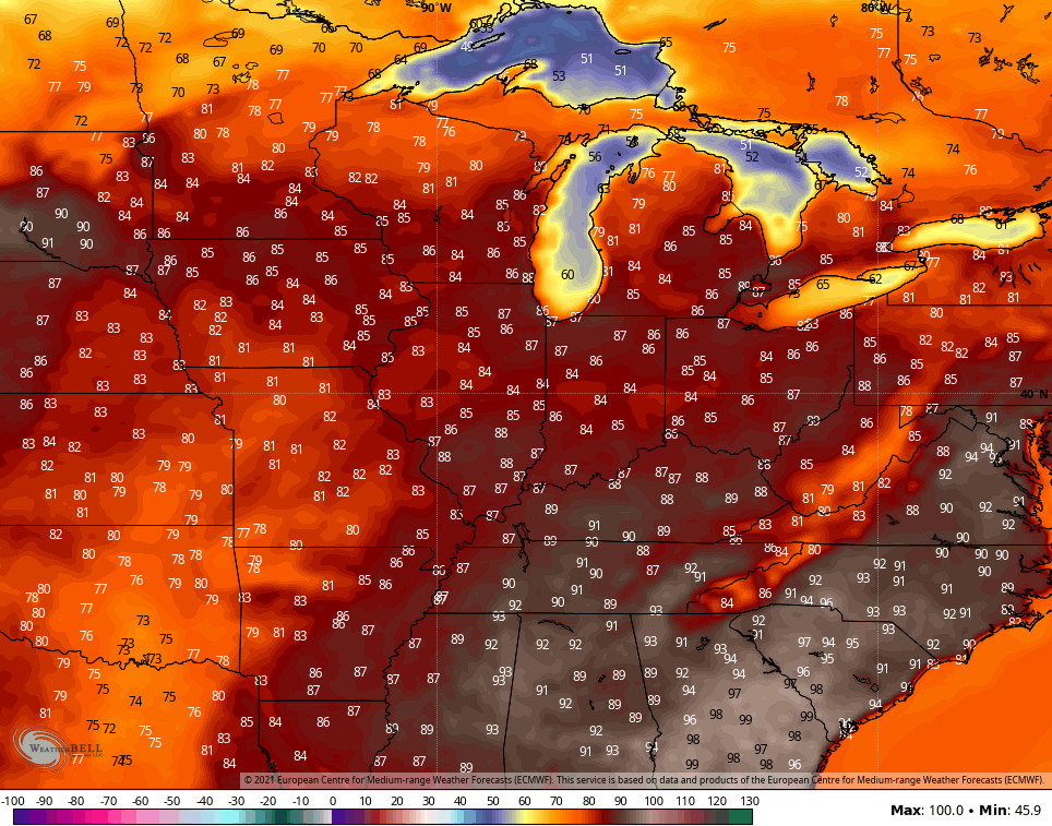
That’s a heck of a May ridge going up and could REALLY boost temps up. Highs for the second half of the week ahead may surge deep into the 80s…

By next weekend, the EURO is showing the first 90…
Kentucky is going from the freezer to the fire in a week and I would expect nothing less!
Have a great Sunday and take care.

Say goodbye to my low energy bills.
Maybe we will have breaks between heat spells this Summer ? I just hope it doesn’t get too dry. I got one more low energy bill coming, and I need to clean and check the heat pumps this week and get them ready for cooling.