Good Wednesday, folks. Rounds of showers and storms are kicking in out there today and this is a sign of things to come as two systems impact the region through early next week. This means a rather stormy setup is upon us and we will be on guard for local strong storms and high water issues.
Tropical humidity is with us today with temps back into the normal 80s. Storms fire up fairly quickly and continue through the afternoon and evening as moisture streams in from the south and southwest. Not everyone sees storms today, but heavy rainfall will be likely for those who do. Here is your daily dose of radars…

Don’t forget to take the interactive radar on a little Florida trip to follow Elsa into the Sunshine State. Here is the latest from the National Hurricane Center…

That system doesn’t have a direct impact on our weather as it stays well to the east, allowing for a cold front to move in here. That increases the storms from Thursday into early Friday as temps come down.
The next system riding in here over the weekend may send rounds of strong storms rolling our from the west and northeast with decreasing action early next week…
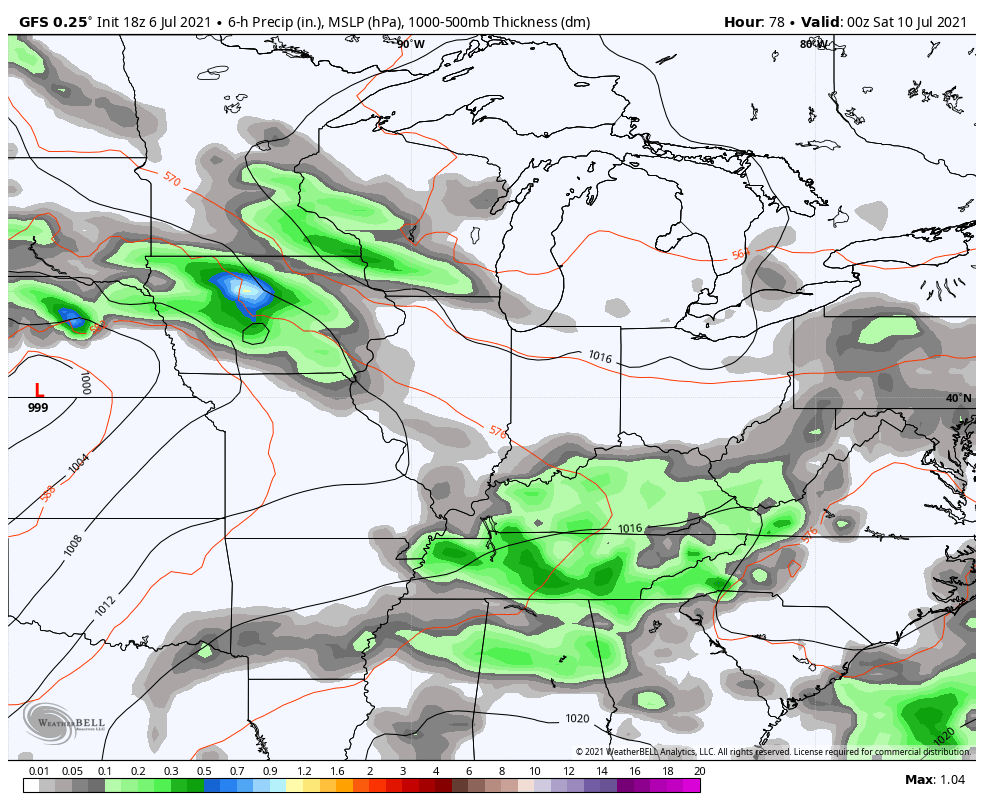
The GFS is spitting out some good totals from today through Tuesday…
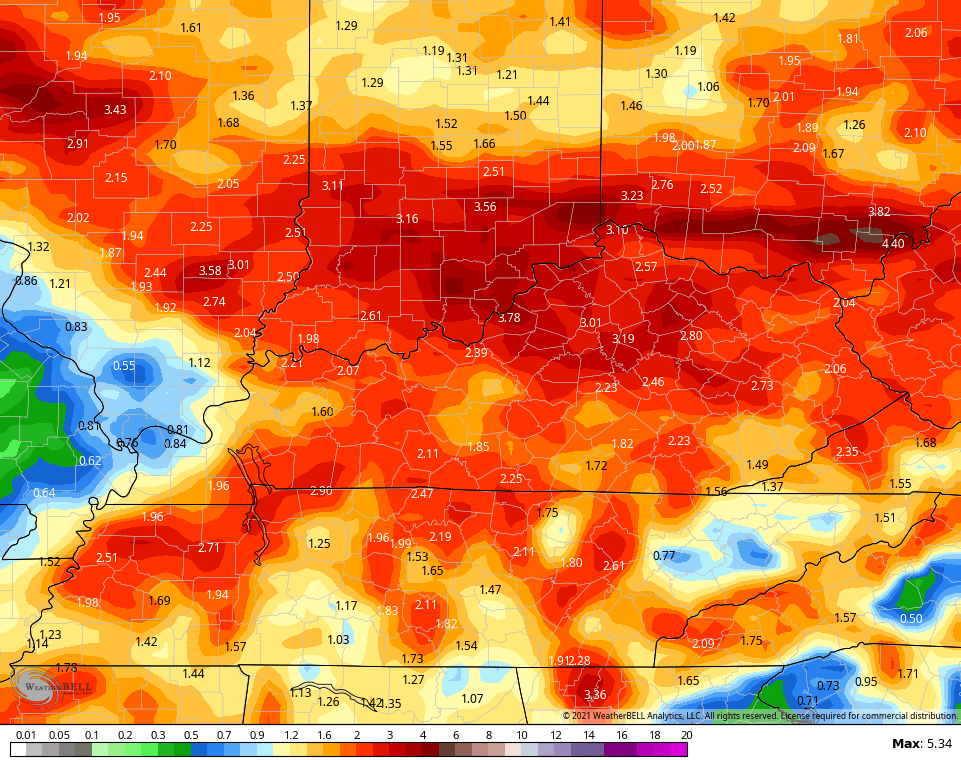
The pattern likely stays rather stormy through the middle of the month, at least. The GFS is consistently spitting out hefty totals for the next 2 weeks…
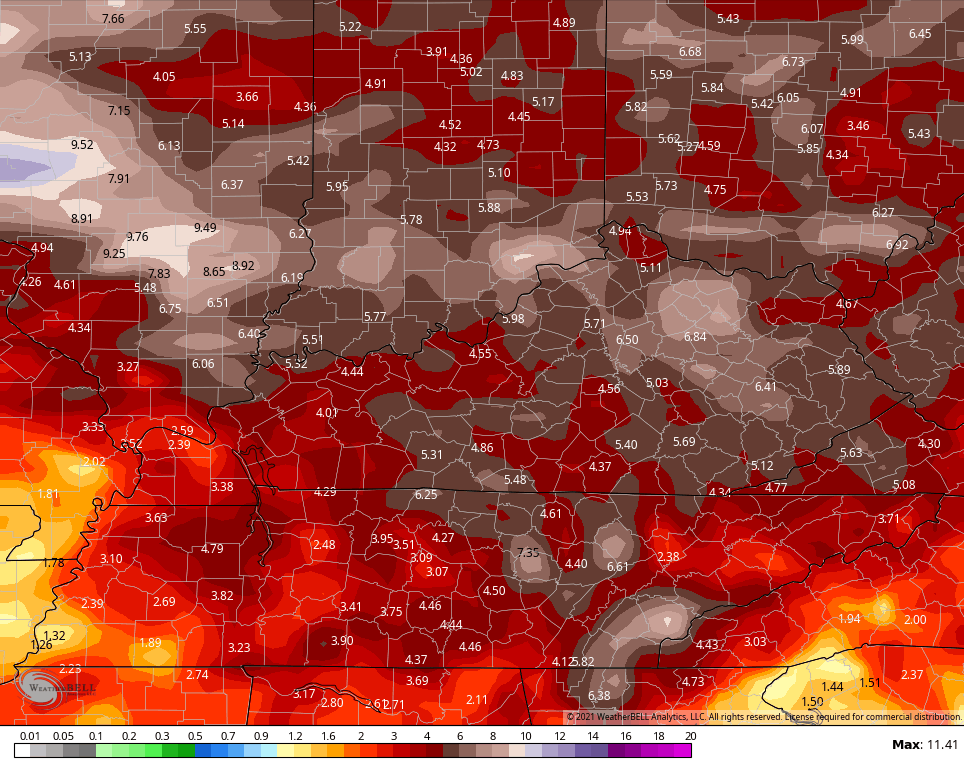
Again, don’t take those verbatim, but as an indication of rounds of storms being rather common during this time.
Make it a great day and take care.

It was a gloomy day yesterday in Louisville.
Dark and overcast.. It rained at my house “maybe “ 10 minutes.
Looks like Tropical Storm Elsa would rob the energy to our southeast and leave my area in mostly miss than hit showers, but we do not need rain at the present.
Lots of haze and smoke in our atmosphere holding the afternoon temperatures in the mid to upper 80’s.
Humidity is becoming more noticeable. Wonder if we will get a break soon ?
Yesterday’s high at my station near Bowling Green was 95°, with a Heat Index peak of 105°. We have had zero precip since last Thursday’s 1.85″, as the atmosphere in our area has seemingly remained capped. We could really use a good soaking rain.