Good Thursday, folks. It’s another day with storms going up across Kentucky and we are, once again, on guard for local high water issues. The setup behind this for the weekend has a little more concerning look as rounds of storms may move across the region bringing an increased threat for some problems.
Let’s kick this part off with what’s going on out there today. A weak cold front approaches the state from the northwest later today into tonight. This will help fuel more in the way of scattered showers and storms ahead of it. Just like in previous days, a few storms may briefly pulse to severe levels and put down torrential rains. Here are your Thursday radars…

Our cold front slows down on top of us into Friday and looks to become stationary into the upcoming weekend. At the same time, low pressure works into the Midwest and cuts into the Great Lakes. This setup means some scattered showers and storms around for Friday, but clusters of storms fire up to our northwest Friday night and roll southeastward into the region this weekend and into early next week…

The overall pattern continues to be conducive for additional showers and storms to drop in here from the northwest later next week…

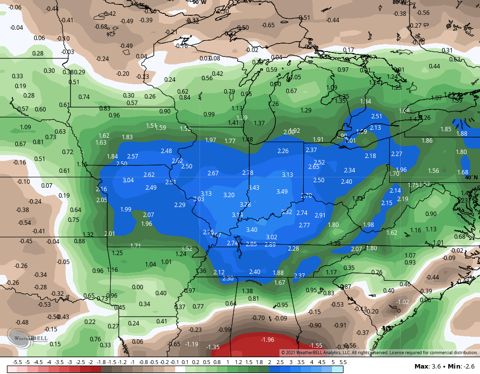
As a matter of fact, the Ensembles are putting the bullseye of the heaviest rains right on top of us for the next two weeks. The GFS Ensembles are way above normal…
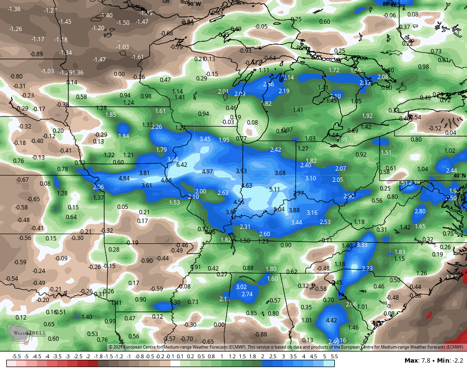
The Euro Ensembles sing a similar tune…
Next week is the midway point of meteorological summer and I see very little in the way of change from how we’ve spent the first half.
Make it a great day and take care.

Bleh. Dislike.
Let’s wait and see how far the stationary front sink south. I don’t have much faith in a GFS forecast.
We are camping this weekend… please no severe weather.
I have yet to see any storms and rain in my area of central Kentucky. Just saying.