Good Saturday, everyone. A more normal summertime temperature pattern is pushing into the region and looks to stick around into the middle of next week. But, this doesn’t look like a pattern settling in for the long haul. As a matter of fact, we may see another deep trough dive into the east to close July and Begin August.
Let’s kick things off with what’s going on out there today. Highs across the west reach the low 90s with a heat index pushing 100. Farther east, things are much cooler with mid and upper 80s with lower humidity levels. There’s also the chance for a storm or two to go up across the west. Here are your radars to keep you company…
Temps on Sunday will be similar to what we have today, but the timing of clouds and storms could keep the digits down a bit. Those storms drop in from the northwest and a few of them could be strong and produce locally heavy rains through Monday…
The Storm Prediction Center has a low-end risk for a few severe storms on Sunday…

Our temps try to surge for a few days into the middle of next week, but this will not hold. Check out how fast a cold front puts an end to this with more showers and storms as early as Thursday…
The EURO is all in on the eastern trough and shows it very well…
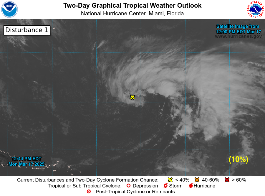
We continue to watch the system off the southeast coast for possible tropical development…

Make it a sensational Saturday and take care.

So the models are back on board with the eastern trough diving down this far south.
Time will tell.
My lawn could use a splash of rain.
Hope I receive some rain Sunday.
It feels great out there this morning with a dew point at 60 degrees and actual temperature at 60 degrees (100% humidity.)
We are good on soil moisture and scattered showers are in my forecast for late Sunday and part of Monday.
Watching the tropics as I have relatives and friends that live in Florida and along the Gulf.
Check out the beautiful full Moon this morning.
The Chicago Metro Area is outlooked for severe weather this afternoon, in the slight risk category. Damaging winds will be the primary hazard, but large hail and a few tornadoes are also possible.
The air mass is very juicy, with dew points around 74 degrees and temperatures in the upper 80s.
90-degree weather is predicted for the Chicago area through Wednesday. Quite a change from the below-normal month of July we had been experiencing.
The SPC has placed the Chicago area in the slight risk category for severe weather this afternoon. Damaging winds are the primary threat, but large hail and a few tornadoes are possible, along with torrential downpours.
The air mass is very juicy, with dew points around 74 degrees and air temperatures in the upper 80s.
The forecast through Wednesday is for highs to reach at least 90 degrees each day here. Quite a change from the below normal July we had been experiencing.
The SPC has placed the Chicago area in the slight risk category for severe weather this afternoon and evening. Damaging winds are the primary threat, but large hail, a few tornadoes, and torrential rainfall are possible.
The air mass is very juicy, with dew points around 74 degrees and air temperatures in the upper 80s.
The forecast is for 90-degree high temps through Wednesday here. Quite a change from the below normal July we had been experiencing.
The air mass is very humid with dew points around 74 degrees and air temperatures in the upper 80’s.
The forecast high temps are predicted to be 90 degrees or higher through Wednesday. Quite a change from the below normal temperatures we had been experiencing.
Dew points are very high here, around 74 degrees, with temperatures approaching 90 degrees.
It’s a very beautiful Saturday afternoon here in central Kentucky. Current temperature of 85 degrees with a dew point of 68 degrees.
The Smoky skies of here lately has change to clear blue skies.
Don’t know if we will get much rain out of the next approaching storm system for tomorrow and Monday ?