Good Sunday and welcome to August! The final month of meteorological Summer is off and running on a much cooler than normal note and this looks to continue through the first week of the month. This pattern will also spawn an upper level low that can bring a few showers and storms into the region for the middle and end of the week.
Let’s kick things off with what’s happening out there today. A few showers and storms are rolling across southern Kentucky early today before a mix of sun and clouds takes over by midday. Another weak front drops in by the evening with a broken line of showers and storms. Here are your radars…

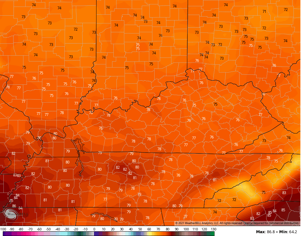
Temps will run on the pleasant side with 75-80 for many, but a few spots may spike just a bit more ahead of the front.
This sets the stage for some awesome air to blow in for the start of the new week. Lows tonight drop into the 50s for many with highs on Monday in the middle and upper 70s for most…
And that’s coming with partly to mostly sunny skies and low humidity.
Tuesday looks like a similar day as our deep trough starts to cut off from the main flow. Once it does, it sticks around for the rest of the week…

That keeps temps much cooler than normal and may also spawn low pressure that spins some showers and storms in here from the east…

Make it a great start to the new month and take care.

That impressive bowling ball of moisture yesterday practically disintegrated before reaching Fayette County. I think between 37 & 43 drops fell on my yard. Who wouldn’t love mild temps, but the persistently dry pattern for some of us is the name of the game.
Three drops of rain on a brick bat at my place. It’s August so it’s suppose to be dry, but it will rain too much one of these days.
Any number of days below 90 degrees in August is good in my book.