Good Tuesday, everyone. We continue with an early fall feel across the Commonwealth and this sets in through the week. Something else setting in is an upper level low spinning right on top of us, bringing an increasing chance for some showers.
This pattern is every bit as cool as advertised and is giving us more of a mid-late September feel. Look at some of those Monday morning lows…
Lexington hit 57 degrees this morning, missing a record low by 2 degrees. Other parts of the state made it into the low 50s to start the day. Here are the top 10 coolest morning lows from the Kentucky Mesonet. #kywx pic.twitter.com/mVCAgah4pO
— Chris Bailey (@Kentuckyweather) August 2, 2021
That’s impressive for what is climatologically the hottest time of the year.
Temps are back in the 50s this morning with afternoon temps ranging from the upper 70s to low 80s with a mix of sun and clouds. As our upper level low starts to crank, a few showers and storms will fire to our east and may back toward the west into eastern Kentucky. Confusing, huh?
Here are your radars to follow along…

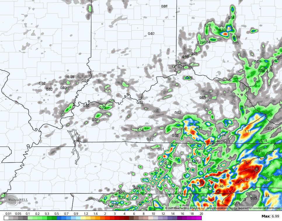
The threat for a few showers and storms then works a little bit to the west into Wednesday and that shows up on the models. Here are the rain numbers through Wednesday…
NAM
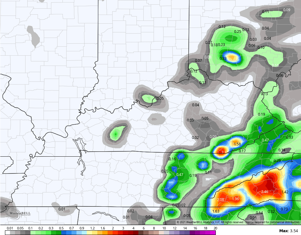
Hi Res NAM
Temps continue to slowly climb through the end of the week with some scattered showers and storms. That’s a trend likely to take us into the upcoming weekend, but I don’t see a ton of rain from this setup at all.
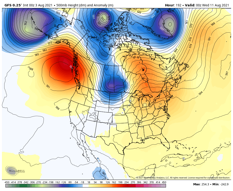
The numbers are likely to take off early next week with 90 degrees potentially showing up for several days. That’s ahead of another change lurking by the end of the week into the middle of the month. The models are just now starting to see the trough potential following up the toasty temps…
GFS
CANADIAN
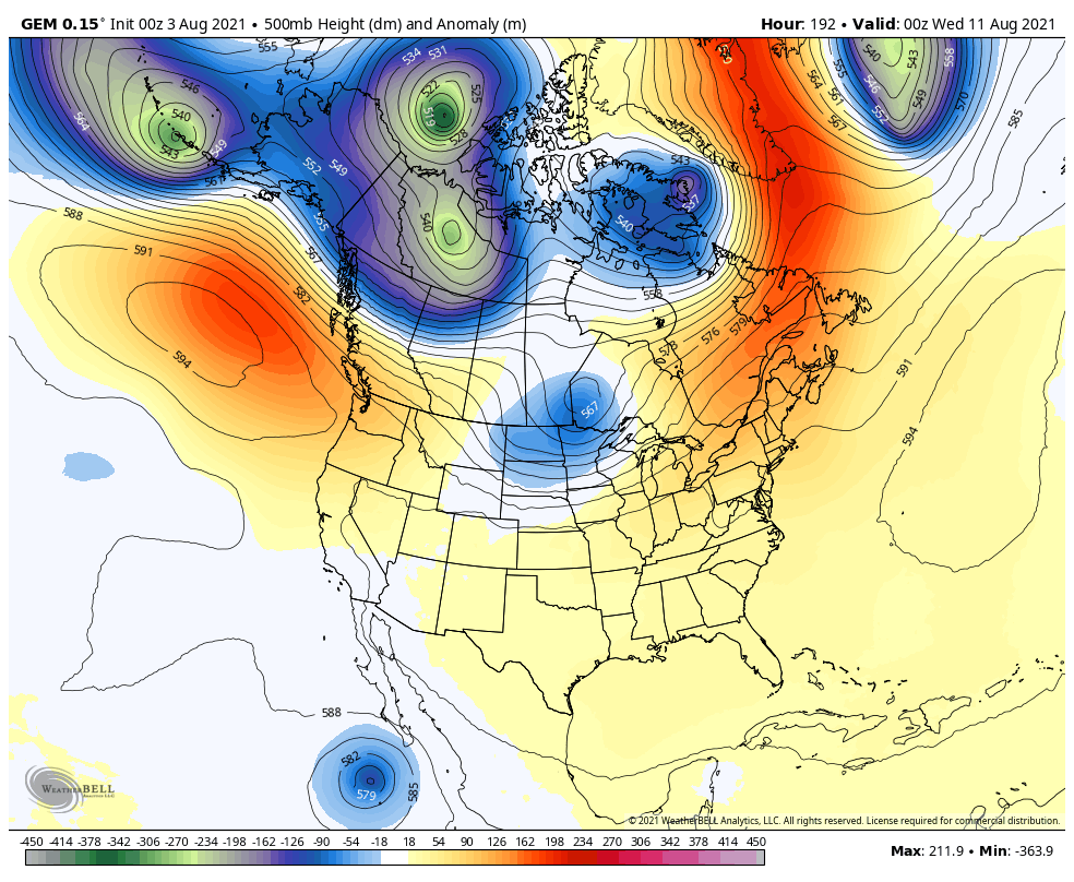
That trough is likely to grow deeper in the coming days.
Make it a great Tuesday and take care.

Fifty eight degrees here this morning and liking the lower dew points in the afternoon. Skies are still somewhat smoky from the wildfires in the Northwest. Hopefully, the skies will clear from the smoke later in the week.
The whole country needs a good, slow and steady rain. Maybe the tropics will get active and start rains where the wildfires are occurring ?
The GFS and the Canadian models are keeping the troughs well to our North. Where’s the European model on this ?
Looks like the models are picking up on a tropical system forming off of Cabo in the Pacific…
Love these fall teases and how they break up the summer here! Spent two summers in Louisiana and that prolonged heat was enough for me!
We bottom out at 57 degrees here in Taylor county this morning, according to the Kentucky Mesonet.
It’s a beautiful Summer day here in central Kentucky.
Got much yard work done this morning.