Good Wednesday to one and all. We continue to feature below normal temps as a few showers and storms increase. This action is coming at us from a big upper level low spinning on the region through the end of the week. Beyond this, temps look to surge for a bit into next week before another trough tries to take care of it.
This pattern is every bit as cool as advertised. Those Tuesday morning lows were impressive…
Lexington hit 55 degrees this morning and this is the coolest temp this early in August since we hit 54 on this same day in 1976. #kywx
— Chris Bailey (@Kentuckyweather) August 3, 2021
It was another impressive morning for cool temps. Many of the Kentucky Mesonet sites hit the low to middle 50s. #kywx pic.twitter.com/ngbG3gqasF
— Chris Bailey (@Kentuckyweather) August 3, 2021
Temps won’t be as cool to start our Wednesday as some clouds will be around. These clouds will also spit out a few showers and thunderstorms across central and eastern Kentucky, but this action looks fairly scattered. Here are your radars to follow along…

The stuff our there today will be coming from the east and southeast and you may actually see this working counter-clockwise around the low. I’ve seen setups like this produce some pockets of very heavy rain, so let’s keep that in mind.
A few more showers and storms will be spinning on Thursday, but I’m torn with how much of a storm chance we get into Friday and Saturday. I’ve been going back and forth on the forecast, but the latest models suggest a few showers and storms show up.
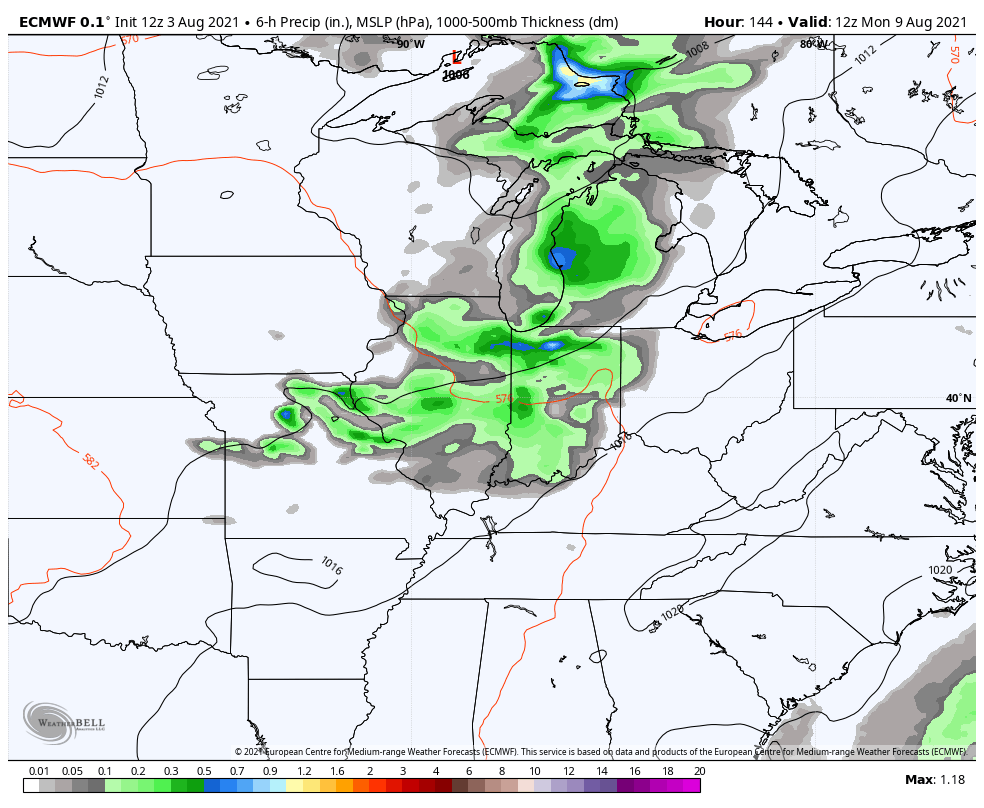
Here’s the NAM through Saturday morning…

The GFS shows something similar through Saturday evening…

Temps do start to climb this weekend into early next week, but we need to watch for a late week trough diving into the country. The models are waffling on this, but the pattern suggests it. The latest EURO is showing the trough…
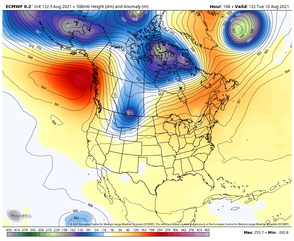
Temps early next week can take off, but some thunderstorms will try to keep things under control. The EURO shows some early week storm clusters to be followed by another fall-like front late in the week…
Have a wonderful Wednesday and take care.

I am going to have to put my faith in the Euro.
I need the rain.
If you take the weather models from yesterday along with the European model they are all on agreement with the trough ?
Not looking forward to the excessive, sultry Summer heat returning next week.
Neither do I but we need a southwest flow to increase the rain chances.
It would have to come from tropical activity ? Just looked at a Fall forecast and it’s calling for above normal precipitation for the Ohio Valley and Fall ending with colder temperatures. We shall see.
It all rides on what goes on with ENSO and the tropics.
The NWS now has new damage threat categories for severe thunderstorm warnings. Here is the link for details:
http://weather.gov/lot/SevereThunderstormWarningsUpdate