Good Thursday, folks. It’s another below normal temperature day across the bluegrass state as we track a few more showers and storms. The threat for a few storms looks to hang tough through the upcoming weekend before the pattern starts to turn more active into next week.
Our cool start to August has entered rare territory for central and eastern Kentucky. Check out this little stat I came up with on Wednesday…
Lexington hit 54 degrees this morning giving us the 3rd straight morning with temps of 57 or lower. That hasn't happened this early in August since 1965. #kywx
— Chris Bailey (@Kentuckyweather) August 4, 2021
There’s a chance today makes it 4 days in a row with lows in the 50s. 👀 By the afternoon, temps rebound into the upper 70s to low 80s for most of central and eastern Kentucky and a few degrees better than that in the west. Scattered showers and storms will also try to go up, especially this afternoon and evening across central and eastern Kentucky.
Here are your radars to track any shower or storm showing up today…

Moisture streams in from the southwest later Friday into Saturday, bringing more in the way of scattered showers and storms. This action looks a little more common across the east than everywhere else…

Temps continue to warm toward more typical August numbers during this time and that continues into early next week. But, some showers and storms try to cut into that and then a strong cold front likely enters the picture later in the week…

The EURO has been showing this trough for a while now…
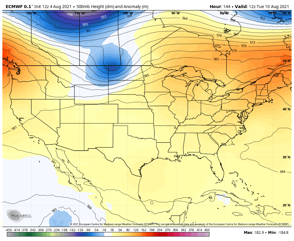
We are entering into a setup with a lot of conflicting signals and that’s leading to some model confusion as we head into the middle of the month. For me, it’s hard to go against the trend of the summer and that’s what the Control run of the EURO Ensembles is sniffing out…
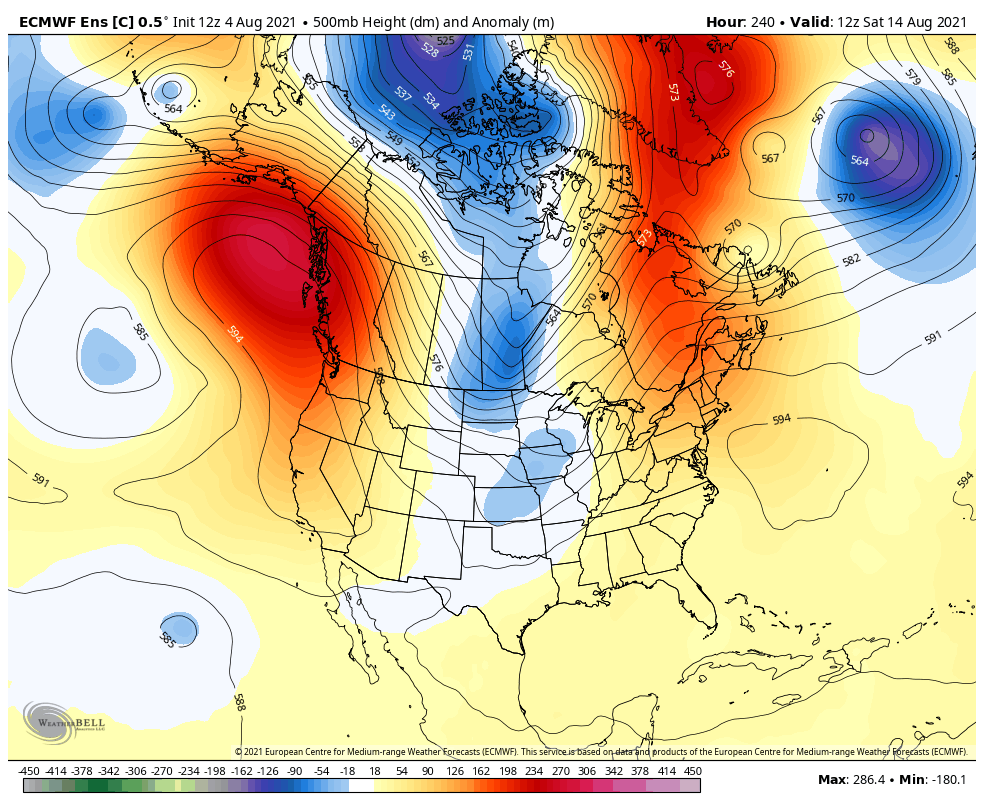
Here’s the 5 day temp departure from that run for August 14-19…
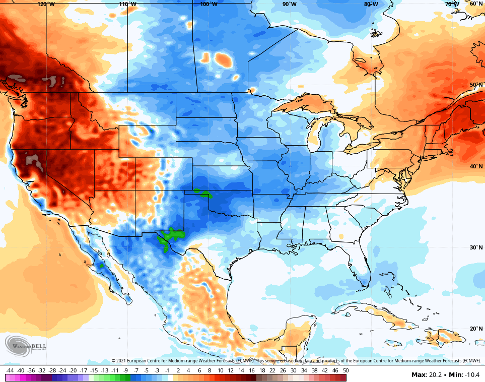
Again, looks a lot like where we’ve spent much of the summer, so far.
Make it a great Thursday and take care.

Can someone spare me some rain?
Is the tropical forecast forecast for this year been a bust? I have not been paying any attention what has been going on in the Atlantic.
Lol, I just went out on line and read that the tropics have a 65% chance of name storms being above normal.
The tropics took a break in July.
Sixty five percent chance for ENSO-neutral to phase into ENSO- La Nina sometime in September. I wonder if NOAA is using this same percentage for forecasting an active, late Atlantic tropical storm season ?