Good Friday, everyone. As a southwest flow starts to kick in, we will be seeing a bit of an increase in showers and storms to jump start the first weekend of August. This action still doesn’t look terribly widespread, but it will be floating around. As this is happening, we are looking ahead toward the middle of the month to see how things play out.
Let’s start this Friday party by talking about what’s going on out there today. A mix of sun and clouds will be noted with an increase in temps and humidity levels. Still, the numbers are likely to come in below normal for many.
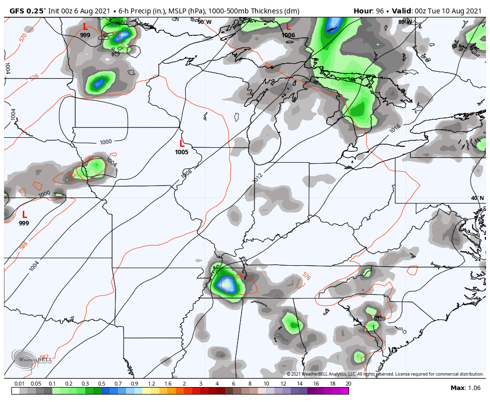
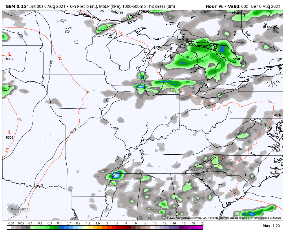
A few showers and storms develop on the aforementioned southwest wind flow. This action looks to be a little more prominent across central and eastern Kentucky…

Just like we’ve seen in recent days, we are likely to find some pockets of heavier rain.
The threat for a few showers and storms will increase into Saturday across central and eastern Kentucky.
The storm risk comes down for Sunday and Monday as temps jump up, especially across the west.
Rounds of showers and storms then look to kick in from Tuesday through the rest of next week…
GFS
CANADIAN
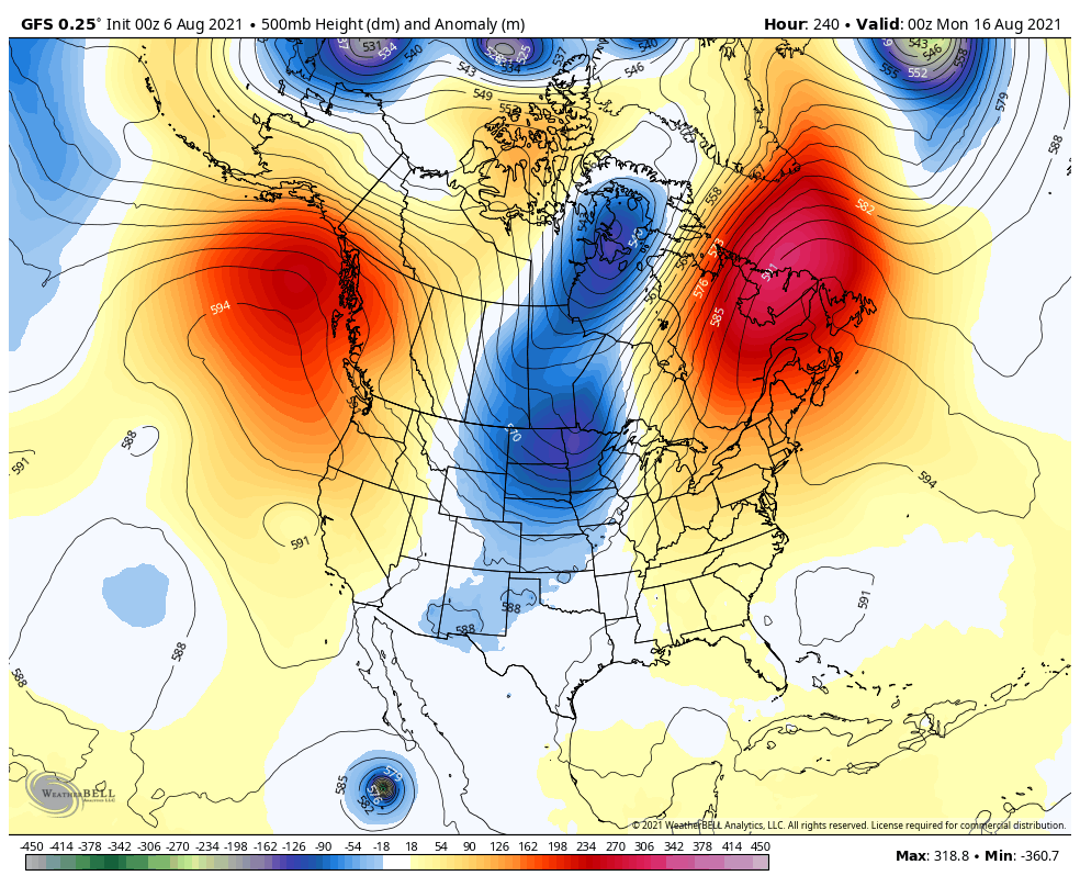
As we look down the road, we find the Control Run of the EURO Ensembles matching more of my thoughts than the other ensembles. This shows the potential for more of a mid-month trough into our region…

The latest GFS is offering up some support…
Fall and winter fans, I will have a sneak peak into what some of the seasonal models are saying with my weekend updates. Spread the word. 🍁❄
After a quiet July, the tropics are starting to pick up the pace a bit. The National Hurricane Center is watching a couple systems well out in the Atlantic…

We’re likely to enter a pretty active setup in the Atlantic hurricane season and what happens in the tropics can sometimes have a big impact on our weather.
Have a fantastic Friday and take care.

A string of below normal temperatures at the start of August is hard to beat, but the dry condition are worrisome. The most recent measurable precipitation at my PWS near Bowling Green was 0.50″ on July 18th, with nothing since that date. The Bowling Green Bubble seems to be working overtime!
A week ago, about this time in the morning one inch of rain fell in a very short time in my backyard. Runoff was fast and now it is like we never received any rain.
With this unpredictable weather pattern, which is common in late Summer, one can only wish that rain will fall on their lawn or crops.
I am hoping that we will hang on to the neutral phase of ENSO and not return for a second year La Nina for this coming Fall and Winter.
In addition to ENSO’s current La Nada status, Judah Cohen points out in his July 26th blog that some anomalous conditions exist in the AO, which is currently negative and is more reminiscent of midwinter conditions. Here’s a link to that blog entry:
https://www.aer.com/science-research/climate-weather/arctic-oscillation/
Great article but what’s really troubling is the widespread extreme heat and drought in the western one third of our nation. Is this cycle natural is what I keep asking myself. I’m seventy years old and have never seen the heat so widespread in the Western part of our country and it was predicted to get worse as the month of August wains. The heat and drought has no borders, it extends well into central Canada. It will get interesting as we begin to phase into a second La Nina and the tropics are beginning to get active as a result of this.
It would be too early to assume a long range forecast on the current teleconnections with one exception the PDO (Pacific Decade Oscillation.) I traced this back to August 1976 when It went from negative to positive and those who are old enough remember the Fall and Winter that followed.