Good Saturday, folks. The first full weekend of August is off and running on more of a normal note across Kentucky as temps start to climb a bit. A few showers and storms are also going back up today and this looks like a taste of what’s ahead for the upcoming week. We will take a look at that and have a little fall/winter talk.
Temps today range from the mid and upper 80s west to the low and middle 80s east. Humidity levels are up a bit and this is combining with a weak disturbance to produce some scattered showers and storms. This action is moving from southwest to northeast and mainly impacting central and eastern Kentucky.
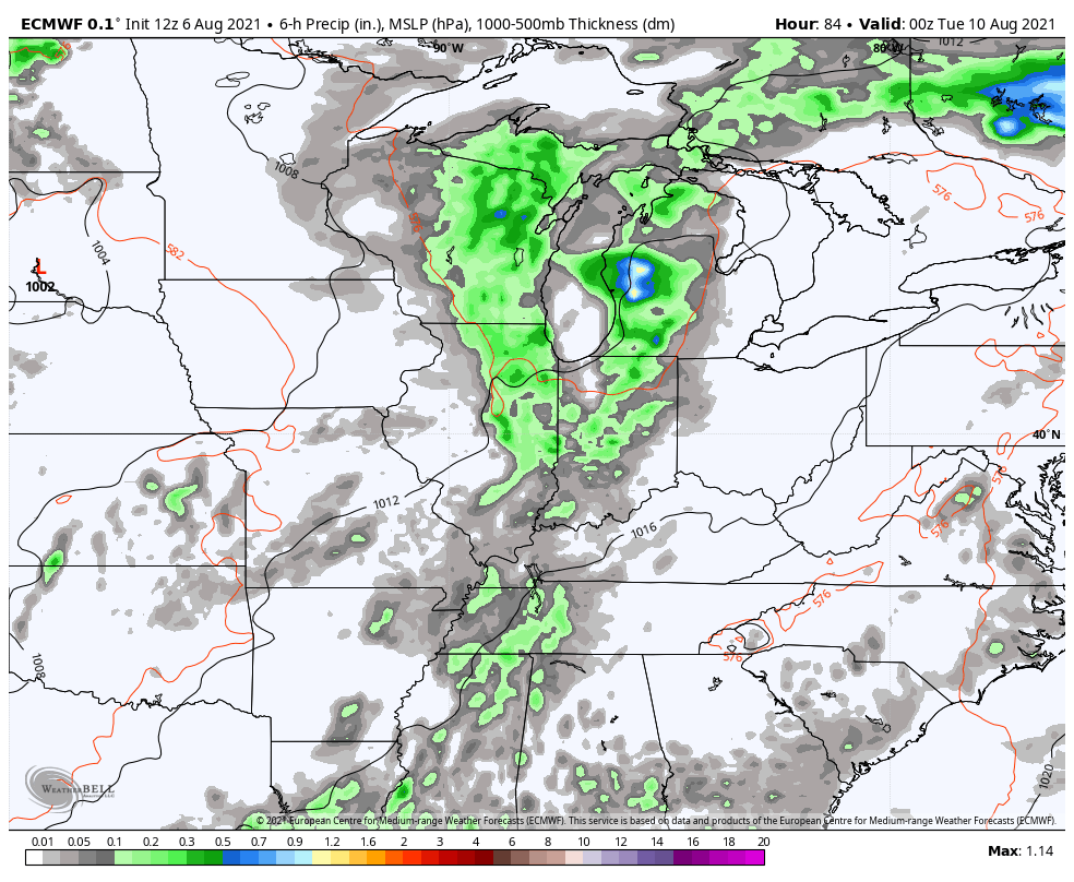
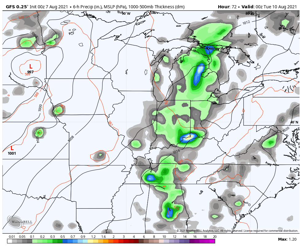
Here are your radars to follow today’s action…

Storm chances come down a bit Sunday as temps climb a little more, making it feel like… August. The same can be said for Monday as storm chances start to ramp back up, especially across the west. This kicks off a pattern with rounds of showers and storms working through the region with a little more action ahead of a late week cold front. There is good agreement on this from the models…
EURO
GFS
At the beginning of each month, many of the seasonal models give us a fresh update on how they think the months ahead will play out. These seasonal models are pretty poor, but not for the reasons you think. None of them can actually see cold air anymore. They have an inherent warm bias that seems to get worse over time.
The Euro Seasonal Model is really bad when it comes to this, but if you know it, you can correct it.
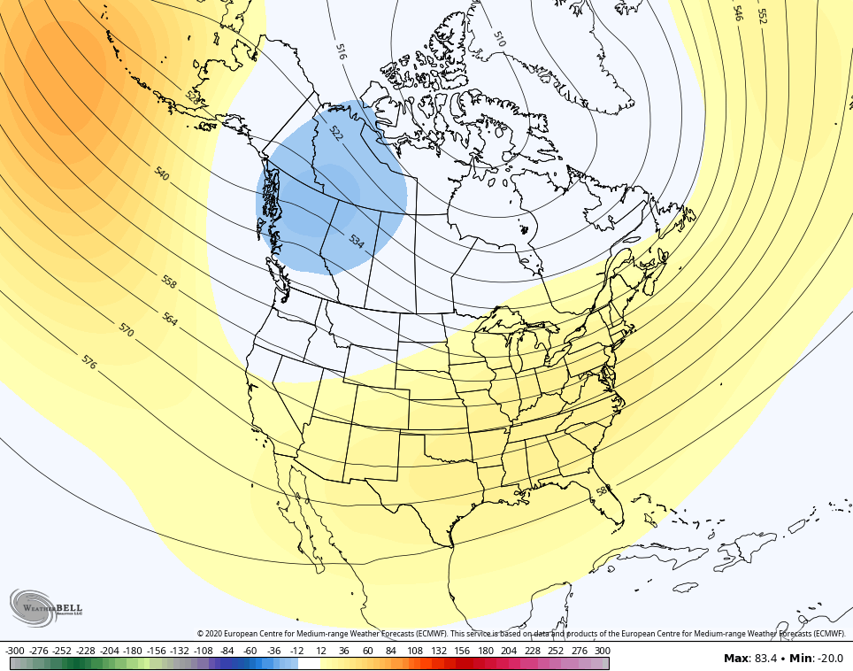
Here’s the 3 month average height anomalies for November-January…
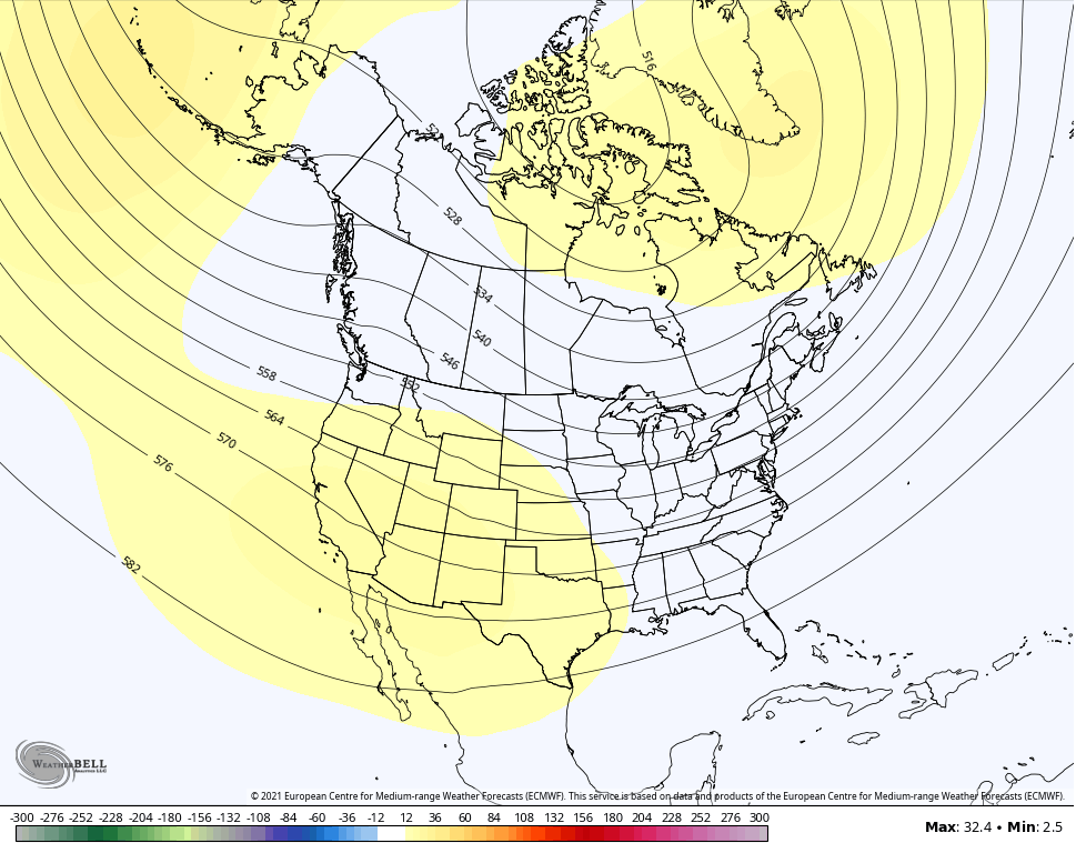
Notice how that suggests a continuation of the current pattern of ridging in the west and a trough in the east. This map at face value isn’t terribly impressive, but it is if you know the bias of the model. The above map suggests an early start to a rocking first half of winter.
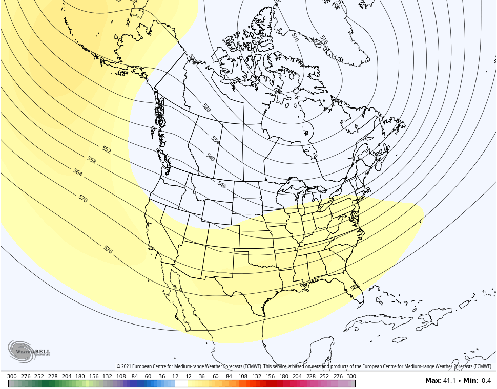
The same model run from December-February takes on a different look as it brings a ridge east for February…
If we go back to this same time last year and check to see what the EURO seasonal had for the same three month period last winter, we find this…
That’s a pretty big fail considering how rough our winter was. Unfortunately, many in the weather world take models verbatim and post them like they’re the gospel. This is the new generation of human weather apps that could care less about actually trying to forecast the weather and simply regurgitate what the last model run said and think weather history started with the invention of Tik Tok.
GET OFF MY LAWN, KIDS. 😎
We will look at another seasonal model with my next update. Have a good one and take care.

I need some rain.
Hopefully next week will bring it.
Hope we all receive some good rains soon.
Last Winter was rough ??? Not what I can remember.
Schroeder, I don’t either we did have a spell late Jan and early February with a deep freeze that the whole country felt. Plus we had our first deep measureable snow fall in t2 years about 7 inches with it.
Also. Schoeder i I got to thinking from Lexingtion and east on of the state did experience more snow and ice storms than here in western, ky. That maybe what Chris was talking about
The deep freeze in Texas was a major disaster for sure, but that severe cold did not make it to Kentucky.
Winter only lasted a couple of weeks in February and it was more pronounce in the eastern part of the state.
Here in south central Kentucky I recorded about 10 inches of Snow mixed with ice from December 1st, 2020 through March 2021 and the lowest temperature in my backyard was 15 degrees.
I don’t know is that a rough Winter for south central Kentucky ?