Good Monday, everyone. Higher humidity is combining with weak disturbances to create rounds of showers and storms rumbling across the region. Some of the storms out there today may be on the strong side as we kick off a stormy setup around here. At the same time, the tropics are about to spring back to life.
Let’s kick things off with our Monday weather. It’s a steamy day with rounds of storms working in from the west. This action may be on the strong side with damaging winds and some hail. The Storm Prediction Center has much of the region in a low-end risk for severe storms…

These storms may also put down enough rain to cause local high water issues. The Hi Res NAM is picking up on some hefty rain totals through Tuesday…

Additional rounds of showers and storms will be with us in the coming days as very steamy air settles in through Friday. That’s when a potent cold front arrives from the northwest, bringing more in the way of strong storms…
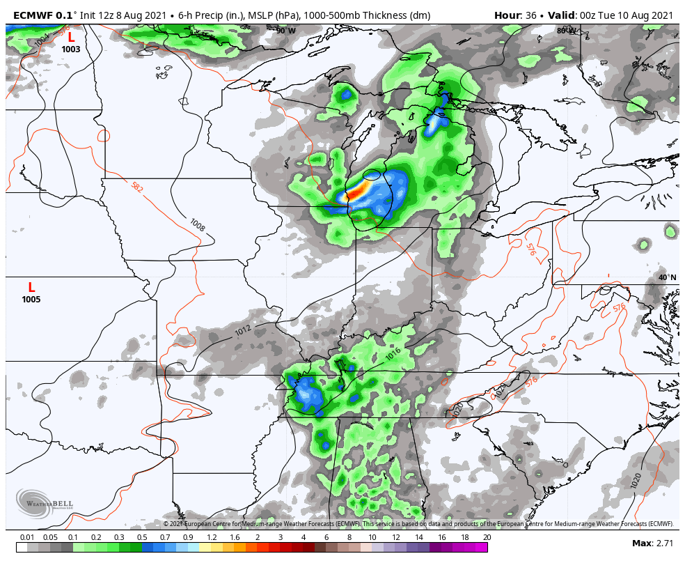
Again, some very heavy rains will show up from time to time and we could have a few cloudbursts.
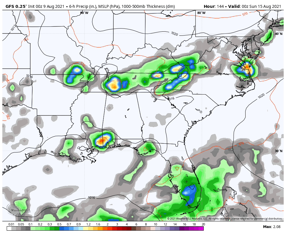
Once into the weekend, temps come down, but the overall setup will depend on what happens in the tropics. We have a few systems of interest to the National Hurricane Center…

One of those storms may be working toward the southeast early next week. It’s gonna be a while before the models figure out what happens with this, but it could set us up with some action. Here’s the latest GFS…
I leave you with your Monday storm tracking toys…

Current watches

Possible Watch Areas

Make it a great day and take care.

Yesterday evening we had a brief shower that dropped a few hundreds of an inch of rain which was very much welcome. We will take what we get.
This mornings showers to our west are not making it into our region of the state, but looks like Louisville may get in on the action ? Best chance after glancing at the radar looks to be up to our North in Indiana. Maybe the next round later.
Hoping that this is not going to be an active tropical storm season, but it looks to be going in that direction ? If it does it could prolong our current weather pattern well into Autumn and maybe another short Winter ?
A Tornado Watch has been issued for the entire Chicago Metro Area until 10 PM this evening. Nothing much on radar now, just a small area of storms near the Wisconsin border, but things could get really interesting later on.
Temperatures are in the upper 70’s, but it’s very humid with dew points in the low 70’s.
Storms in our area now with moderate circulation which could result in strong winds at the surface. Thunderstorm late this afternoon brought well over an inch of much needed rain to my backyard. Now I’m good on moisture for a couple of weeks.
A couple of tornado warnings have already been issued for south of the Rockford area, in DeKalb County.