Good Friday, folks. We have a strong cold front working into the region tonight and this will likely spawn some strong to severe storms ahead of it. Much better air blows in for the weekend as we focus on Tropical Storm Fred down in the Gulf and the potential impact on our weather next week.
Today is another very steamy one as southwest winds gust up through the afternoon. A couple of showers and storms may go up early, but the main action comes late afternoon into the evening. That’s when a line of showers and storms then develops and drops southeastward across Kentucky, bringing the potential for pockets of damaging winds and hail. The Storm Prediction Center has is un a low-end severe weather risk today…

These storms may also produce torrential rains, so local high water issues will be possible.
A few leftover showers and storms linger into Saturday as temps and humidity levels drop from the north. The front slides a little farther south for Sunday, keeping a few showers and storms in the south and southeast. For the rest of the state, Sunday looks and feels pretty good. That said, a few storms may drift north as the day wears on.
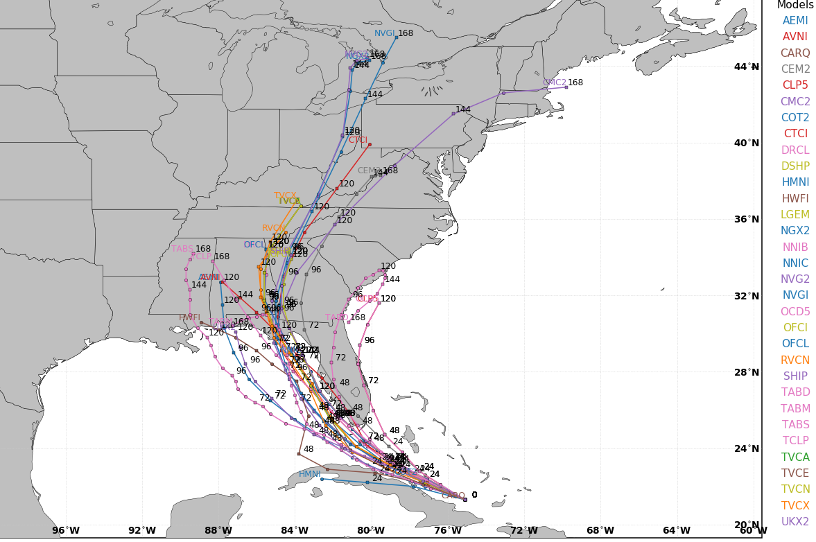
That’s when moisture returns from the south as Tropical Storm Fred works toward the Florida Panhandle, creating a pipeline of tropical rains into our region. Here’s the latest info and track on Fred from the National Hurricane Center…

You can see how the cone gets into Kentucky and the overnight hurricane model runs show a potential track into eastern Kentucky…
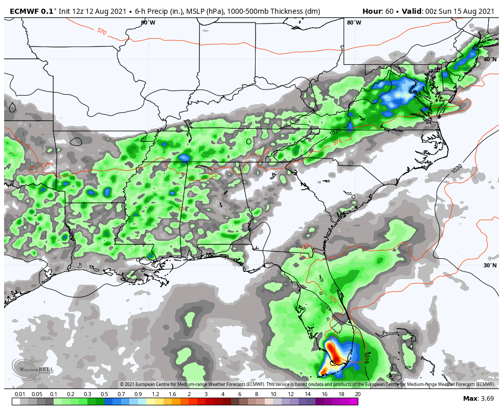
Here’s how the EURO sees the setup…
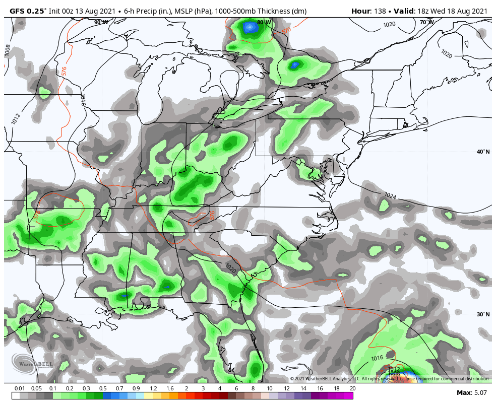
The GFS…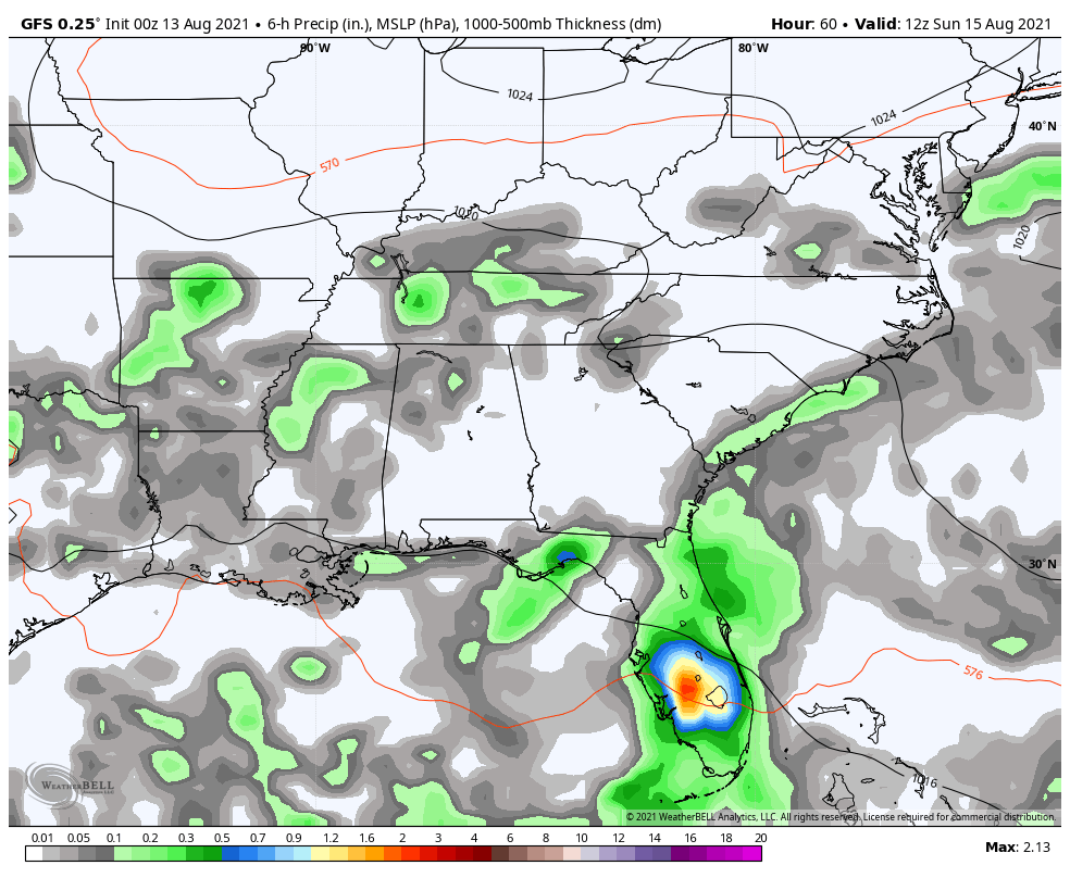
The overall setup is conducive for heavy rains in our region and that’s something we will need to pay close attention to.
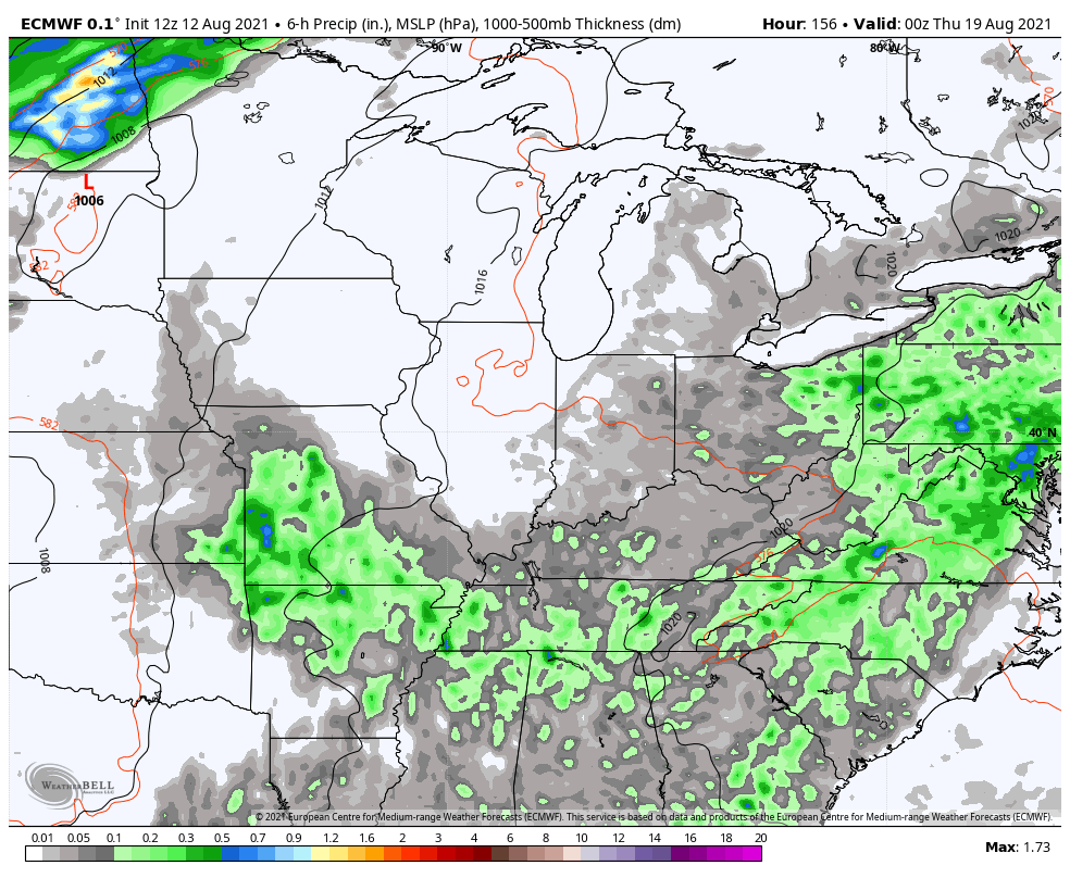
Once the leftovers of Fred roll through, the pattern continues to look active with another strong cold front dropping in here late next week. This may have additional rounds of showers and storms ahead of it. Here’s the EURO…
The GFS also sees this front, but it’s also seeing another tropical system making a run at the southeast…
I will have updates as needed and will be tracking storms on WKYT-TV starting at 4pm. Until then, I have you all set to track the stormy weather…

Current watches

Possible Watch Areas

Enjoy your Friday and take care.

I see the National Hurricane Center has Fred tracking over or near Nashville..
It looks like Fred is going to be a major rain producer for Ky.
Yeah, we could use some more rain here in my county, but not the severe weather predicted for late this afternoon.
Schroeder, looks like this front going to be a dry one for our area. Hopefully the Tropical Fred will bring up some moisture next week.
We had about 0.17 inches of rain earlier with a thunderstorm.
Too early to tell where the remains of Fred will end up, but I hope we all get a good rain