Good Saturday, everyone. It’s a much better feeling weekend across Kentucky, but the focus of the forecast is on just how active things are becoming. A stalled front will spawn scattered showers and storms through the weekend, then tropical moisture from Fred could drench parts of the state in the coming week.
Our front slows down across the region today and this will lead to some scattered showers and storms going up. The greatest risk is across southern Kentucky through the afternoon. Here are your radars…

The front then slowly returns back to the north later tonight and Sunday and there may be a weak disturbance along it. This opens the door for rounds of showers and storms to kick in and continue through early in the week. This shows up well on the NAM through Monday night…
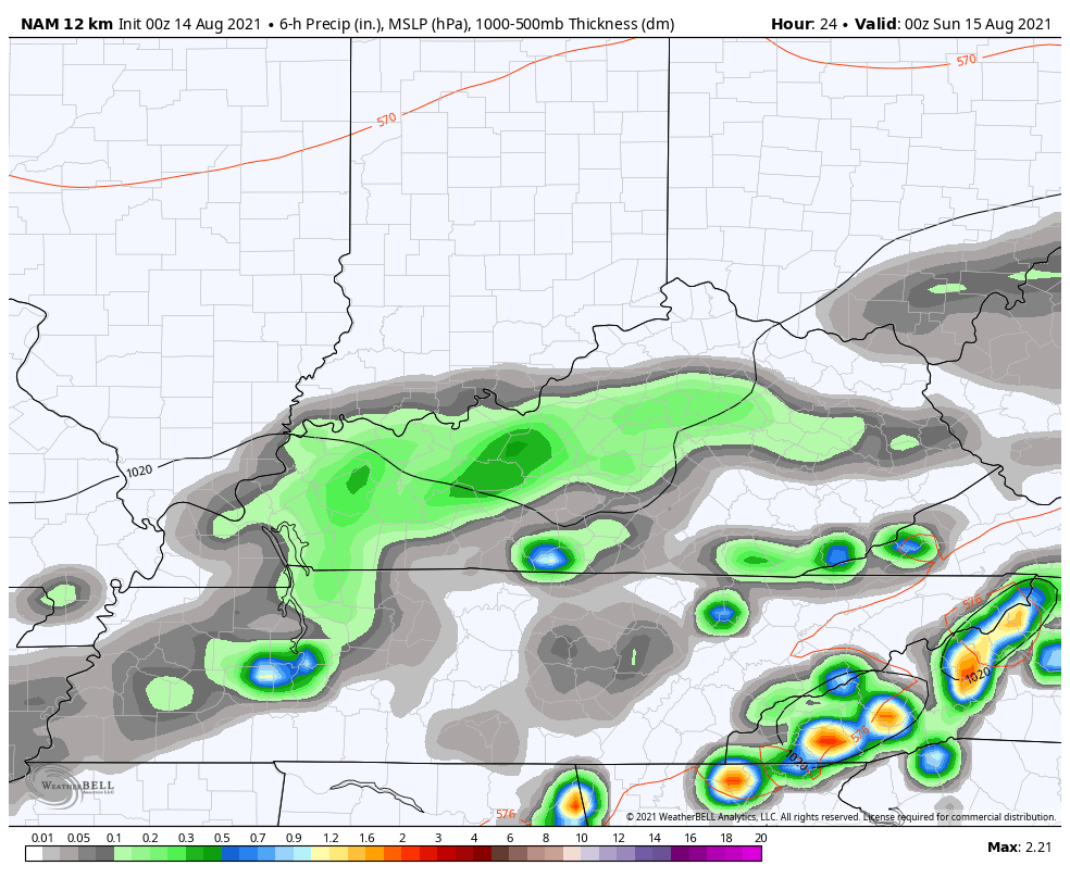
Tropical moisture is streaming in here well in advance of Fred down in the Gulf of Mexico, so local flooding issues will be possible. This will especially be the case as what’s left of Fred works toward our region and may move right on top of Kentucky.
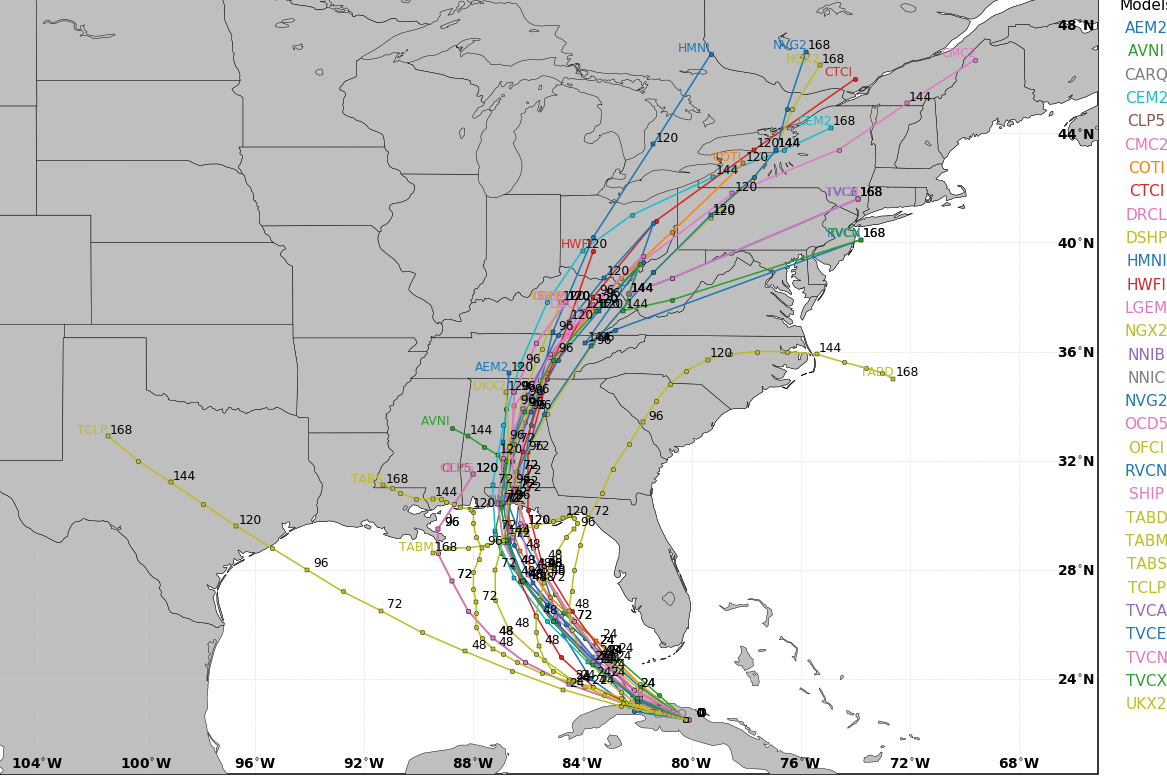
The track from the National Hurricane Center is showing what we’ve been talking about for days…

The track keeps bending toward the west and this will give Fred a better chance of becoming a hurricane before making landfall. The latest hurricane models are all showing this farther west track into the Florida Panhandle and then are tightly clustered on a track into Kentucky…
That would bring tropical moisture through Wednesday and could result in some issues. Behind this will come another cold front with showers and storms continuing for the end of the week.
That’s when we are likely to be dealing with Grace approaching the southeast. Here’s the latest on this system to be…

Did I mention this pattern was going to be active?
Make it a great day and take care.

I can see why CB is so concerned about the heavy rain threat for Kentucky for the coming week. On Thursday morning and early afternoon, Gibson City, IL (about 120 miles SSW of Chicago) received nearly nine inches of rain from a storm cluster concentrated in the area, and all major highways in and out of town became impassable. http://weather.gov/lot/2021aug12
Meantime, here in the Chicago area, sunny, beautiful weather is predicted for the next several days, which is very welcome following a very stormy week!
I can see why CB is so concerned about the heavy rain threat for Kentucky in the coming week. On Thursday morning and early afternoon, Gibson City, IL (about 120 miles SSW of Chicago) received nearly nine inches of rain from a storm cluster centered on that area. All major highways in and out of town became imp-a-s-s-able due to the flooding. http://weather.gov/lot/2021aug12
Meantime, here in the Chicago area. sunny skies and beautiful temps in the low 80s with low humidity are predicted for the next several days. That’s very welcome after a very hot, sticky, and stormy week!
Wow, close to nine inches of rain. I can’t remember experiencing any weather type like that before.
With the tropics getting active, looks like more of the same as the weather pattern in 2020.
No surprise here.